Finatics.ionafish.com

Explore Lakes & Waterways

Waterway information can change. Before visiting or fishing any location, verify current access rights, regulations, permits, fees, restrictions, and local conditions.

Explore Club-reviewed waterways, access information, and fishing notes.

Waterway Information Notice

Waterway information displayed by IonaBrand is compiled, reconciled, and normalized from multiple public and official information sources.

Where available, IonaBrand generally uses federal public geographic and hydrographic information as the foundation for Waterway identity, names, location, and other geographic information. Fishing, public-access, species, regulations, facilities, and local-use information may then be supplemented or verified using state, local, fisheries, park, public-authority, and other official sources appropriate to the information being presented.

IonaBrand does not represent any individual state, agency, authority, or source as providing the complete Waterway record shown here. Information from different sources may be independently compared, reconciled, normalized, and combined into the shared IonaBrand Waterway information presented to Clubs and their members.

The only constant is change. Public access, ownership, regulations, permits, fees, facilities, operating hours, conditions, and other Waterway information may change or become outdated.

Clubs may maintain their own Club-specific information, observations, warnings, access notes, and local knowledge for their private display and use. Club-created information remains separate from shared IonaBrand Waterway information and is not overwritten by periodic updates to the shared Waterway record.

IonaBrand does not continuously and independently monitor, verify, or guarantee the accuracy, completeness, availability, or current status of Waterway information.

Before visiting, boating, fishing, or otherwise using any location, Clubs and their members are responsible for confirming current access rights, land ownership, fishing regulations, licenses and permits, fees, operating hours, motor restrictions, parking conditions, closures, and other applicable requirements with the appropriate state, local, property, regulatory, or managing authority.

Internet Connection Required

This function requires a stable internet connection. If a map does not display, please reconnect and try again.

Mill Pond

Pond • United States, Atlantic, New Jersey, Port Republic • 43.86762091 acres

View Official Location on Map

Waterway Information

Identity & Location
Waterway Name
Mill Pond
State
New Jersey
County / Counties
Atlantic
Nearest Town
Port Republic
Hydrologic Class
Standing water
Waterway Type
Pond
Size / Acres
43.8676 acres
Map Location
39.515774, -74.500102
Fishing Access
Public Fishing Access
Confirmed
Permit Required
No permit required
Boat Access & Restrictions
Cartop / Kayak Launch
Available
Motor Use
Electric motors only
Fishing Information
Fish Species Reported for This Waterway

Species records and fish populations may change over time.

  • Largemouth Bass identification image Largemouth Bass Micropterus salmoidesReported
  • Yellow Perch identification image Yellow Perch Perca flavescensReported
  • CatfishReported
  • PickerelReported
  • SunfishReported
Management & Official Information
Managed By
Municipal
Sources & Method
Sources used for New Jersey Waterways

IonaFish compiles Waterway information from public and government sources, geographic data, fisheries information, and reviewed research. Information is normalized and presented in IonaFish's fisherman-focused format.

  1. Primary fishing and access authorities — New Jersey Fish & Wildlife / NJDEPThe publicly accessible fishing-water catalog qualifies the established standing-water pack. Current trout-stocked stream data, Places to Fish, trout-water listings, the Freshwater Fishing Digest, and reviewed New Jersey park or access material qualify applicable flowing-water records.
  2. Supporting identity and geography — USGS, GNIS, and federal hydrographyFederal names, identifiers, locations, and hydrologic context support canonical identity and geographic reconciliation where actually used; they do not by themselves qualify New Jersey fishing-pack membership.
  3. Bounded New Jersey and local corroborationNew Jersey government, county, municipal, park, public-authority, and other official sources support specific access, location, restrictions, stocking, fisheries, or local-use facts where directly reviewed.
  4. Historical provenance and reviewed researchInactive historical hydrography and reviewed geographic or map research may be retained for provenance and reconciliation. They are not active fishing, access, or statewide membership authority.
  5. IonaFish review, reconciliation, and normalizationIonaFish independently reviews and reconciles applicable source facts into shared canonical Waterway identities, normalized terminology, fact-level provenance, and fisherman-focused presentation.

This state-level list describes sources used across the Waterway research and mapping workflow. Not every source contributed to every individual Waterway.

Mill Pond

Pond • United States, New Jersey, Passaic, Ringwood • 1.85006779 acres

View Official Location on Map

Waterway Information

Identity & Location
Waterway Name
Mill Pond
State
New Jersey
County / Counties
Passaic
Nearest Town
Ringwood
Hydrologic Class
Standing water
Waterway Type
Pond
Size / Acres
1.85007 acres
Map Location
41.138515, -74.251438
Fishing Access
Public Fishing Access
Confirmed
Permit Required
No permit required
Boat Access & Restrictions
Motor Use
No motors
Fishing Information
Fish Species Reported for This Waterway

Species records and fish populations may change over time.

  • Largemouth Bass identification image Largemouth Bass Micropterus salmoidesReported
  • Smallmouth Bass identification image Smallmouth Bass Micropterus dolomieuReported
  • Yellow Perch identification image Yellow Perch Perca flavescensReported
  • CatfishReported
  • PickerelReported
  • SunfishReported
Amenities
Picnicking
Yes
Management & Official Information
Managed By
State
Sources & Method
Sources used for New Jersey Waterways

IonaFish compiles Waterway information from public and government sources, geographic data, fisheries information, and reviewed research. Information is normalized and presented in IonaFish's fisherman-focused format.

  1. Primary fishing and access authorities — New Jersey Fish & Wildlife / NJDEPThe publicly accessible fishing-water catalog qualifies the established standing-water pack. Current trout-stocked stream data, Places to Fish, trout-water listings, the Freshwater Fishing Digest, and reviewed New Jersey park or access material qualify applicable flowing-water records.
  2. Supporting identity and geography — USGS, GNIS, and federal hydrographyFederal names, identifiers, locations, and hydrologic context support canonical identity and geographic reconciliation where actually used; they do not by themselves qualify New Jersey fishing-pack membership.
  3. Bounded New Jersey and local corroborationNew Jersey government, county, municipal, park, public-authority, and other official sources support specific access, location, restrictions, stocking, fisheries, or local-use facts where directly reviewed.
  4. Historical provenance and reviewed researchInactive historical hydrography and reviewed geographic or map research may be retained for provenance and reconciliation. They are not active fishing, access, or statewide membership authority.
  5. IonaFish review, reconciliation, and normalizationIonaFish independently reviews and reconciles applicable source facts into shared canonical Waterway identities, normalized terminology, fact-level provenance, and fisherman-focused presentation.

This state-level list describes sources used across the Waterway research and mapping workflow. Not every source contributed to every individual Waterway.

Mill Pond (Silver Lake)

Pond • United States, Bergen, New Jersey, Park Ridge • 8.57157659 acres

View Official Location on Map

Waterway Information

Identity & Location
Waterway Name
Mill Pond (Silver Lake)
State
New Jersey
County / Counties
Bergen
Nearest Town
Park Ridge
Hydrologic Class
Standing water
Waterway Type
Pond
Size / Acres
8.57158 acres
Map Location
41.038328, -74.036816
Fishing Access
Public Fishing Access
Confirmed
Permit Required
No permit required
Boat Access & Restrictions
Motor Use
No motors
Fishing Information
Trout Information
Seasonal trout water
Fish Species Reported for This Waterway

Species records and fish populations may change over time.

  • Largemouth Bass identification image Largemouth Bass Micropterus salmoidesReported
  • CatfishReported
  • SunfishReported
  • Trout (seasonal)Stocked
Management & Official Information
Managed By
Municipal
Sources & Method
Sources used for New Jersey Waterways

IonaFish compiles Waterway information from public and government sources, geographic data, fisheries information, and reviewed research. Information is normalized and presented in IonaFish's fisherman-focused format.

  1. Primary fishing and access authorities — New Jersey Fish & Wildlife / NJDEPThe publicly accessible fishing-water catalog qualifies the established standing-water pack. Current trout-stocked stream data, Places to Fish, trout-water listings, the Freshwater Fishing Digest, and reviewed New Jersey park or access material qualify applicable flowing-water records.
  2. Supporting identity and geography — USGS, GNIS, and federal hydrographyFederal names, identifiers, locations, and hydrologic context support canonical identity and geographic reconciliation where actually used; they do not by themselves qualify New Jersey fishing-pack membership.
  3. Bounded New Jersey and local corroborationNew Jersey government, county, municipal, park, public-authority, and other official sources support specific access, location, restrictions, stocking, fisheries, or local-use facts where directly reviewed.
  4. Historical provenance and reviewed researchInactive historical hydrography and reviewed geographic or map research may be retained for provenance and reconciliation. They are not active fishing, access, or statewide membership authority.
  5. IonaFish review, reconciliation, and normalizationIonaFish independently reviews and reconciles applicable source facts into shared canonical Waterway identities, normalized terminology, fact-level provenance, and fisherman-focused presentation.

This state-level list describes sources used across the Waterway research and mapping workflow. Not every source contributed to every individual Waterway.

Mill River

River • United States, Connecticut

Waterway Information

Identity & Location
Waterway Name
Mill River
State
Connecticut
County / Counties
Unknown
Hydrologic Class
Flowing water
Waterway Type
River
Map Location
Unknown
Fishing Access
Public Fishing Access
Conditional
Access Conditions
Rivers and streams may have multiple public access locations with different ownership, parking, fees, regulations, and seasonal restrictions. Check current state or managing-authority information before visiting., This is not a whole-waterway access claim; current property rules, hours, parking limits, closures, and posted restrictions apply., Special regulations apply within the reviewed Trout Management Area reach.
Fishing Information
Fish Species Reported for This Waterway

Species records and fish populations may change over time.

  • Brook Trout identification image Brook Trout Salvelinus fontinalisSurveyed
  • Bluegill identification image Bluegill Lepomis macrochirusSurveyed
  • Rainbow Trout identification image Rainbow Trout Oncorhynchus mykissSurveyed · Stocked
  • Largemouth Bass identification image Largemouth Bass Micropterus salmoidesSurveyed
  • Brown Bullhead identification image Brown Bullhead Ameiurus nebulosusSurveyed
  • Smallmouth Bass identification image Smallmouth Bass Micropterus dolomieuSurveyed
  • Pumpkinseed identification image Pumpkinseed Lepomis gibbosusSurveyed
  • Blacknose Dace identification image Blacknose Dace Rhinichthys atratulusSurveyed
  • Golden Shiner identification image Golden Shiner Notemigonus crysoleucasSurveyed
  • Yellow Perch identification image Yellow Perch Perca flavescensSurveyed
  • White Sucker identification image White Sucker Catostomus commersoniiSurveyed
  • Redbreast Sunfish identification image Redbreast Sunfish Lepomis auritusSurveyed
  • American Eel identification image American Eel Anguilla rostrataSurveyed
  • Chain Pickerel identification image Chain Pickerel Esox nigerSurveyed
  • Brown Trout identification image Brown Trout Salmo truttaSurveyed · Stocked
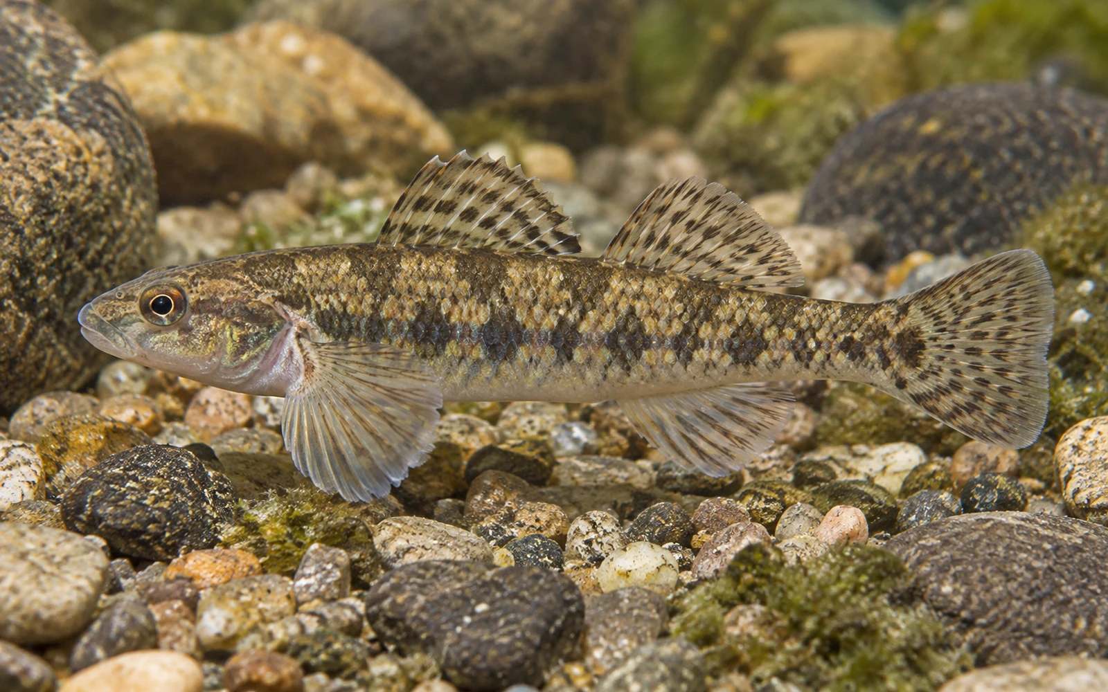
  • Tessellated Darter identification image Tessellated Darter Etheostoma olmstediSurveyed
  • Rock Bass identification image Rock Bass Ambloplites rupestrisSurveyed
  • TroutStocked
Sources & Method
Sources used for Connecticut Waterways

IonaFish compiles Waterway information from public and government sources, geographic data, fisheries information, and reviewed research. Information is normalized and presented in IonaFish's fisherman-focused format.

  1. Connecticut DEEP stocked lakes and stocked streamsOfficial Waterway identity, type, location, geometry, and reviewed reach context for the approved Connecticut cohort.
  2. Connecticut DEEP 2026 Fishing GuideReviewed public-fishing access, managed-water designation, and material access or special-regulation conditions.
  3. Connecticut DEEP Community Fishing WatersStanding-water identity and locality corroboration where directly used.
  4. Connecticut DEEP Fish Community DataWaterway- and municipality-matched survey observations with exact sample years; historical observations are not presented as necessarily current.
  5. Connecticut DEEP 2025 Annual and 2026 Current Fish Stocking ReportsCompleted Waterway-specific stocking evidence. Exact species and broad Trout wording retain the source's original specificity.
  6. Connecticut DEEP fish distribution-map methodologyArchived methodology explains explicit capture points and historical-versus-recent symbols. Shaded drainage distributions are not Waterway-level evidence.
  7. IonaFish review, reconciliation, and normalizationCanonical parent-Waterway identities, reach-limited access presentation, provenance linkage, and fisherman-focused terminology.

This state-level list describes sources used across the Waterway research and mapping workflow. Not every source contributed to every individual Waterway.

Mill River

River • United States, Connecticut

Waterway Information

Identity & Location
Waterway Name
Mill River
State
Connecticut
County / Counties
Unknown
Hydrologic Class
Flowing water
Waterway Type
River
Map Location
Unknown
Fishing Access
Public Fishing Access
Conditional
Access Conditions
Rivers and streams may have multiple public access locations with different ownership, parking, fees, regulations, and seasonal restrictions. Check current state or managing-authority information before visiting., This is not a whole-waterway access claim; current property rules, hours, parking limits, closures, and posted restrictions apply., Special regulations apply within the reviewed Trout Management Area reach.
Fishing Information
Fish Species Reported for This Waterway

Species records and fish populations may change over time.

  • Brook Trout identification image Brook Trout Salvelinus fontinalisSurveyed · Stocked
  • Bluegill identification image Bluegill Lepomis macrochirusSurveyed
  • Rainbow Trout identification image Rainbow Trout Oncorhynchus mykissSurveyed · Stocked
  • Largemouth Bass identification image Largemouth Bass Micropterus salmoidesSurveyed
  • Brown Bullhead identification image Brown Bullhead Ameiurus nebulosusSurveyed
  • Pumpkinseed identification image Pumpkinseed Lepomis gibbosusSurveyed
  • Blacknose Dace identification image Blacknose Dace Rhinichthys atratulusSurveyed
  • Golden Shiner identification image Golden Shiner Notemigonus crysoleucasSurveyed
  • Yellow Perch identification image Yellow Perch Perca flavescensSurveyed
  • White Sucker identification image White Sucker Catostomus commersoniiSurveyed
  • Redbreast Sunfish identification image Redbreast Sunfish Lepomis auritusSurveyed
  • American Eel identification image American Eel Anguilla rostrataSurveyed
  • Chain Pickerel identification image Chain Pickerel Esox nigerSurveyed
  • Brown Trout identification image Brown Trout Salmo truttaSurveyed · Stocked
  • Tessellated Darter identification image Tessellated Darter Etheostoma olmstediSurveyed
  • Spottail Shiner identification image Spottail Shiner Notropis hudsoniusSurveyed
  • TroutStocked
Sources & Method
Sources used for Connecticut Waterways

IonaFish compiles Waterway information from public and government sources, geographic data, fisheries information, and reviewed research. Information is normalized and presented in IonaFish's fisherman-focused format.

  1. Connecticut DEEP stocked lakes and stocked streamsOfficial Waterway identity, type, location, geometry, and reviewed reach context for the approved Connecticut cohort.
  2. Connecticut DEEP 2026 Fishing GuideReviewed public-fishing access, managed-water designation, and material access or special-regulation conditions.
  3. Connecticut DEEP Community Fishing WatersStanding-water identity and locality corroboration where directly used.
  4. Connecticut DEEP Fish Community DataWaterway- and municipality-matched survey observations with exact sample years; historical observations are not presented as necessarily current.
  5. Connecticut DEEP 2025 Annual and 2026 Current Fish Stocking ReportsCompleted Waterway-specific stocking evidence. Exact species and broad Trout wording retain the source's original specificity.
  6. Connecticut DEEP fish distribution-map methodologyArchived methodology explains explicit capture points and historical-versus-recent symbols. Shaded drainage distributions are not Waterway-level evidence.
  7. IonaFish review, reconciliation, and normalizationCanonical parent-Waterway identities, reach-limited access presentation, provenance linkage, and fisherman-focused terminology.

This state-level list describes sources used across the Waterway research and mapping workflow. Not every source contributed to every individual Waterway.

Mill Run Reservoir

Reservoir • United States, Blair, Pennsylvania

View Official Location on Map

Waterway Information

Identity & Location
Waterway Name
Mill Run Reservoir
State
Pennsylvania
County / Counties
Blair
Hydrologic Class
Standing water
Waterway Type
Reservoir
Map Location
40.519104, -78.452179
Known Alternate Names
Mill Run Dam
Fishing Access
Public Fishing Access
Unknown
Sources & Method
Sources used for Pennsylvania Waterways

IonaFish compiles Waterway information from public and government sources, geographic data, fisheries information, and reviewed research. Information is normalized and presented in IonaFish's fisherman-focused format.

  1. Direct active production sources — Pennsylvania Fish and Boat Commission (PFBC)PFBC Waterway, fisheries, stocking, regulation, verified access, and open-fishing records that actively supply final Pennsylvania facts.
  2. Supporting identity and geography — GNIS and USGSFederal names, identifiers, and geographic support only where actually bound to a final Waterway.
  3. Legacy provenance — historical NHD and retired hydrography identifiersRetained on historical records where applicable; these are not active statewide coverage sources.
  4. Bounded local corroborationCounty, municipal, park, authority, and other local public sources only where they directly support a reviewed record.
  5. Review methodology — reviewed geographic and map researchUsed to reconcile identity and access locations as a review method, not as an authoritative source family.
  6. IonaFish normalizationIonaFish reconciles source facts into canonical Waterway identities, normalized terminology, and fisherman-focused presentation.

This state-level list describes sources used across the Waterway research and mapping workflow. Not every source contributed to every individual Waterway.

Miller Pond

Pond • United States, Pennsylvania, Wayne

View Official Location on Map

Waterway Information

Identity & Location
Waterway Name
Miller Pond
State
Pennsylvania
County / Counties
Wayne
Hydrologic Class
Standing water
Waterway Type
Pond
Map Location
41.716667, -75.356667
Fishing Access
Public Fishing Access
Confirmed
Access Conditions
Miller Pond 3 PFBC N Electric Motors Only 10 spaces or more
Fishing Information
Fish Species Reported for This Waterway

Species records and fish populations may change over time.

  • Bluegill identification image Bluegill Lepomis macrochirusReported
  • Largemouth Bass identification image Largemouth Bass Micropterus salmoidesReported
  • Pumpkinseed identification image Pumpkinseed Lepomis gibbosusReported
  • Yellow Perch identification image Yellow Perch Perca flavescensReported
  • Chain Pickerel identification image Chain Pickerel Esox nigerReported
Sources & Method
Sources used for Pennsylvania Waterways

IonaFish compiles Waterway information from public and government sources, geographic data, fisheries information, and reviewed research. Information is normalized and presented in IonaFish's fisherman-focused format.

  1. Direct active production sources — Pennsylvania Fish and Boat Commission (PFBC)PFBC Waterway, fisheries, stocking, regulation, verified access, and open-fishing records that actively supply final Pennsylvania facts.
  2. Supporting identity and geography — GNIS and USGSFederal names, identifiers, and geographic support only where actually bound to a final Waterway.
  3. Legacy provenance — historical NHD and retired hydrography identifiersRetained on historical records where applicable; these are not active statewide coverage sources.
  4. Bounded local corroborationCounty, municipal, park, authority, and other local public sources only where they directly support a reviewed record.
  5. Review methodology — reviewed geographic and map researchUsed to reconcile identity and access locations as a review method, not as an authoritative source family.
  6. IonaFish normalizationIonaFish reconciles source facts into canonical Waterway identities, normalized terminology, and fisherman-focused presentation.

This state-level list describes sources used across the Waterway research and mapping workflow. Not every source contributed to every individual Waterway.

Miller Run

Unknown • United States, Pennsylvania, Somerset

View Official Location on Map

Waterway Information

Identity & Location
Waterway Name
Miller Run
State
Pennsylvania
County / Counties
Somerset
Hydrologic Class
Flowing water
Waterway Type
Unknown
Map Location
39.772820, -78.986950
Fishing Access
Public Fishing Access
Conditional
Access Conditions
Rivers and streams may have multiple public access locations with different ownership, parking, launch facilities, regulations, and seasonal restrictions. Some sections may cross private property, and PFBC listing, stocking, or mapping does not guarantee public access. Check current PFBC and managing-authority information before visiting.
Sources & Method
Sources used for Pennsylvania Waterways

IonaFish compiles Waterway information from public and government sources, geographic data, fisheries information, and reviewed research. Information is normalized and presented in IonaFish's fisherman-focused format.

  1. Direct active production sources — Pennsylvania Fish and Boat Commission (PFBC)PFBC Waterway, fisheries, stocking, regulation, verified access, and open-fishing records that actively supply final Pennsylvania facts.
  2. Supporting identity and geography — GNIS and USGSFederal names, identifiers, and geographic support only where actually bound to a final Waterway.
  3. Legacy provenance — historical NHD and retired hydrography identifiersRetained on historical records where applicable; these are not active statewide coverage sources.
  4. Bounded local corroborationCounty, municipal, park, authority, and other local public sources only where they directly support a reviewed record.
  5. Review methodology — reviewed geographic and map researchUsed to reconcile identity and access locations as a review method, not as an authoritative source family.
  6. IonaFish normalizationIonaFish reconciles source facts into canonical Waterway identities, normalized terminology, and fisherman-focused presentation.

This state-level list describes sources used across the Waterway research and mapping workflow. Not every source contributed to every individual Waterway.

Miller's Pond

Lake • United States, Connecticut, Middlesex

View Official Location on Map

Waterway Information

Identity & Location
Waterway Name
Miller's Pond
State
Connecticut
County / Counties
Middlesex
Nearest Town
Durham
Hydrologic Class
Standing water
Waterway Type
Lake
Map Location
41.476488, -72.633356
Known Alternate Names
Millers Pond
Fishing Access
Public Fishing Access
Conditional
Access Conditions
Carry-in watercraft access requires an approximately 300-yard carry.
Fishing Information
Fish Species Reported for This Waterway

Species records and fish populations may change over time.

  • Brook Trout identification image Brook Trout Salvelinus fontinalisStocked
  • Bluegill identification image Bluegill Lepomis macrochirusSurveyed
  • Rainbow Trout identification image Rainbow Trout Oncorhynchus mykissStocked
  • Largemouth Bass identification image Largemouth Bass Micropterus salmoidesSurveyed
  • Pumpkinseed identification image Pumpkinseed Lepomis gibbosusSurveyed
  • Yellow Perch identification image Yellow Perch Perca flavescensSurveyed
  • Black Crappie identification image Black Crappie Pomoxis nigromaculatusSurveyed
  • American Eel identification image American Eel Anguilla rostrataSurveyed
  • Brown Trout identification image Brown Trout Salmo truttaStocked
  • TroutStocked
Sources & Method
Sources used for Connecticut Waterways

IonaFish compiles Waterway information from public and government sources, geographic data, fisheries information, and reviewed research. Information is normalized and presented in IonaFish's fisherman-focused format.

  1. Connecticut DEEP stocked lakes and stocked streamsOfficial Waterway identity, type, location, geometry, and reviewed reach context for the approved Connecticut cohort.
  2. Connecticut DEEP 2026 Fishing GuideReviewed public-fishing access, managed-water designation, and material access or special-regulation conditions.
  3. Connecticut DEEP Community Fishing WatersStanding-water identity and locality corroboration where directly used.
  4. Connecticut DEEP Fish Community DataWaterway- and municipality-matched survey observations with exact sample years; historical observations are not presented as necessarily current.
  5. Connecticut DEEP 2025 Annual and 2026 Current Fish Stocking ReportsCompleted Waterway-specific stocking evidence. Exact species and broad Trout wording retain the source's original specificity.
  6. Connecticut DEEP fish distribution-map methodologyArchived methodology explains explicit capture points and historical-versus-recent symbols. Shaded drainage distributions are not Waterway-level evidence.
  7. IonaFish review, reconciliation, and normalizationCanonical parent-Waterway identities, reach-limited access presentation, provenance linkage, and fisherman-focused terminology.

This state-level list describes sources used across the Waterway research and mapping workflow. Not every source contributed to every individual Waterway.

Millers Run

Unknown • Allegheny, Washington, United States, Pennsylvania

View Official Location on Map

Waterway Information

Identity & Location
Waterway Name
Millers Run
State
Pennsylvania
County / Counties
Allegheny, Washington
Hydrologic Class
Flowing water
Waterway Type
Unknown
Map Location
40.320500, -80.210620
Fishing Access
Public Fishing Access
Conditional
Access Conditions
Rivers and streams may have multiple public access locations with different ownership, parking, launch facilities, regulations, and seasonal restrictions. Some sections may cross private property, and PFBC listing, stocking, or mapping does not guarantee public access. Check current PFBC and managing-authority information before visiting.
Sources & Method
Sources used for Pennsylvania Waterways

IonaFish compiles Waterway information from public and government sources, geographic data, fisheries information, and reviewed research. Information is normalized and presented in IonaFish's fisherman-focused format.

  1. Direct active production sources — Pennsylvania Fish and Boat Commission (PFBC)PFBC Waterway, fisheries, stocking, regulation, verified access, and open-fishing records that actively supply final Pennsylvania facts.
  2. Supporting identity and geography — GNIS and USGSFederal names, identifiers, and geographic support only where actually bound to a final Waterway.
  3. Legacy provenance — historical NHD and retired hydrography identifiersRetained on historical records where applicable; these are not active statewide coverage sources.
  4. Bounded local corroborationCounty, municipal, park, authority, and other local public sources only where they directly support a reviewed record.
  5. Review methodology — reviewed geographic and map researchUsed to reconcile identity and access locations as a review method, not as an authoritative source family.
  6. IonaFish normalizationIonaFish reconciles source facts into canonical Waterway identities, normalized terminology, and fisherman-focused presentation.

This state-level list describes sources used across the Waterway research and mapping workflow. Not every source contributed to every individual Waterway.

Millhurst Pond

Pond • United States, Millhurst, Monmouth, New Jersey • 21.87489355 acres

View Official Location on Map

Waterway Information

Identity & Location
Waterway Name
Millhurst Pond
State
New Jersey
County / Counties
Monmouth
Nearest Town
Millhurst
Hydrologic Class
Standing water
Waterway Type
Pond
Size / Acres
21.8749 acres
Map Location
40.244933, -74.341169
Fishing Access
Public Fishing Access
Confirmed
Permit Required
No permit required
Boat Access & Restrictions
Motor Use
No motors
Fishing Information
Fish Species Reported for This Waterway

Species records and fish populations may change over time.

  • Largemouth Bass identification image Largemouth Bass Micropterus salmoidesReported
  • Common Carp identification image Common Carp Cyprinus carpioReported
  • CatfishReported
  • PickerelReported
  • SunfishReported
Management & Official Information
Managed By
Municipal, Private
Sources & Method
Sources used for New Jersey Waterways

IonaFish compiles Waterway information from public and government sources, geographic data, fisheries information, and reviewed research. Information is normalized and presented in IonaFish's fisherman-focused format.

  1. Primary fishing and access authorities — New Jersey Fish & Wildlife / NJDEPThe publicly accessible fishing-water catalog qualifies the established standing-water pack. Current trout-stocked stream data, Places to Fish, trout-water listings, the Freshwater Fishing Digest, and reviewed New Jersey park or access material qualify applicable flowing-water records.
  2. Supporting identity and geography — USGS, GNIS, and federal hydrographyFederal names, identifiers, locations, and hydrologic context support canonical identity and geographic reconciliation where actually used; they do not by themselves qualify New Jersey fishing-pack membership.
  3. Bounded New Jersey and local corroborationNew Jersey government, county, municipal, park, public-authority, and other official sources support specific access, location, restrictions, stocking, fisheries, or local-use facts where directly reviewed.
  4. Historical provenance and reviewed researchInactive historical hydrography and reviewed geographic or map research may be retained for provenance and reconciliation. They are not active fishing, access, or statewide membership authority.
  5. IonaFish review, reconciliation, and normalizationIonaFish independently reviews and reconciles applicable source facts into shared canonical Waterway identities, normalized terminology, fact-level provenance, and fisherman-focused presentation.

This state-level list describes sources used across the Waterway research and mapping workflow. Not every source contributed to every individual Waterway.

Millsboro Pond

Pond • United States, Delaware, Sussex • 101.0 acres

View Official Location on Map

Waterway Information

Identity & Location
Waterway Name
Millsboro Pond
State
Delaware
County / Counties
Sussex
Hydrologic Class
Standing water
Waterway Type
Pond
Size / Acres
101 acres
Map Location
38.596947, -75.294415
Fishing Access
Public Fishing Access
Confirmed, See Access Conditions
Access Conditions
Delaware fishing license requirements and applicable freshwater regulations apply. Boats must operate at no-wake speed. Check current DNREC information for site-specific shoreline, launch, hours, and other restrictions., Motors are limited to five horsepower.
Boat Access & Restrictions
Boat Ramp
Available
Fishing Information
Fish Species Reported for This Waterway

Species records and fish populations may change over time.

  • Gizzard Shad identification image Gizzard Shad Dorosoma cepedianumSurveyed
  • Bluegill identification image Bluegill Lepomis macrochirusSurveyed
  • Largemouth Bass identification image Largemouth Bass Micropterus salmoidesSurveyed
  • Creek Chubsucker identification image Creek Chubsucker Erimyzon oblongusSurveyed
  • Redear Sunfish identification image Redear Sunfish Lepomis microlophusSurveyed
  • Yellow Perch identification image Yellow Perch Perca flavescensSurveyed
  • Black Crappie identification image Black Crappie Pomoxis nigromaculatusSurveyed
  • American Eel identification image American Eel Anguilla rostrataSurveyed
  • Chain Pickerel identification image Chain Pickerel Esox nigerSurveyed
  • Common Carp identification image Common Carp Cyprinus carpioSurveyed
Sources & Method
Sources used for Delaware Waterways

IonaFish compiles Waterway information from public and government sources, geographic data, fisheries information, and reviewed research. Information is normalized and presented in IonaFish's fisherman-focused format.

  1. Delaware FirstMap and DNREC public-pond geographic dataMain/youth pond points, polygons, fishing facilities, and fishing-access review layers.
  2. DNREC Public Freshwater Fishing Ponds and Small Pond AnglingPublic-pond identity and youth-program information.
  3. DNREC Freshwater Trout Fishing and Fish StockingTrout-program identity, designation, stocking context, and official fisheries resources.
  4. DNREC Freshwater Pond Fish Community SurveysPond-specific fisheries survey evidence.
  5. DNREC Tidal Largemouth Bass SurveyTidal-system identity and largemouth bass evidence.
  6. DNREC Shad Restoration and Species and Habitat MonitoringNanticoke River and related fisheries evidence.
  7. Delaware Fish FactsTaxonomy and fisheries evidence review support.
  8. IonaFish normalization, compilation, and presentationCanonical identity decisions, normalization, provenance linkage, and fisherman-focused presentation.

This state-level list describes sources used across the Waterway research and mapping workflow. Not every source contributed to every individual Waterway.

Millstone Creek

Creek • United States, Jefferson, Pennsylvania

View Official Location on Map

Waterway Information

Identity & Location
Waterway Name
Millstone Creek
State
Pennsylvania
County / Counties
Jefferson
Hydrologic Class
Flowing water
Waterway Type
Creek
Map Location
41.366010, -79.074680
Fishing Access
Public Fishing Access
Conditional
Access Conditions
Rivers and streams may have multiple public access locations with different ownership, parking, launch facilities, regulations, and seasonal restrictions. Some sections may cross private property, and PFBC listing, stocking, or mapping does not guarantee public access. Check current PFBC and managing-authority information before visiting.
Sources & Method
Sources used for Pennsylvania Waterways

IonaFish compiles Waterway information from public and government sources, geographic data, fisheries information, and reviewed research. Information is normalized and presented in IonaFish's fisherman-focused format.

  1. Direct active production sources — Pennsylvania Fish and Boat Commission (PFBC)PFBC Waterway, fisheries, stocking, regulation, verified access, and open-fishing records that actively supply final Pennsylvania facts.
  2. Supporting identity and geography — GNIS and USGSFederal names, identifiers, and geographic support only where actually bound to a final Waterway.
  3. Legacy provenance — historical NHD and retired hydrography identifiersRetained on historical records where applicable; these are not active statewide coverage sources.
  4. Bounded local corroborationCounty, municipal, park, authority, and other local public sources only where they directly support a reviewed record.
  5. Review methodology — reviewed geographic and map researchUsed to reconcile identity and access locations as a review method, not as an authoritative source family.
  6. IonaFish normalizationIonaFish reconciles source facts into canonical Waterway identities, normalized terminology, and fisherman-focused presentation.

This state-level list describes sources used across the Waterway research and mapping workflow. Not every source contributed to every individual Waterway.
Milltown Landing Pond

Unknown • United States, Maryland

Waterway Information

Identity & Location
Waterway Name
Milltown Landing Pond
State
Maryland
County / Counties
Unknown
Hydrologic Class
Standing water
Waterway Type
Unknown
Map Location
Unknown
Fishing Access
Public Fishing Access
Confirmed
Sources & Method
Sources used for Maryland Waterways

IonaFish compiles Waterway information from public and government sources, geographic data, fisheries information, and reviewed research. Information is normalized and presented in IonaFish's fisherman-focused format.

  1. U.S. Geological Survey 3D Hydrography Program (3DHP)Federal hydrography used for candidate identity and location support.
  2. Geographic Names Information System (GNIS)Federal names, identifiers, feature classes, and location support.
  3. Maryland Department of Natural Resources official factual pages and schedulesCandidate-specific fishing, stocking, public-access, freshwater/tidal-scope, and restriction facts where used.
  4. U.S. Fish and Wildlife Service official factual pagesCandidate-specific federal refuge fishing and access facts where used.
  5. U.S. National Park Service official factual pagesCandidate-specific federal park fishing, access, launch, and restriction facts where used.
  6. U.S. Army Corps of Engineers official factual pagesCandidate-specific federal reservoir fishing, access, and launch facts where used.
  7. Maryland local governments, park agencies, and public reservoir authoritiesCandidate-specific fishing, access, permit, fee, hour, launch, and restriction facts where used.
  8. IonaFish normalization, compilation, and presentationReviewed candidate bindings, fact-level provenance, and fisherman-focused presentation.

This state-level list describes sources used across the Waterway research and mapping workflow. Not every source contributed to every individual Waterway.

Milton Lake

Lake • United States, New Jersey, Rahway, Union • 9.15909058 acres

View Official Location on Map

Waterway Information

Identity & Location
Waterway Name
Milton Lake
State
New Jersey
County / Counties
Union
Nearest Town
Rahway
Hydrologic Class
Standing water
Waterway Type
Lake
Size / Acres
9.15909 acres
Map Location
40.606577, -74.300707
Fishing Access
Public Fishing Access
Confirmed
Permit Required
Permit required
Boat Access & Restrictions
Cartop / Kayak Launch
Available
Motor Use
No motors
Fishing Information
Trout Information
Seasonal trout water
Fish Species Reported for This Waterway

Species records and fish populations may change over time.

  • Rainbow Trout identification image Rainbow Trout Oncorhynchus mykissStocked
  • Largemouth Bass identification image Largemouth Bass Micropterus salmoidesReported
  • Common Carp identification image Common Carp Cyprinus carpioReported
  • Channel Catfish identification image Channel Catfish Ictalurus punctatusReported · Stocked
  • CrappieReported
  • PickerelReported
  • SunfishReported
Amenities
Picnicking
Yes
Management & Official Information
Managed By
County
Sources & Method
Sources used for New Jersey Waterways

IonaFish compiles Waterway information from public and government sources, geographic data, fisheries information, and reviewed research. Information is normalized and presented in IonaFish's fisherman-focused format.

  1. Primary fishing and access authorities — New Jersey Fish & Wildlife / NJDEPThe publicly accessible fishing-water catalog qualifies the established standing-water pack. Current trout-stocked stream data, Places to Fish, trout-water listings, the Freshwater Fishing Digest, and reviewed New Jersey park or access material qualify applicable flowing-water records.
  2. Supporting identity and geography — USGS, GNIS, and federal hydrographyFederal names, identifiers, locations, and hydrologic context support canonical identity and geographic reconciliation where actually used; they do not by themselves qualify New Jersey fishing-pack membership.
  3. Bounded New Jersey and local corroborationNew Jersey government, county, municipal, park, public-authority, and other official sources support specific access, location, restrictions, stocking, fisheries, or local-use facts where directly reviewed.
  4. Historical provenance and reviewed researchInactive historical hydrography and reviewed geographic or map research may be retained for provenance and reconciliation. They are not active fishing, access, or statewide membership authority.
  5. IonaFish review, reconciliation, and normalizationIonaFish independently reviews and reconciles applicable source facts into shared canonical Waterway identities, normalized terminology, fact-level provenance, and fisherman-focused presentation.

This state-level list describes sources used across the Waterway research and mapping workflow. Not every source contributed to every individual Waterway.

Mindowaskin Pond

Pond • United States, New Jersey, Union, Westfield • 2.08968045 acres

View Official Location on Map

Waterway Information

Identity & Location
Waterway Name
Mindowaskin Pond
State
New Jersey
County / Counties
Union
Nearest Town
Westfield
Hydrologic Class
Standing water
Waterway Type
Pond
Size / Acres
2.08968 acres
Map Location
40.654634, -74.346684
Known Alternate Names
Mindowaskin Lake
Fishing Access
Public Fishing Access
Confirmed
Permit Required
No permit required
Boat Access & Restrictions
Motor Use
No motors
Fishing Information
Fish Species Reported for This Waterway

Species records and fish populations may change over time.

  • Largemouth Bass identification image Largemouth Bass Micropterus salmoidesReported
  • Common Carp identification image Common Carp Cyprinus carpioReported
  • CatfishReported
  • SunfishReported
Amenities
Picnicking
Yes
Management & Official Information
Managed By
Municipal
Sources & Method
Sources used for New Jersey Waterways

IonaFish compiles Waterway information from public and government sources, geographic data, fisheries information, and reviewed research. Information is normalized and presented in IonaFish's fisherman-focused format.

  1. Primary fishing and access authorities — New Jersey Fish & Wildlife / NJDEPThe publicly accessible fishing-water catalog qualifies the established standing-water pack. Current trout-stocked stream data, Places to Fish, trout-water listings, the Freshwater Fishing Digest, and reviewed New Jersey park or access material qualify applicable flowing-water records.
  2. Supporting identity and geography — USGS, GNIS, and federal hydrographyFederal names, identifiers, locations, and hydrologic context support canonical identity and geographic reconciliation where actually used; they do not by themselves qualify New Jersey fishing-pack membership.
  3. Bounded New Jersey and local corroborationNew Jersey government, county, municipal, park, public-authority, and other official sources support specific access, location, restrictions, stocking, fisheries, or local-use facts where directly reviewed.
  4. Historical provenance and reviewed researchInactive historical hydrography and reviewed geographic or map research may be retained for provenance and reconciliation. They are not active fishing, access, or statewide membership authority.
  5. IonaFish review, reconciliation, and normalizationIonaFish independently reviews and reconciles applicable source facts into shared canonical Waterway identities, normalized terminology, fact-level provenance, and fisherman-focused presentation.

This state-level list describes sources used across the Waterway research and mapping workflow. Not every source contributed to every individual Waterway.

Mingamahone Brook

Stream • United States, Monmouth, New Jersey

View Official Location on Map

Waterway Information

Identity & Location
Waterway Name
Mingamahone Brook
State
New Jersey
County / Counties
Monmouth
Hydrologic Class
Flowing water
Waterway Type
Stream
Map Location
40.174315, -74.152505
Fishing Access
Public Fishing Access
Conditional
Access Conditions
Rivers and streams may have multiple public access locations with different ownership, parking, fees, regulations, and seasonal restrictions. Check current state or managing-authority information before visiting.
Fishing Information
Fish Species Reported for This Waterway

Species records and fish populations may change over time.

  • Rainbow Trout identification image Rainbow Trout Oncorhynchus mykissStocked
Sources & Method
Sources used for New Jersey Waterways

IonaFish compiles Waterway information from public and government sources, geographic data, fisheries information, and reviewed research. Information is normalized and presented in IonaFish's fisherman-focused format.

  1. Primary fishing and access authorities — New Jersey Fish & Wildlife / NJDEPThe publicly accessible fishing-water catalog qualifies the established standing-water pack. Current trout-stocked stream data, Places to Fish, trout-water listings, the Freshwater Fishing Digest, and reviewed New Jersey park or access material qualify applicable flowing-water records.
  2. Supporting identity and geography — USGS, GNIS, and federal hydrographyFederal names, identifiers, locations, and hydrologic context support canonical identity and geographic reconciliation where actually used; they do not by themselves qualify New Jersey fishing-pack membership.
  3. Bounded New Jersey and local corroborationNew Jersey government, county, municipal, park, public-authority, and other official sources support specific access, location, restrictions, stocking, fisheries, or local-use facts where directly reviewed.
  4. Historical provenance and reviewed researchInactive historical hydrography and reviewed geographic or map research may be retained for provenance and reconciliation. They are not active fishing, access, or statewide membership authority.
  5. IonaFish review, reconciliation, and normalizationIonaFish independently reviews and reconciles applicable source facts into shared canonical Waterway identities, normalized terminology, fact-level provenance, and fisherman-focused presentation.

This state-level list describes sources used across the Waterway research and mapping workflow. Not every source contributed to every individual Waterway.

Mingo Creek

Creek • United States, Pennsylvania, Washington

View Official Location on Map

Waterway Information

Identity & Location
Waterway Name
Mingo Creek
State
Pennsylvania
County / Counties
Washington
Hydrologic Class
Flowing water
Waterway Type
Creek
Map Location
40.199711, -80.033418
Fishing Access
Public Fishing Access
Conditional
Access Conditions
Rivers and streams may have multiple public access locations with different ownership, parking, launch facilities, regulations, and seasonal restrictions. Some sections may cross private property, and PFBC listing, stocking, or mapping does not guarantee public access. Check current PFBC and managing-authority information before visiting.
Sources & Method
Sources used for Pennsylvania Waterways

IonaFish compiles Waterway information from public and government sources, geographic data, fisheries information, and reviewed research. Information is normalized and presented in IonaFish's fisherman-focused format.

  1. Direct active production sources — Pennsylvania Fish and Boat Commission (PFBC)PFBC Waterway, fisheries, stocking, regulation, verified access, and open-fishing records that actively supply final Pennsylvania facts.
  2. Supporting identity and geography — GNIS and USGSFederal names, identifiers, and geographic support only where actually bound to a final Waterway.
  3. Legacy provenance — historical NHD and retired hydrography identifiersRetained on historical records where applicable; these are not active statewide coverage sources.
  4. Bounded local corroborationCounty, municipal, park, authority, and other local public sources only where they directly support a reviewed record.
  5. Review methodology — reviewed geographic and map researchUsed to reconcile identity and access locations as a review method, not as an authoritative source family.
  6. IonaFish normalizationIonaFish reconciles source facts into canonical Waterway identities, normalized terminology, and fisherman-focused presentation.

This state-level list describes sources used across the Waterway research and mapping workflow. Not every source contributed to every individual Waterway.

Minsi Lake

Lake • United States, Northampton, Pennsylvania

View Official Location on Map

Waterway Information

Identity & Location
Waterway Name
Minsi Lake
State
Pennsylvania
County / Counties
Northampton
Hydrologic Class
Standing water
Waterway Type
Lake
Map Location
40.911667, -75.170278
Known Alternate Names
Minsi Lk
Fishing Access
Public Fishing Access
Unknown
Fishing Information
Fish Species Reported for This Waterway

Species records and fish populations may change over time.

  • Bluegill identification image Bluegill Lepomis macrochirusReported
  • Largemouth Bass identification image Largemouth Bass Micropterus salmoidesReported · Stocked
  • Pumpkinseed identification image Pumpkinseed Lepomis gibbosusReported
  • Golden Shiner identification image Golden Shiner Notemigonus crysoleucasStocked
  • Yellow Perch identification image Yellow Perch Perca flavescensReported · Stocked
  • Black Crappie identification image Black Crappie Pomoxis nigromaculatusReported · Stocked
  • Chain Pickerel identification image Chain Pickerel Esox nigerReported
  • Walleye identification image Walleye Sander vitreusStocked
  • TroutStocked
Sources & Method
Sources used for Pennsylvania Waterways

IonaFish compiles Waterway information from public and government sources, geographic data, fisheries information, and reviewed research. Information is normalized and presented in IonaFish's fisherman-focused format.

  1. Direct active production sources — Pennsylvania Fish and Boat Commission (PFBC)PFBC Waterway, fisheries, stocking, regulation, verified access, and open-fishing records that actively supply final Pennsylvania facts.
  2. Supporting identity and geography — GNIS and USGSFederal names, identifiers, and geographic support only where actually bound to a final Waterway.
  3. Legacy provenance — historical NHD and retired hydrography identifiersRetained on historical records where applicable; these are not active statewide coverage sources.
  4. Bounded local corroborationCounty, municipal, park, authority, and other local public sources only where they directly support a reviewed record.
  5. Review methodology — reviewed geographic and map researchUsed to reconcile identity and access locations as a review method, not as an authoritative source family.
  6. IonaFish normalizationIonaFish reconciles source facts into canonical Waterway identities, normalized terminology, and fisherman-focused presentation.

This state-level list describes sources used across the Waterway research and mapping workflow. Not every source contributed to every individual Waterway.

Mirror Lake

Lake • United States, Browns Mills, Burlington, New Jersey • 145.16858297 acres

View Official Location on Map

Waterway Information

Identity & Location
Waterway Name
Mirror Lake
State
New Jersey
County / Counties
Burlington
Nearest Town
Browns Mills
Hydrologic Class
Standing water
Waterway Type
Lake
Size / Acres
145.169 acres
Map Location
39.973046, -74.567027
Fishing Access
Public Fishing Access
Confirmed
Permit Required
No permit required
Boat Access & Restrictions
Boat Ramp
Available
Cartop / Kayak Launch
Available
Motor Use
Electric motors only
Fishing Information
Fish Species Reported for This Waterway

Species records and fish populations may change over time.

  • Largemouth Bass identification image Largemouth Bass Micropterus salmoidesReported
  • Yellow Perch identification image Yellow Perch Perca flavescensReported
  • Common Carp identification image Common Carp Cyprinus carpioReported
  • Channel Catfish identification image Channel Catfish Ictalurus punctatusReported
  • CrappieReported
  • PickerelReported
  • SunfishReported
Amenities
Swimming
Yes
Picnicking
Yes
Management & Official Information
Managed By
Municipal
Sources & Method
Sources used for New Jersey Waterways

IonaFish compiles Waterway information from public and government sources, geographic data, fisheries information, and reviewed research. Information is normalized and presented in IonaFish's fisherman-focused format.

  1. Primary fishing and access authorities — New Jersey Fish & Wildlife / NJDEPThe publicly accessible fishing-water catalog qualifies the established standing-water pack. Current trout-stocked stream data, Places to Fish, trout-water listings, the Freshwater Fishing Digest, and reviewed New Jersey park or access material qualify applicable flowing-water records.
  2. Supporting identity and geography — USGS, GNIS, and federal hydrographyFederal names, identifiers, locations, and hydrologic context support canonical identity and geographic reconciliation where actually used; they do not by themselves qualify New Jersey fishing-pack membership.
  3. Bounded New Jersey and local corroborationNew Jersey government, county, municipal, park, public-authority, and other official sources support specific access, location, restrictions, stocking, fisheries, or local-use facts where directly reviewed.
  4. Historical provenance and reviewed researchInactive historical hydrography and reviewed geographic or map research may be retained for provenance and reconciliation. They are not active fishing, access, or statewide membership authority.
  5. IonaFish review, reconciliation, and normalizationIonaFish independently reviews and reconciles applicable source facts into shared canonical Waterway identities, normalized terminology, fact-level provenance, and fisherman-focused presentation.

This state-level list describes sources used across the Waterway research and mapping workflow. Not every source contributed to every individual Waterway.

Mix Run

Unknown • Cameron, Elk, United States, Pennsylvania

View Official Location on Map

Waterway Information

Identity & Location
Waterway Name
Mix Run
State
Pennsylvania
County / Counties
Cameron, Elk
Hydrologic Class
Flowing water
Waterway Type
Unknown
Map Location
41.315292, -78.213175
Fishing Access
Public Fishing Access
Conditional
Access Conditions
Rivers and streams may have multiple public access locations with different ownership, parking, launch facilities, regulations, and seasonal restrictions. Some sections may cross private property, and PFBC listing, stocking, or mapping does not guarantee public access. Check current PFBC and managing-authority information before visiting.
Fishing Information
Fish Species Reported for This Waterway

Species records and fish populations may change over time.

  • Brook Trout identification image Brook Trout Salvelinus fontinalisReported
  • Brown Trout identification image Brown Trout Salmo truttaReported
  • TroutReported
Sources & Method
Sources used for Pennsylvania Waterways

IonaFish compiles Waterway information from public and government sources, geographic data, fisheries information, and reviewed research. Information is normalized and presented in IonaFish's fisherman-focused format.

  1. Direct active production sources — Pennsylvania Fish and Boat Commission (PFBC)PFBC Waterway, fisheries, stocking, regulation, verified access, and open-fishing records that actively supply final Pennsylvania facts.
  2. Supporting identity and geography — GNIS and USGSFederal names, identifiers, and geographic support only where actually bound to a final Waterway.
  3. Legacy provenance — historical NHD and retired hydrography identifiersRetained on historical records where applicable; these are not active statewide coverage sources.
  4. Bounded local corroborationCounty, municipal, park, authority, and other local public sources only where they directly support a reviewed record.
  5. Review methodology — reviewed geographic and map researchUsed to reconcile identity and access locations as a review method, not as an authoritative source family.
  6. IonaFish normalizationIonaFish reconciles source facts into canonical Waterway identities, normalized terminology, and fisherman-focused presentation.

This state-level list describes sources used across the Waterway research and mapping workflow. Not every source contributed to every individual Waterway.

Mohawk Pond

Pond • United States, Monmouth, New Jersey, Red Bank • 1.54512515 acres

View Official Location on Map

Waterway Information

Identity & Location
Waterway Name
Mohawk Pond
State
New Jersey
County / Counties
Monmouth
Nearest Town
Red Bank
Hydrologic Class
Standing water
Waterway Type
Pond
Size / Acres
1.54513 acres
Map Location
40.338854, -74.069794
Fishing Access
Public Fishing Access
Confirmed
Permit Required
No permit required
Boat Access & Restrictions
Motor Use
No motors
Fishing Information
Trout Information
Seasonal trout water
Fish Species Reported for This Waterway

Species records and fish populations may change over time.

  • Rainbow Trout identification image Rainbow Trout Oncorhynchus mykissStocked
  • Largemouth Bass identification image Largemouth Bass Micropterus salmoidesReported
  • SunfishReported
Management & Official Information
Managed By
Municipal
Sources & Method
Sources used for New Jersey Waterways

IonaFish compiles Waterway information from public and government sources, geographic data, fisheries information, and reviewed research. Information is normalized and presented in IonaFish's fisherman-focused format.

  1. Primary fishing and access authorities — New Jersey Fish & Wildlife / NJDEPThe publicly accessible fishing-water catalog qualifies the established standing-water pack. Current trout-stocked stream data, Places to Fish, trout-water listings, the Freshwater Fishing Digest, and reviewed New Jersey park or access material qualify applicable flowing-water records.
  2. Supporting identity and geography — USGS, GNIS, and federal hydrographyFederal names, identifiers, locations, and hydrologic context support canonical identity and geographic reconciliation where actually used; they do not by themselves qualify New Jersey fishing-pack membership.
  3. Bounded New Jersey and local corroborationNew Jersey government, county, municipal, park, public-authority, and other official sources support specific access, location, restrictions, stocking, fisheries, or local-use facts where directly reviewed.
  4. Historical provenance and reviewed researchInactive historical hydrography and reviewed geographic or map research may be retained for provenance and reconciliation. They are not active fishing, access, or statewide membership authority.
  5. IonaFish review, reconciliation, and normalizationIonaFish independently reviews and reconciles applicable source facts into shared canonical Waterway identities, normalized terminology, fact-level provenance, and fisherman-focused presentation.

This state-level list describes sources used across the Waterway research and mapping workflow. Not every source contributed to every individual Waterway.

Mohegan Lake

Lake • United States, Connecticut, Fairfield

View Official Location on Map

Waterway Information

Identity & Location
Waterway Name
Mohegan Lake
State
Connecticut
County / Counties
Fairfield
Nearest Town
Fairfield
Hydrologic Class
Standing water
Waterway Type
Lake
Map Location
41.205206, -73.254658
Fishing Access
Public Fishing Access
Confirmed
Fishing Information
Fish Species Reported for This Waterway

Species records and fish populations may change over time.

  • Brook Trout identification image Brook Trout Salvelinus fontinalisStocked
  • Rainbow Trout identification image Rainbow Trout Oncorhynchus mykissStocked
  • TroutStocked
Sources & Method
Sources used for Connecticut Waterways

IonaFish compiles Waterway information from public and government sources, geographic data, fisheries information, and reviewed research. Information is normalized and presented in IonaFish's fisherman-focused format.

  1. Connecticut DEEP stocked lakes and stocked streamsOfficial Waterway identity, type, location, geometry, and reviewed reach context for the approved Connecticut cohort.
  2. Connecticut DEEP 2026 Fishing GuideReviewed public-fishing access, managed-water designation, and material access or special-regulation conditions.
  3. Connecticut DEEP Community Fishing WatersStanding-water identity and locality corroboration where directly used.
  4. Connecticut DEEP Fish Community DataWaterway- and municipality-matched survey observations with exact sample years; historical observations are not presented as necessarily current.
  5. Connecticut DEEP 2025 Annual and 2026 Current Fish Stocking ReportsCompleted Waterway-specific stocking evidence. Exact species and broad Trout wording retain the source's original specificity.
  6. Connecticut DEEP fish distribution-map methodologyArchived methodology explains explicit capture points and historical-versus-recent symbols. Shaded drainage distributions are not Waterway-level evidence.
  7. IonaFish review, reconciliation, and normalizationCanonical parent-Waterway identities, reach-limited access presentation, provenance linkage, and fisherman-focused terminology.

This state-level list describes sources used across the Waterway research and mapping workflow. Not every source contributed to every individual Waterway.

Monksville Reservoir

Reservoir • United States, New Jersey, Passaic, Ringwood • 517.05187413 acres

View Official Location on Map

Waterway Information

Identity & Location
Waterway Name
Monksville Reservoir
State
New Jersey
County / Counties
Passaic
Nearest Town
Ringwood
Hydrologic Class
Standing water
Waterway Type
Reservoir
Size / Acres
517.052 acres
Map Location
41.128057, -74.307830
Fishing Access
Public Fishing Access
Confirmed
Permit Required
No permit required
Boat Access & Restrictions
Boat Ramp
Available
Cartop / Kayak Launch
Available
Motor Use
Horsepower limited
Horsepower Limit
Maximum 9.9 hp
Fishing Information
Fish Species Reported for This Waterway

Species records and fish populations may change over time.

  • Largemouth Bass identification image Largemouth Bass Micropterus salmoidesReported
  • Smallmouth Bass identification image Smallmouth Bass Micropterus dolomieuReported
  • Hybrid Striped Bass identification image Hybrid Striped Bass Morone saxatilis x Morone chrysopsStocked
  • Yellow Perch identification image Yellow Perch Perca flavescensReported
  • Tiger Muskellunge identification image Tiger Muskellunge Esox lucius x Esox masquinongyStocked
  • Muskellunge identification image Muskellunge Esox masquinongyStocked
  • Walleye identification image Walleye Sander vitreusReported · Stocked
  • Channel Catfish identification image Channel Catfish Ictalurus punctatusReported · Stocked
  • CrappieReported
  • Musky/Northern PikeReported
  • PickerelReported
  • SunfishReported
Management & Official Information
Managed By
State
Sources & Method
Sources used for New Jersey Waterways

IonaFish compiles Waterway information from public and government sources, geographic data, fisheries information, and reviewed research. Information is normalized and presented in IonaFish's fisherman-focused format.

  1. Primary fishing and access authorities — New Jersey Fish & Wildlife / NJDEPThe publicly accessible fishing-water catalog qualifies the established standing-water pack. Current trout-stocked stream data, Places to Fish, trout-water listings, the Freshwater Fishing Digest, and reviewed New Jersey park or access material qualify applicable flowing-water records.
  2. Supporting identity and geography — USGS, GNIS, and federal hydrographyFederal names, identifiers, locations, and hydrologic context support canonical identity and geographic reconciliation where actually used; they do not by themselves qualify New Jersey fishing-pack membership.
  3. Bounded New Jersey and local corroborationNew Jersey government, county, municipal, park, public-authority, and other official sources support specific access, location, restrictions, stocking, fisheries, or local-use facts where directly reviewed.
  4. Historical provenance and reviewed researchInactive historical hydrography and reviewed geographic or map research may be retained for provenance and reconciliation. They are not active fishing, access, or statewide membership authority.
  5. IonaFish review, reconciliation, and normalizationIonaFish independently reviews and reconciles applicable source facts into shared canonical Waterway identities, normalized terminology, fact-level provenance, and fisherman-focused presentation.

This state-level list describes sources used across the Waterway research and mapping workflow. Not every source contributed to every individual Waterway.

Monocacy Creek

Creek • United States, Northampton, Pennsylvania

View Official Location on Map

Waterway Information

Identity & Location
Waterway Name
Monocacy Creek
State
Pennsylvania
County / Counties
Northampton
Hydrologic Class
Flowing water
Waterway Type
Creek
Map Location
40.688176, -75.345106
Fishing Access
Public Fishing Access
Conditional
Access Conditions
Rivers and streams may have multiple public access locations with different ownership, parking, launch facilities, regulations, and seasonal restrictions. Some sections may cross private property, and PFBC listing, stocking, or mapping does not guarantee public access. Check current PFBC and managing-authority information before visiting.
Fishing Information
Fish Species Reported for This Waterway

Species records and fish populations may change over time.

  • Brown Trout identification image Brown Trout Salmo truttaReported
  • TroutReported
Sources & Method
Sources used for Pennsylvania Waterways

IonaFish compiles Waterway information from public and government sources, geographic data, fisheries information, and reviewed research. Information is normalized and presented in IonaFish's fisherman-focused format.

  1. Direct active production sources — Pennsylvania Fish and Boat Commission (PFBC)PFBC Waterway, fisheries, stocking, regulation, verified access, and open-fishing records that actively supply final Pennsylvania facts.
  2. Supporting identity and geography — GNIS and USGSFederal names, identifiers, and geographic support only where actually bound to a final Waterway.
  3. Legacy provenance — historical NHD and retired hydrography identifiersRetained on historical records where applicable; these are not active statewide coverage sources.
  4. Bounded local corroborationCounty, municipal, park, authority, and other local public sources only where they directly support a reviewed record.
  5. Review methodology — reviewed geographic and map researchUsed to reconcile identity and access locations as a review method, not as an authoritative source family.
  6. IonaFish normalizationIonaFish reconciles source facts into canonical Waterway identities, normalized terminology, and fisherman-focused presentation.

This state-level list describes sources used across the Waterway research and mapping workflow. Not every source contributed to every individual Waterway.

Monocacy River

Unknown • United States, Maryland

View Official Location on Map

Waterway Information

Identity & Location
Waterway Name
Monocacy River
State
Maryland
County / Counties
Unknown
Hydrologic Class
Flowing water
Waterway Type
Unknown
Map Location
39.222881, -77.454153
Fishing Access
Public Fishing Access
Confirmed
Sources & Method
Sources used for Maryland Waterways

IonaFish compiles Waterway information from public and government sources, geographic data, fisheries information, and reviewed research. Information is normalized and presented in IonaFish's fisherman-focused format.

  1. U.S. Geological Survey 3D Hydrography Program (3DHP)Federal hydrography used for candidate identity and location support.
  2. Geographic Names Information System (GNIS)Federal names, identifiers, feature classes, and location support.
  3. Maryland Department of Natural Resources official factual pages and schedulesCandidate-specific fishing, stocking, public-access, freshwater/tidal-scope, and restriction facts where used.
  4. U.S. Fish and Wildlife Service official factual pagesCandidate-specific federal refuge fishing and access facts where used.
  5. U.S. National Park Service official factual pagesCandidate-specific federal park fishing, access, launch, and restriction facts where used.
  6. U.S. Army Corps of Engineers official factual pagesCandidate-specific federal reservoir fishing, access, and launch facts where used.
  7. Maryland local governments, park agencies, and public reservoir authoritiesCandidate-specific fishing, access, permit, fee, hour, launch, and restriction facts where used.
  8. IonaFish normalization, compilation, and presentationReviewed candidate bindings, fact-level provenance, and fisherman-focused presentation.

This state-level list describes sources used across the Waterway research and mapping workflow. Not every source contributed to every individual Waterway.

Monongahela River

River • Allegheny, Fayette, Greene, Washington, United States, Pennsylvania

View Official Location on Map

Waterway Information

Identity & Location
Waterway Name
Monongahela River
State
Pennsylvania
County / Counties
Allegheny, Fayette, Greene, Washington
Hydrologic Class
Flowing water
Waterway Type
River
Map Location
40.440833, -80.014167
Fishing Access
Public Fishing Access
Confirmed
Access Conditions
Rivers and streams may have multiple public access locations with different ownership, parking, launch facilities, regulations, and seasonal restrictions. Some sections may cross private property, and PFBC listing, stocking, or mapping does not guarantee public access. Check current PFBC and managing-authority information before visiting.
Fishing Information
Fish Species Reported for This Waterway

Species records and fish populations may change over time.

  • White Crappie identification image White Crappie Pomoxis annularisReported
  • Smallmouth Bass identification image Smallmouth Bass Micropterus dolomieuReported
  • Blue Catfish identification image Blue Catfish Ictalurus furcatusStocked
  • Hybrid Striped Bass identification image Hybrid Striped Bass Morone saxatilis x Morone chrysopsStocked
  • White Bass identification image White Bass Morone chrysopsReported
  • Tiger Muskellunge identification image Tiger Muskellunge Esox lucius x Esox masquinongyReported · Stocked
  • Muskellunge identification image Muskellunge Esox masquinongyReported · Stocked
  • Flathead Catfish identification image Flathead Catfish Pylodictis olivarisReported
  • Spotted Bass identification image Spotted Bass Micropterus punctulatusReported
  • Common Carp identification image Common Carp Cyprinus carpioReported
  • Rock Bass identification image Rock Bass Ambloplites rupestrisReported
  • Sauger identification image Sauger Sander canadensisReported
  • Walleye identification image Walleye Sander vitreusReported · Stocked
  • Channel Catfish identification image Channel Catfish Ictalurus punctatusReported
Sources & Method
Sources used for Pennsylvania Waterways

IonaFish compiles Waterway information from public and government sources, geographic data, fisheries information, and reviewed research. Information is normalized and presented in IonaFish's fisherman-focused format.

  1. Direct active production sources — Pennsylvania Fish and Boat Commission (PFBC)PFBC Waterway, fisheries, stocking, regulation, verified access, and open-fishing records that actively supply final Pennsylvania facts.
  2. Supporting identity and geography — GNIS and USGSFederal names, identifiers, and geographic support only where actually bound to a final Waterway.
  3. Legacy provenance — historical NHD and retired hydrography identifiersRetained on historical records where applicable; these are not active statewide coverage sources.
  4. Bounded local corroborationCounty, municipal, park, authority, and other local public sources only where they directly support a reviewed record.
  5. Review methodology — reviewed geographic and map researchUsed to reconcile identity and access locations as a review method, not as an authoritative source family.
  6. IonaFish normalizationIonaFish reconciles source facts into canonical Waterway identities, normalized terminology, and fisherman-focused presentation.

This state-level list describes sources used across the Waterway research and mapping workflow. Not every source contributed to every individual Waterway.

Montour Creek

Creek • United States, Pennsylvania, Perry

View Official Location on Map

Waterway Information

Identity & Location
Waterway Name
Montour Creek
State
Pennsylvania
County / Counties
Perry
Hydrologic Class
Flowing water
Waterway Type
Creek
Map Location
40.357020, -77.318570
Fishing Access
Public Fishing Access
Conditional
Access Conditions
Rivers and streams may have multiple public access locations with different ownership, parking, launch facilities, regulations, and seasonal restrictions. Some sections may cross private property, and PFBC listing, stocking, or mapping does not guarantee public access. Check current PFBC and managing-authority information before visiting.
Sources & Method
Sources used for Pennsylvania Waterways

IonaFish compiles Waterway information from public and government sources, geographic data, fisheries information, and reviewed research. Information is normalized and presented in IonaFish's fisherman-focused format.

  1. Direct active production sources — Pennsylvania Fish and Boat Commission (PFBC)PFBC Waterway, fisheries, stocking, regulation, verified access, and open-fishing records that actively supply final Pennsylvania facts.
  2. Supporting identity and geography — GNIS and USGSFederal names, identifiers, and geographic support only where actually bound to a final Waterway.
  3. Legacy provenance — historical NHD and retired hydrography identifiersRetained on historical records where applicable; these are not active statewide coverage sources.
  4. Bounded local corroborationCounty, municipal, park, authority, and other local public sources only where they directly support a reviewed record.
  5. Review methodology — reviewed geographic and map researchUsed to reconcile identity and access locations as a review method, not as an authoritative source family.
  6. IonaFish normalizationIonaFish reconciles source facts into canonical Waterway identities, normalized terminology, and fisherman-focused presentation.

This state-level list describes sources used across the Waterway research and mapping workflow. Not every source contributed to every individual Waterway.

Montour Preserve Pond

Pond • United States, Montour, Pennsylvania

View Official Location on Map

Waterway Information

Identity & Location
Waterway Name
Montour Preserve Pond
State
Pennsylvania
County / Counties
Montour
Hydrologic Class
Standing water
Waterway Type
Pond
Map Location
41.106944, -76.677222
Fishing Access
Public Fishing Access
Unknown
Sources & Method
Sources used for Pennsylvania Waterways

IonaFish compiles Waterway information from public and government sources, geographic data, fisheries information, and reviewed research. Information is normalized and presented in IonaFish's fisherman-focused format.

  1. Direct active production sources — Pennsylvania Fish and Boat Commission (PFBC)PFBC Waterway, fisheries, stocking, regulation, verified access, and open-fishing records that actively supply final Pennsylvania facts.
  2. Supporting identity and geography — GNIS and USGSFederal names, identifiers, and geographic support only where actually bound to a final Waterway.
  3. Legacy provenance — historical NHD and retired hydrography identifiersRetained on historical records where applicable; these are not active statewide coverage sources.
  4. Bounded local corroborationCounty, municipal, park, authority, and other local public sources only where they directly support a reviewed record.
  5. Review methodology — reviewed geographic and map researchUsed to reconcile identity and access locations as a review method, not as an authoritative source family.
  6. IonaFish normalizationIonaFish reconciles source facts into canonical Waterway identities, normalized terminology, and fisherman-focused presentation.

This state-level list describes sources used across the Waterway research and mapping workflow. Not every source contributed to every individual Waterway.

Montour Run

Unknown • United States, Allegheny, Pennsylvania

View Official Location on Map

Waterway Information

Identity & Location
Waterway Name
Montour Run
State
Pennsylvania
County / Counties
Allegheny
Hydrologic Class
Flowing water
Waterway Type
Unknown
Map Location
40.475297, -80.156736
Fishing Access
Public Fishing Access
Conditional
Access Conditions
Rivers and streams may have multiple public access locations with different ownership, parking, launch facilities, regulations, and seasonal restrictions. Some sections may cross private property, and PFBC listing, stocking, or mapping does not guarantee public access. Check current PFBC and managing-authority information before visiting.
Fishing Information
Fish Species Reported for This Waterway

Species records and fish populations may change over time.

  • White Bass identification image White Bass Morone chrysopsReported
  • Sauger identification image Sauger Sander canadensisReported
Sources & Method
Sources used for Pennsylvania Waterways

IonaFish compiles Waterway information from public and government sources, geographic data, fisheries information, and reviewed research. Information is normalized and presented in IonaFish's fisherman-focused format.

  1. Direct active production sources — Pennsylvania Fish and Boat Commission (PFBC)PFBC Waterway, fisheries, stocking, regulation, verified access, and open-fishing records that actively supply final Pennsylvania facts.
  2. Supporting identity and geography — GNIS and USGSFederal names, identifiers, and geographic support only where actually bound to a final Waterway.
  3. Legacy provenance — historical NHD and retired hydrography identifiersRetained on historical records where applicable; these are not active statewide coverage sources.
  4. Bounded local corroborationCounty, municipal, park, authority, and other local public sources only where they directly support a reviewed record.
  5. Review methodology — reviewed geographic and map researchUsed to reconcile identity and access locations as a review method, not as an authoritative source family.
  6. IonaFish normalizationIonaFish reconciles source facts into canonical Waterway identities, normalized terminology, and fisherman-focused presentation.

This state-level list describes sources used across the Waterway research and mapping workflow. Not every source contributed to every individual Waterway.

Moon Lake

Lake • United States, Luzerne, Pennsylvania

View Official Location on Map

Waterway Information

Identity & Location
Waterway Name
Moon Lake
State
Pennsylvania
County / Counties
Luzerne
Hydrologic Class
Standing water
Waterway Type
Lake
Map Location
41.251111, -76.047778
Known Alternate Names
Moon Lk
Fishing Access
Public Fishing Access
Unknown
Fishing Information
Fish Species Reported for This Waterway

Species records and fish populations may change over time.

  • Rainbow Trout identification image Rainbow Trout Oncorhynchus mykissReported
  • Largemouth Bass identification image Largemouth Bass Micropterus salmoidesReported
  • TroutStocked
Sources & Method
Sources used for Pennsylvania Waterways

IonaFish compiles Waterway information from public and government sources, geographic data, fisheries information, and reviewed research. Information is normalized and presented in IonaFish's fisherman-focused format.

  1. Direct active production sources — Pennsylvania Fish and Boat Commission (PFBC)PFBC Waterway, fisheries, stocking, regulation, verified access, and open-fishing records that actively supply final Pennsylvania facts.
  2. Supporting identity and geography — GNIS and USGSFederal names, identifiers, and geographic support only where actually bound to a final Waterway.
  3. Legacy provenance — historical NHD and retired hydrography identifiersRetained on historical records where applicable; these are not active statewide coverage sources.
  4. Bounded local corroborationCounty, municipal, park, authority, and other local public sources only where they directly support a reviewed record.
  5. Review methodology — reviewed geographic and map researchUsed to reconcile identity and access locations as a review method, not as an authoritative source family.
  6. IonaFish normalizationIonaFish reconciles source facts into canonical Waterway identities, normalized terminology, and fisherman-focused presentation.

This state-level list describes sources used across the Waterway research and mapping workflow. Not every source contributed to every individual Waterway.

Moores Lake

Lake • United States, Delaware, Kent • 27.2 acres

View Official Location on Map

Waterway Information

Identity & Location
Waterway Name
Moores Lake
State
Delaware
County / Counties
Kent
Hydrologic Class
Standing water
Waterway Type
Lake
Size / Acres
27.2 acres
Map Location
39.127910, -75.523453
Fishing Access
Public Fishing Access
Confirmed, See Access Conditions
Access Conditions
Delaware fishing license requirements and applicable freshwater regulations apply. Boats must operate at no-wake speed. Check current DNREC information for site-specific shoreline, launch, hours, and other restrictions.
Boat Access & Restrictions
Boat Ramp
Available
Fishing Information
Fish Species Reported for This Waterway

Species records and fish populations may change over time.

  • Green Sunfish identification image Green Sunfish Lepomis cyanellusSurveyed
  • Gizzard Shad identification image Gizzard Shad Dorosoma cepedianumSurveyed
  • Bluegill identification image Bluegill Lepomis macrochirusSurveyed
  • Largemouth Bass identification image Largemouth Bass Micropterus salmoidesSurveyed
  • Brown Bullhead identification image Brown Bullhead Ameiurus nebulosusSurveyed
  • Creek Chubsucker identification image Creek Chubsucker Erimyzon oblongusSurveyed
  • Pumpkinseed identification image Pumpkinseed Lepomis gibbosusSurveyed
  • Golden Shiner identification image Golden Shiner Notemigonus crysoleucasSurveyed
  • Yellow Perch identification image Yellow Perch Perca flavescensSurveyed
  • Black Crappie identification image Black Crappie Pomoxis nigromaculatusSurveyed
  • American Eel identification image American Eel Anguilla rostrataSurveyed
  • Blueback Herring identification image Blueback Herring Alosa aestivalisObserved
  • Chain Pickerel identification image Chain Pickerel Esox nigerSurveyed
  • White Perch identification image White Perch Morone americanaSurveyed
  • Common Carp identification image Common Carp Cyprinus carpioSurveyed
Sources & Method
Sources used for Delaware Waterways

IonaFish compiles Waterway information from public and government sources, geographic data, fisheries information, and reviewed research. Information is normalized and presented in IonaFish's fisherman-focused format.

  1. Delaware FirstMap and DNREC public-pond geographic dataMain/youth pond points, polygons, fishing facilities, and fishing-access review layers.
  2. DNREC Public Freshwater Fishing Ponds and Small Pond AnglingPublic-pond identity and youth-program information.
  3. DNREC Freshwater Trout Fishing and Fish StockingTrout-program identity, designation, stocking context, and official fisheries resources.
  4. DNREC Freshwater Pond Fish Community SurveysPond-specific fisheries survey evidence.
  5. DNREC Tidal Largemouth Bass SurveyTidal-system identity and largemouth bass evidence.
  6. DNREC Shad Restoration and Species and Habitat MonitoringNanticoke River and related fisheries evidence.
  7. Delaware Fish FactsTaxonomy and fisheries evidence review support.
  8. IonaFish normalization, compilation, and presentationCanonical identity decisions, normalization, provenance linkage, and fisherman-focused presentation.

This state-level list describes sources used across the Waterway research and mapping workflow. Not every source contributed to every individual Waterway.
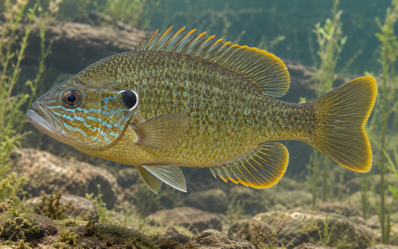
Moose Creek

Creek • United States, Clearfield, Pennsylvania

View Official Location on Map

Waterway Information

Identity & Location
Waterway Name
Moose Creek
State
Pennsylvania
County / Counties
Clearfield
Hydrologic Class
Flowing water
Waterway Type
Creek
Map Location
41.039763, -78.453918
Fishing Access
Public Fishing Access
Conditional
Access Conditions
Rivers and streams may have multiple public access locations with different ownership, parking, launch facilities, regulations, and seasonal restrictions. Some sections may cross private property, and PFBC listing, stocking, or mapping does not guarantee public access. Check current PFBC and managing-authority information before visiting.
Fishing Information
Fish Species Reported for This Waterway

Species records and fish populations may change over time.

  • Brook Trout identification image Brook Trout Salvelinus fontinalisReported
  • TroutReported
Sources & Method
Sources used for Pennsylvania Waterways

IonaFish compiles Waterway information from public and government sources, geographic data, fisheries information, and reviewed research. Information is normalized and presented in IonaFish's fisherman-focused format.

  1. Direct active production sources — Pennsylvania Fish and Boat Commission (PFBC)PFBC Waterway, fisheries, stocking, regulation, verified access, and open-fishing records that actively supply final Pennsylvania facts.
  2. Supporting identity and geography — GNIS and USGSFederal names, identifiers, and geographic support only where actually bound to a final Waterway.
  3. Legacy provenance — historical NHD and retired hydrography identifiersRetained on historical records where applicable; these are not active statewide coverage sources.
  4. Bounded local corroborationCounty, municipal, park, authority, and other local public sources only where they directly support a reviewed record.
  5. Review methodology — reviewed geographic and map researchUsed to reconcile identity and access locations as a review method, not as an authoritative source family.
  6. IonaFish normalizationIonaFish reconciles source facts into canonical Waterway identities, normalized terminology, and fisherman-focused presentation.

This state-level list describes sources used across the Waterway research and mapping workflow. Not every source contributed to every individual Waterway.

Moosup Pond

Lake • United States, Connecticut, Windham

View Official Location on Map

Waterway Information

Identity & Location
Waterway Name
Moosup Pond
State
Connecticut
County / Counties
Windham
Nearest Town
Plainfield
Hydrologic Class
Standing water
Waterway Type
Lake
Map Location
41.734529, -71.865738
Fishing Access
Public Fishing Access
Confirmed
Fishing Information
Fish Species Reported for This Waterway

Species records and fish populations may change over time.

  • Bluegill identification image Bluegill Lepomis macrochirusSurveyed
  • Rainbow Trout identification image Rainbow Trout Oncorhynchus mykissSurveyed · Stocked
  • Largemouth Bass identification image Largemouth Bass Micropterus salmoidesSurveyed
  • Pumpkinseed identification image Pumpkinseed Lepomis gibbosusSurveyed
  • Golden Shiner identification image Golden Shiner Notemigonus crysoleucasSurveyed
  • Yellow Perch identification image Yellow Perch Perca flavescensSurveyed
  • White Sucker identification image White Sucker Catostomus commersoniiSurveyed
  • Black Crappie identification image Black Crappie Pomoxis nigromaculatusSurveyed
  • American Eel identification image American Eel Anguilla rostrataSurveyed
  • Yellow Bullhead identification image Yellow Bullhead Ameiurus natalisSurveyed
  • Chain Pickerel identification image Chain Pickerel Esox nigerSurveyed
  • Brown Trout identification image Brown Trout Salmo truttaStocked
  • TroutStocked
Sources & Method
Sources used for Connecticut Waterways

IonaFish compiles Waterway information from public and government sources, geographic data, fisheries information, and reviewed research. Information is normalized and presented in IonaFish's fisherman-focused format.

  1. Connecticut DEEP stocked lakes and stocked streamsOfficial Waterway identity, type, location, geometry, and reviewed reach context for the approved Connecticut cohort.
  2. Connecticut DEEP 2026 Fishing GuideReviewed public-fishing access, managed-water designation, and material access or special-regulation conditions.
  3. Connecticut DEEP Community Fishing WatersStanding-water identity and locality corroboration where directly used.
  4. Connecticut DEEP Fish Community DataWaterway- and municipality-matched survey observations with exact sample years; historical observations are not presented as necessarily current.
  5. Connecticut DEEP 2025 Annual and 2026 Current Fish Stocking ReportsCompleted Waterway-specific stocking evidence. Exact species and broad Trout wording retain the source's original specificity.
  6. Connecticut DEEP fish distribution-map methodologyArchived methodology explains explicit capture points and historical-versus-recent symbols. Shaded drainage distributions are not Waterway-level evidence.
  7. IonaFish review, reconciliation, and normalizationCanonical parent-Waterway identities, reach-limited access presentation, provenance linkage, and fisherman-focused terminology.

This state-level list describes sources used across the Waterway research and mapping workflow. Not every source contributed to every individual Waterway.

Moosup River

River • United States, Connecticut

Waterway Information

Identity & Location
Waterway Name
Moosup River
State
Connecticut
County / Counties
Unknown
Hydrologic Class
Flowing water
Waterway Type
River
Map Location
Unknown
Fishing Access
Public Fishing Access
Conditional
Access Conditions
Rivers and streams may have multiple public access locations with different ownership, parking, fees, regulations, and seasonal restrictions. Check current state or managing-authority information before visiting., This is not a whole-waterway access claim; current property rules, hours, parking limits, closures, and posted restrictions apply., Special regulations apply within the reviewed Trout Management Area reach.
Fishing Information
Fish Species Reported for This Waterway

Species records and fish populations may change over time.

  • Brook Trout identification image Brook Trout Salvelinus fontinalisStocked
  • Green Sunfish identification image Green Sunfish Lepomis cyanellusSurveyed
  • Bluegill identification image Bluegill Lepomis macrochirusSurveyed
  • Rainbow Trout identification image Rainbow Trout Oncorhynchus mykissSurveyed · Stocked
  • Largemouth Bass identification image Largemouth Bass Micropterus salmoidesSurveyed
  • Brown Bullhead identification image Brown Bullhead Ameiurus nebulosusSurveyed
  • Smallmouth Bass identification image Smallmouth Bass Micropterus dolomieuSurveyed
  • Pumpkinseed identification image Pumpkinseed Lepomis gibbosusSurveyed
  • Blacknose Dace identification image Blacknose Dace Rhinichthys atratulusSurveyed
  • Golden Shiner identification image Golden Shiner Notemigonus crysoleucasSurveyed
  • Yellow Perch identification image Yellow Perch Perca flavescensSurveyed
  • White Sucker identification image White Sucker Catostomus commersoniiSurveyed
  • Redbreast Sunfish identification image Redbreast Sunfish Lepomis auritusSurveyed
  • Black Crappie identification image Black Crappie Pomoxis nigromaculatusSurveyed
  • American Eel identification image American Eel Anguilla rostrataSurveyed
  • Yellow Bullhead identification image Yellow Bullhead Ameiurus natalisSurveyed
  • Chain Pickerel identification image Chain Pickerel Esox nigerSurveyed
  • Common Carp identification image Common Carp Cyprinus carpioSurveyed
  • Brown Trout identification image Brown Trout Salmo truttaSurveyed · Stocked
  • Tessellated Darter identification image Tessellated Darter Etheostoma olmstediSurveyed
  • Spottail Shiner identification image Spottail Shiner Notropis hudsoniusSurveyed
  • TroutStocked
Sources & Method
Sources used for Connecticut Waterways

IonaFish compiles Waterway information from public and government sources, geographic data, fisheries information, and reviewed research. Information is normalized and presented in IonaFish's fisherman-focused format.

  1. Connecticut DEEP stocked lakes and stocked streamsOfficial Waterway identity, type, location, geometry, and reviewed reach context for the approved Connecticut cohort.
  2. Connecticut DEEP 2026 Fishing GuideReviewed public-fishing access, managed-water designation, and material access or special-regulation conditions.
  3. Connecticut DEEP Community Fishing WatersStanding-water identity and locality corroboration where directly used.
  4. Connecticut DEEP Fish Community DataWaterway- and municipality-matched survey observations with exact sample years; historical observations are not presented as necessarily current.
  5. Connecticut DEEP 2025 Annual and 2026 Current Fish Stocking ReportsCompleted Waterway-specific stocking evidence. Exact species and broad Trout wording retain the source's original specificity.
  6. Connecticut DEEP fish distribution-map methodologyArchived methodology explains explicit capture points and historical-versus-recent symbols. Shaded drainage distributions are not Waterway-level evidence.
  7. IonaFish review, reconciliation, and normalizationCanonical parent-Waterway identities, reach-limited access presentation, provenance linkage, and fisherman-focused terminology.

This state-level list describes sources used across the Waterway research and mapping workflow. Not every source contributed to every individual Waterway.

Morgan Brook

Creek • United States, Connecticut

Waterway Information

Identity & Location
Waterway Name
Morgan Brook
State
Connecticut
County / Counties
Unknown
Hydrologic Class
Flowing water
Waterway Type
Creek
Map Location
Unknown
Fishing Access
Public Fishing Access
Conditional
Access Conditions
Rivers and streams may have multiple public access locations with different ownership, parking, fees, regulations, and seasonal restrictions. Check current state or managing-authority information before visiting., This is not a whole-waterway access claim; current property rules, hours, parking limits, closures, and posted restrictions apply., The reviewed Wild Trout Management Area reach is year-round catch-and-release with current special-gear rules.
Fishing Information
Fish Species Reported for This Waterway

Species records and fish populations may change over time.

  • Brook Trout identification image Brook Trout Salvelinus fontinalisSurveyed
  • Bluegill identification image Bluegill Lepomis macrochirusSurveyed
  • Rainbow Trout identification image Rainbow Trout Oncorhynchus mykissSurveyed · Stocked
  • Largemouth Bass identification image Largemouth Bass Micropterus salmoidesSurveyed
  • Brown Bullhead identification image Brown Bullhead Ameiurus nebulosusSurveyed
  • Atlantic Salmon identification image Atlantic Salmon Salmo salarSurveyed
  • Pumpkinseed identification image Pumpkinseed Lepomis gibbosusSurveyed
  • Blacknose Dace identification image Blacknose Dace Rhinichthys atratulusSurveyed
  • Golden Shiner identification image Golden Shiner Notemigonus crysoleucasSurveyed
  • White Sucker identification image White Sucker Catostomus commersoniiSurveyed
  • American Eel identification image American Eel Anguilla rostrataSurveyed
  • Chain Pickerel identification image Chain Pickerel Esox nigerSurveyed
  • Brown Trout identification image Brown Trout Salmo truttaSurveyed
  • Tessellated Darter identification image Tessellated Darter Etheostoma olmstediSurveyed
  • Rock Bass identification image Rock Bass Ambloplites rupestrisSurveyed
Sources & Method
Sources used for Connecticut Waterways

IonaFish compiles Waterway information from public and government sources, geographic data, fisheries information, and reviewed research. Information is normalized and presented in IonaFish's fisherman-focused format.

  1. Connecticut DEEP stocked lakes and stocked streamsOfficial Waterway identity, type, location, geometry, and reviewed reach context for the approved Connecticut cohort.
  2. Connecticut DEEP 2026 Fishing GuideReviewed public-fishing access, managed-water designation, and material access or special-regulation conditions.
  3. Connecticut DEEP Community Fishing WatersStanding-water identity and locality corroboration where directly used.
  4. Connecticut DEEP Fish Community DataWaterway- and municipality-matched survey observations with exact sample years; historical observations are not presented as necessarily current.
  5. Connecticut DEEP 2025 Annual and 2026 Current Fish Stocking ReportsCompleted Waterway-specific stocking evidence. Exact species and broad Trout wording retain the source's original specificity.
  6. Connecticut DEEP fish distribution-map methodologyArchived methodology explains explicit capture points and historical-versus-recent symbols. Shaded drainage distributions are not Waterway-level evidence.
  7. IonaFish review, reconciliation, and normalizationCanonical parent-Waterway identities, reach-limited access presentation, provenance linkage, and fisherman-focused terminology.

This state-level list describes sources used across the Waterway research and mapping workflow. Not every source contributed to every individual Waterway.
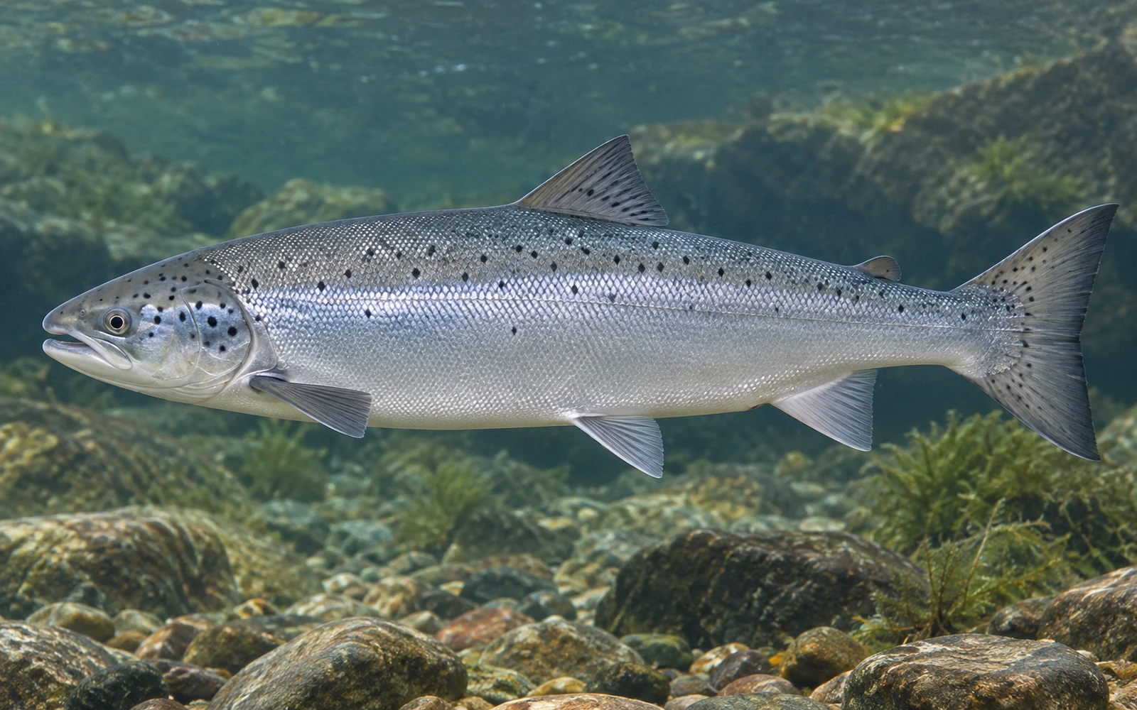
Morgan Run

Stream • United States, Carroll, Maryland

View Official Location on Map

Waterway Information

Identity & Location
Waterway Name
Morgan Run
State
Maryland
County / Counties
Carroll
Hydrologic Class
Flowing water
Waterway Type
Stream
Map Location
39.422882, -76.888589
Fishing Access
Public Fishing Access
Confirmed, See Access Conditions
Access Conditions
Maryland fishing license and current regulations apply, catch-and-return trout rules apply, public use is sunrise to sunset
Fishing Information
Fish Species Reported for This Waterway

Species records and fish populations may change over time.

  • TroutStocked
Sources & Method
Sources used for Maryland Waterways

IonaFish compiles Waterway information from public and government sources, geographic data, fisheries information, and reviewed research. Information is normalized and presented in IonaFish's fisherman-focused format.

  1. U.S. Geological Survey 3D Hydrography Program (3DHP)Federal hydrography used for candidate identity and location support.
  2. Geographic Names Information System (GNIS)Federal names, identifiers, feature classes, and location support.
  3. Maryland Department of Natural Resources official factual pages and schedulesCandidate-specific fishing, stocking, public-access, freshwater/tidal-scope, and restriction facts where used.
  4. U.S. Fish and Wildlife Service official factual pagesCandidate-specific federal refuge fishing and access facts where used.
  5. U.S. National Park Service official factual pagesCandidate-specific federal park fishing, access, launch, and restriction facts where used.
  6. U.S. Army Corps of Engineers official factual pagesCandidate-specific federal reservoir fishing, access, and launch facts where used.
  7. Maryland local governments, park agencies, and public reservoir authoritiesCandidate-specific fishing, access, permit, fee, hour, launch, and restriction facts where used.
  8. IonaFish normalization, compilation, and presentationReviewed candidate bindings, fact-level provenance, and fisherman-focused presentation.

This state-level list describes sources used across the Waterway research and mapping workflow. Not every source contributed to every individual Waterway.

Morris County Park Pond (Malhon Dickerson Reservation)

Pond • United States, Morris, New Jersey, Sparta • 0.67843429 acres

View Official Location on Map

Waterway Information

Identity & Location
Waterway Name
Morris County Park Pond (Malhon Dickerson Reservation)
State
New Jersey
County / Counties
Morris
Nearest Town
Sparta
Hydrologic Class
Standing water
Waterway Type
Pond
Size / Acres
0.678434 acres
Map Location
41.018527, -74.552259
Fishing Access
Public Fishing Access
Confirmed
Permit Required
No permit required
Boat Access & Restrictions
Motor Use
No motors
Fishing Information
Fish Species Reported for This Waterway

Species records and fish populations may change over time.

  • Largemouth Bass identification image Largemouth Bass Micropterus salmoidesReported
  • Channel Catfish identification image Channel Catfish Ictalurus punctatusReported
  • SunfishReported
Amenities
Picnicking
Yes
Camping / Cabins
Yes
Management & Official Information
Managed By
County
Sources & Method
Sources used for New Jersey Waterways

IonaFish compiles Waterway information from public and government sources, geographic data, fisheries information, and reviewed research. Information is normalized and presented in IonaFish's fisherman-focused format.

  1. Primary fishing and access authorities — New Jersey Fish & Wildlife / NJDEPThe publicly accessible fishing-water catalog qualifies the established standing-water pack. Current trout-stocked stream data, Places to Fish, trout-water listings, the Freshwater Fishing Digest, and reviewed New Jersey park or access material qualify applicable flowing-water records.
  2. Supporting identity and geography — USGS, GNIS, and federal hydrographyFederal names, identifiers, locations, and hydrologic context support canonical identity and geographic reconciliation where actually used; they do not by themselves qualify New Jersey fishing-pack membership.
  3. Bounded New Jersey and local corroborationNew Jersey government, county, municipal, park, public-authority, and other official sources support specific access, location, restrictions, stocking, fisheries, or local-use facts where directly reviewed.
  4. Historical provenance and reviewed researchInactive historical hydrography and reviewed geographic or map research may be retained for provenance and reconciliation. They are not active fishing, access, or statewide membership authority.
  5. IonaFish review, reconciliation, and normalizationIonaFish independently reviews and reconciles applicable source facts into shared canonical Waterway identities, normalized terminology, fact-level provenance, and fisherman-focused presentation.

This state-level list describes sources used across the Waterway research and mapping workflow. Not every source contributed to every individual Waterway.

Mosquito Creek

Creek • Centre, Clearfield, Elk, United States, Pennsylvania

View Official Location on Map

Waterway Information

Identity & Location
Waterway Name
Mosquito Creek
State
Pennsylvania
County / Counties
Centre, Clearfield, Elk
Hydrologic Class
Flowing water
Waterway Type
Creek
Map Location
41.123243, -78.121897
Fishing Access
Public Fishing Access
Conditional
Access Conditions
Rivers and streams may have multiple public access locations with different ownership, parking, launch facilities, regulations, and seasonal restrictions. Some sections may cross private property, and PFBC listing, stocking, or mapping does not guarantee public access. Check current PFBC and managing-authority information before visiting.
Fishing Information
Fish Species Reported for This Waterway

Species records and fish populations may change over time.

  • TroutReported
Sources & Method
Sources used for Pennsylvania Waterways

IonaFish compiles Waterway information from public and government sources, geographic data, fisheries information, and reviewed research. Information is normalized and presented in IonaFish's fisherman-focused format.

  1. Direct active production sources — Pennsylvania Fish and Boat Commission (PFBC)PFBC Waterway, fisheries, stocking, regulation, verified access, and open-fishing records that actively supply final Pennsylvania facts.
  2. Supporting identity and geography — GNIS and USGSFederal names, identifiers, and geographic support only where actually bound to a final Waterway.
  3. Legacy provenance — historical NHD and retired hydrography identifiersRetained on historical records where applicable; these are not active statewide coverage sources.
  4. Bounded local corroborationCounty, municipal, park, authority, and other local public sources only where they directly support a reviewed record.
  5. Review methodology — reviewed geographic and map researchUsed to reconcile identity and access locations as a review method, not as an authoritative source family.
  6. IonaFish normalizationIonaFish reconciles source facts into canonical Waterway identities, normalized terminology, and fisherman-focused presentation.

This state-level list describes sources used across the Waterway research and mapping workflow. Not every source contributed to every individual Waterway.

Mountain Creek

Creek • United States, Fayette, Pennsylvania

View Official Location on Map

Waterway Information

Identity & Location
Waterway Name
Mountain Creek
State
Pennsylvania
County / Counties
Fayette
Hydrologic Class
Flowing water
Waterway Type
Creek
Map Location
39.782060, -79.792320
Fishing Access
Public Fishing Access
Conditional
Access Conditions
Rivers and streams may have multiple public access locations with different ownership, parking, launch facilities, regulations, and seasonal restrictions. Some sections may cross private property, and PFBC listing, stocking, or mapping does not guarantee public access. Check current PFBC and managing-authority information before visiting.
Sources & Method
Sources used for Pennsylvania Waterways

IonaFish compiles Waterway information from public and government sources, geographic data, fisheries information, and reviewed research. Information is normalized and presented in IonaFish's fisherman-focused format.

  1. Direct active production sources — Pennsylvania Fish and Boat Commission (PFBC)PFBC Waterway, fisheries, stocking, regulation, verified access, and open-fishing records that actively supply final Pennsylvania facts.
  2. Supporting identity and geography — GNIS and USGSFederal names, identifiers, and geographic support only where actually bound to a final Waterway.
  3. Legacy provenance — historical NHD and retired hydrography identifiersRetained on historical records where applicable; these are not active statewide coverage sources.
  4. Bounded local corroborationCounty, municipal, park, authority, and other local public sources only where they directly support a reviewed record.
  5. Review methodology — reviewed geographic and map researchUsed to reconcile identity and access locations as a review method, not as an authoritative source family.
  6. IonaFish normalizationIonaFish reconciles source facts into canonical Waterway identities, normalized terminology, and fisherman-focused presentation.

This state-level list describes sources used across the Waterway research and mapping workflow. Not every source contributed to every individual Waterway.

Mountain Creek

Creek • United States, Cumberland, Pennsylvania

View Official Location on Map

Waterway Information

Identity & Location
Waterway Name
Mountain Creek
State
Pennsylvania
County / Counties
Cumberland
Hydrologic Class
Flowing water
Waterway Type
Creek
Map Location
40.112465, -77.185902
Fishing Access
Public Fishing Access
Conditional
Access Conditions
Rivers and streams may have multiple public access locations with different ownership, parking, launch facilities, regulations, and seasonal restrictions. Some sections may cross private property, and PFBC listing, stocking, or mapping does not guarantee public access. Check current PFBC and managing-authority information before visiting.
Fishing Information
Fish Species Reported for This Waterway

Species records and fish populations may change over time.

  • TroutReported
Sources & Method
Sources used for Pennsylvania Waterways

IonaFish compiles Waterway information from public and government sources, geographic data, fisheries information, and reviewed research. Information is normalized and presented in IonaFish's fisherman-focused format.

  1. Direct active production sources — Pennsylvania Fish and Boat Commission (PFBC)PFBC Waterway, fisheries, stocking, regulation, verified access, and open-fishing records that actively supply final Pennsylvania facts.
  2. Supporting identity and geography — GNIS and USGSFederal names, identifiers, and geographic support only where actually bound to a final Waterway.
  3. Legacy provenance — historical NHD and retired hydrography identifiersRetained on historical records where applicable; these are not active statewide coverage sources.
  4. Bounded local corroborationCounty, municipal, park, authority, and other local public sources only where they directly support a reviewed record.
  5. Review methodology — reviewed geographic and map researchUsed to reconcile identity and access locations as a review method, not as an authoritative source family.
  6. IonaFish normalizationIonaFish reconciles source facts into canonical Waterway identities, normalized terminology, and fisherman-focused presentation.

This state-level list describes sources used across the Waterway research and mapping workflow. Not every source contributed to every individual Waterway.

Mountain Farm Pond

Pond • United States, Hunterdon, New Jersey, Teetertown • 4.52382278 acres

View Official Location on Map

Waterway Information

Identity & Location
Waterway Name
Mountain Farm Pond
State
New Jersey
County / Counties
Hunterdon
Nearest Town
Teetertown
Hydrologic Class
Standing water
Waterway Type
Pond
Size / Acres
4.52382 acres
Map Location
40.754340, -74.852578
Fishing Access
Public Fishing Access
Confirmed
Permit Required
No permit required
Boat Access & Restrictions
Motor Use
No motors
Fishing Information
Trout Information
Seasonal trout water
Fish Species Reported for This Waterway

Species records and fish populations may change over time.

  • Rainbow Trout identification image Rainbow Trout Oncorhynchus mykissStocked
  • Largemouth Bass identification image Largemouth Bass Micropterus salmoidesReported
  • Brown Trout identification image Brown Trout Salmo truttaStocked
  • SunfishReported
Amenities
Picnicking
Yes
Management & Official Information
Managed By
County
Sources & Method
Sources used for New Jersey Waterways

IonaFish compiles Waterway information from public and government sources, geographic data, fisheries information, and reviewed research. Information is normalized and presented in IonaFish's fisherman-focused format.

  1. Primary fishing and access authorities — New Jersey Fish & Wildlife / NJDEPThe publicly accessible fishing-water catalog qualifies the established standing-water pack. Current trout-stocked stream data, Places to Fish, trout-water listings, the Freshwater Fishing Digest, and reviewed New Jersey park or access material qualify applicable flowing-water records.
  2. Supporting identity and geography — USGS, GNIS, and federal hydrographyFederal names, identifiers, locations, and hydrologic context support canonical identity and geographic reconciliation where actually used; they do not by themselves qualify New Jersey fishing-pack membership.
  3. Bounded New Jersey and local corroborationNew Jersey government, county, municipal, park, public-authority, and other official sources support specific access, location, restrictions, stocking, fisheries, or local-use facts where directly reviewed.
  4. Historical provenance and reviewed researchInactive historical hydrography and reviewed geographic or map research may be retained for provenance and reconciliation. They are not active fishing, access, or statewide membership authority.
  5. IonaFish review, reconciliation, and normalizationIonaFish independently reviews and reconciles applicable source facts into shared canonical Waterway identities, normalized terminology, fact-level provenance, and fisherman-focused presentation.

This state-level list describes sources used across the Waterway research and mapping workflow. Not every source contributed to every individual Waterway.

Mountain Lake

Lake • United States, Buttzville, New Jersey, Warren • 116.74354017 acres

View Official Location on Map

Waterway Information

Identity & Location
Waterway Name
Mountain Lake
State
New Jersey
County / Counties
Warren
Nearest Town
Buttzville
Hydrologic Class
Standing water
Waterway Type
Lake
Size / Acres
116.744 acres
Map Location
40.858639, -74.984706
Fishing Access
Public Fishing Access
Confirmed
Permit Required
No permit required
Boat Access & Restrictions
Boat Ramp
Available
Cartop / Kayak Launch
Available
Motor Use
No motors
Fishing Information
Trout Information
Seasonal trout water
Fish Species Reported for This Waterway

Species records and fish populations may change over time.

  • Largemouth Bass identification image Largemouth Bass Micropterus salmoidesReported
  • Common Carp identification image Common Carp Cyprinus carpioReported
  • CatfishReported
  • CrappieReported
  • Musky/Northern PikeReported
  • PickerelReported
  • SunfishReported
  • Trout (seasonal)Stocked
Amenities
Swimming
Yes
Picnicking
Yes
Management & Official Information
Managed By
State, Municipal, Private
Sources & Method
Sources used for New Jersey Waterways

IonaFish compiles Waterway information from public and government sources, geographic data, fisheries information, and reviewed research. Information is normalized and presented in IonaFish's fisherman-focused format.

  1. Primary fishing and access authorities — New Jersey Fish & Wildlife / NJDEPThe publicly accessible fishing-water catalog qualifies the established standing-water pack. Current trout-stocked stream data, Places to Fish, trout-water listings, the Freshwater Fishing Digest, and reviewed New Jersey park or access material qualify applicable flowing-water records.
  2. Supporting identity and geography — USGS, GNIS, and federal hydrographyFederal names, identifiers, locations, and hydrologic context support canonical identity and geographic reconciliation where actually used; they do not by themselves qualify New Jersey fishing-pack membership.
  3. Bounded New Jersey and local corroborationNew Jersey government, county, municipal, park, public-authority, and other official sources support specific access, location, restrictions, stocking, fisheries, or local-use facts where directly reviewed.
  4. Historical provenance and reviewed researchInactive historical hydrography and reviewed geographic or map research may be retained for provenance and reconciliation. They are not active fishing, access, or statewide membership authority.
  5. IonaFish review, reconciliation, and normalizationIonaFish independently reviews and reconciles applicable source facts into shared canonical Waterway identities, normalized terminology, fact-level provenance, and fisherman-focused presentation.

This state-level list describes sources used across the Waterway research and mapping workflow. Not every source contributed to every individual Waterway.

Mountain Lake

Lake • United States, Bradford, Pennsylvania

View Official Location on Map

Waterway Information

Identity & Location
Waterway Name
Mountain Lake
State
Pennsylvania
County / Counties
Bradford
Hydrologic Class
Standing water
Waterway Type
Lake
Map Location
41.766109, -76.584442
Fishing Access
Public Fishing Access
Unknown
Fishing Information
Fish Species Reported for This Waterway

Species records and fish populations may change over time.

  • Largemouth Bass identification image Largemouth Bass Micropterus salmoidesReported
  • TroutStocked
Sources & Method
Sources used for Pennsylvania Waterways

IonaFish compiles Waterway information from public and government sources, geographic data, fisheries information, and reviewed research. Information is normalized and presented in IonaFish's fisherman-focused format.

  1. Direct active production sources — Pennsylvania Fish and Boat Commission (PFBC)PFBC Waterway, fisheries, stocking, regulation, verified access, and open-fishing records that actively supply final Pennsylvania facts.
  2. Supporting identity and geography — GNIS and USGSFederal names, identifiers, and geographic support only where actually bound to a final Waterway.
  3. Legacy provenance — historical NHD and retired hydrography identifiersRetained on historical records where applicable; these are not active statewide coverage sources.
  4. Bounded local corroborationCounty, municipal, park, authority, and other local public sources only where they directly support a reviewed record.
  5. Review methodology — reviewed geographic and map researchUsed to reconcile identity and access locations as a review method, not as an authoritative source family.
  6. IonaFish normalizationIonaFish reconciles source facts into canonical Waterway identities, normalized terminology, and fisherman-focused presentation.

This state-level list describes sources used across the Waterway research and mapping workflow. Not every source contributed to every individual Waterway.

Mountain Springs Lake ** DRAWDOWN STATUS

Lake • United States, Luzerne, Pennsylvania

View Official Location on Map

Waterway Information

Identity & Location
Waterway Name
Mountain Springs Lake ** DRAWDOWN STATUS
State
Pennsylvania
County / Counties
Luzerne
Hydrologic Class
Standing water
Waterway Type
Lake
Map Location
41.339722, -76.226669
Known Alternate Names
Mount Spring Lake
Fishing Access
Public Fishing Access
Unknown
Sources & Method
Sources used for Pennsylvania Waterways

IonaFish compiles Waterway information from public and government sources, geographic data, fisheries information, and reviewed research. Information is normalized and presented in IonaFish's fisherman-focused format.

  1. Direct active production sources — Pennsylvania Fish and Boat Commission (PFBC)PFBC Waterway, fisheries, stocking, regulation, verified access, and open-fishing records that actively supply final Pennsylvania facts.
  2. Supporting identity and geography — GNIS and USGSFederal names, identifiers, and geographic support only where actually bound to a final Waterway.
  3. Legacy provenance — historical NHD and retired hydrography identifiersRetained on historical records where applicable; these are not active statewide coverage sources.
  4. Bounded local corroborationCounty, municipal, park, authority, and other local public sources only where they directly support a reviewed record.
  5. Review methodology — reviewed geographic and map researchUsed to reconcile identity and access locations as a review method, not as an authoritative source family.
  6. IonaFish normalizationIonaFish reconciles source facts into canonical Waterway identities, normalized terminology, and fisherman-focused presentation.

This state-level list describes sources used across the Waterway research and mapping workflow. Not every source contributed to every individual Waterway.

Mt. Hope Pond

Pond • United States, Morris, New Jersey, Rockaway • 18.11953195 acres

View Official Location on Map

Waterway Information

Identity & Location
Waterway Name
Mt. Hope Pond
State
New Jersey
County / Counties
Morris
Nearest Town
Rockaway
Hydrologic Class
Standing water
Waterway Type
Pond
Size / Acres
18.1195 acres
Map Location
40.929888, -74.548456
Known Alternate Names
Mount Hope Pond
Fishing Access
Public Fishing Access
Confirmed
Permit Required
No permit required
Boat Access & Restrictions
Motor Use
No motors
Fishing Information
Trout Information
Seasonal trout water
Fish Species Reported for This Waterway

Species records and fish populations may change over time.

  • Rainbow Trout identification image Rainbow Trout Oncorhynchus mykissStocked
  • Largemouth Bass identification image Largemouth Bass Micropterus salmoidesReported
  • Channel Catfish identification image Channel Catfish Ictalurus punctatusReported
  • SunfishReported
Amenities
Swimming
Yes
Management & Official Information
Managed By
Private
Sources & Method
Sources used for New Jersey Waterways

IonaFish compiles Waterway information from public and government sources, geographic data, fisheries information, and reviewed research. Information is normalized and presented in IonaFish's fisherman-focused format.

  1. Primary fishing and access authorities — New Jersey Fish & Wildlife / NJDEPThe publicly accessible fishing-water catalog qualifies the established standing-water pack. Current trout-stocked stream data, Places to Fish, trout-water listings, the Freshwater Fishing Digest, and reviewed New Jersey park or access material qualify applicable flowing-water records.
  2. Supporting identity and geography — USGS, GNIS, and federal hydrographyFederal names, identifiers, locations, and hydrologic context support canonical identity and geographic reconciliation where actually used; they do not by themselves qualify New Jersey fishing-pack membership.
  3. Bounded New Jersey and local corroborationNew Jersey government, county, municipal, park, public-authority, and other official sources support specific access, location, restrictions, stocking, fisheries, or local-use facts where directly reviewed.
  4. Historical provenance and reviewed researchInactive historical hydrography and reviewed geographic or map research may be retained for provenance and reconciliation. They are not active fishing, access, or statewide membership authority.
  5. IonaFish review, reconciliation, and normalizationIonaFish independently reviews and reconciles applicable source facts into shared canonical Waterway identities, normalized terminology, fact-level provenance, and fisherman-focused presentation.

This state-level list describes sources used across the Waterway research and mapping workflow. Not every source contributed to every individual Waterway.

Mud Lake

Lake • United States, Crawford, Pennsylvania

View Official Location on Map

Waterway Information

Identity & Location
Waterway Name
Mud Lake
State
Pennsylvania
County / Counties
Crawford
Hydrologic Class
Standing water
Waterway Type
Lake
Map Location
41.552778, -80.367778
Fishing Access
Public Fishing Access
Unknown
Fishing Information
Fish Species Reported for This Waterway

Species records and fish populations may change over time.

  • Pumpkinseed identification image Pumpkinseed Lepomis gibbosusReported
  • Black Crappie identification image Black Crappie Pomoxis nigromaculatusReported
Sources & Method
Sources used for Pennsylvania Waterways

IonaFish compiles Waterway information from public and government sources, geographic data, fisheries information, and reviewed research. Information is normalized and presented in IonaFish's fisherman-focused format.

  1. Direct active production sources — Pennsylvania Fish and Boat Commission (PFBC)PFBC Waterway, fisheries, stocking, regulation, verified access, and open-fishing records that actively supply final Pennsylvania facts.
  2. Supporting identity and geography — GNIS and USGSFederal names, identifiers, and geographic support only where actually bound to a final Waterway.
  3. Legacy provenance — historical NHD and retired hydrography identifiersRetained on historical records where applicable; these are not active statewide coverage sources.
  4. Bounded local corroborationCounty, municipal, park, authority, and other local public sources only where they directly support a reviewed record.
  5. Review methodology — reviewed geographic and map researchUsed to reconcile identity and access locations as a review method, not as an authoritative source family.
  6. IonaFish normalizationIonaFish reconciles source facts into canonical Waterway identities, normalized terminology, and fisherman-focused presentation.

This state-level list describes sources used across the Waterway research and mapping workflow. Not every source contributed to every individual Waterway.

Mud Mill Pond

Pond • United States, Delaware, Kent • 60.0 acres

View Official Location on Map

Waterway Information

Identity & Location
Waterway Name
Mud Mill Pond
State
Delaware
County / Counties
Kent
Hydrologic Class
Standing water
Waterway Type
Pond
Size / Acres
60 acres
Map Location
39.070687, -75.738833
Known Alternate Names
Mud Millpond
Fishing Access
Public Fishing Access
Confirmed, See Access Conditions
Access Conditions
Delaware fishing license requirements and applicable freshwater regulations apply. Boats must operate at no-wake speed. Check current DNREC information for site-specific shoreline, launch, hours, and other restrictions.
Boat Access & Restrictions
Boat Ramp
Available
Fishing Information
Fish Species Reported for This Waterway

Species records and fish populations may change over time.

  • Gizzard Shad identification image Gizzard Shad Dorosoma cepedianumSurveyed
  • Bluegill identification image Bluegill Lepomis macrochirusSurveyed
  • Largemouth Bass identification image Largemouth Bass Micropterus salmoidesSurveyed
  • Brown Bullhead identification image Brown Bullhead Ameiurus nebulosusSurveyed
  • Northern Snakehead identification image Northern Snakehead Channa argusReported
  • Black Crappie identification image Black Crappie Pomoxis nigromaculatusSurveyed
  • Yellow Bullhead identification image Yellow Bullhead Ameiurus natalisSurveyed
  • Common Carp identification image Common Carp Cyprinus carpioSurveyed
Sources & Method
Sources used for Delaware Waterways

IonaFish compiles Waterway information from public and government sources, geographic data, fisheries information, and reviewed research. Information is normalized and presented in IonaFish's fisherman-focused format.

  1. Delaware FirstMap and DNREC public-pond geographic dataMain/youth pond points, polygons, fishing facilities, and fishing-access review layers.
  2. DNREC Public Freshwater Fishing Ponds and Small Pond AnglingPublic-pond identity and youth-program information.
  3. DNREC Freshwater Trout Fishing and Fish StockingTrout-program identity, designation, stocking context, and official fisheries resources.
  4. DNREC Freshwater Pond Fish Community SurveysPond-specific fisheries survey evidence.
  5. DNREC Tidal Largemouth Bass SurveyTidal-system identity and largemouth bass evidence.
  6. DNREC Shad Restoration and Species and Habitat MonitoringNanticoke River and related fisheries evidence.
  7. Delaware Fish FactsTaxonomy and fisheries evidence review support.
  8. IonaFish normalization, compilation, and presentationCanonical identity decisions, normalization, provenance linkage, and fisherman-focused presentation.

This state-level list describes sources used across the Waterway research and mapping workflow. Not every source contributed to every individual Waterway.

Mud Pond

Pond • United States, Pennsylvania, Pike

View Official Location on Map

Waterway Information

Identity & Location
Waterway Name
Mud Pond
State
Pennsylvania
County / Counties
Pike
Hydrologic Class
Standing water
Waterway Type
Pond
Map Location
41.272950, -75.183319
Fishing Access
Public Fishing Access
Unknown
Sources & Method
Sources used for Pennsylvania Waterways

IonaFish compiles Waterway information from public and government sources, geographic data, fisheries information, and reviewed research. Information is normalized and presented in IonaFish's fisherman-focused format.

  1. Direct active production sources — Pennsylvania Fish and Boat Commission (PFBC)PFBC Waterway, fisheries, stocking, regulation, verified access, and open-fishing records that actively supply final Pennsylvania facts.
  2. Supporting identity and geography — GNIS and USGSFederal names, identifiers, and geographic support only where actually bound to a final Waterway.
  3. Legacy provenance — historical NHD and retired hydrography identifiersRetained on historical records where applicable; these are not active statewide coverage sources.
  4. Bounded local corroborationCounty, municipal, park, authority, and other local public sources only where they directly support a reviewed record.
  5. Review methodology — reviewed geographic and map researchUsed to reconcile identity and access locations as a review method, not as an authoritative source family.
  6. IonaFish normalizationIonaFish reconciles source facts into canonical Waterway identities, normalized terminology, and fisherman-focused presentation.

This state-level list describes sources used across the Waterway research and mapping workflow. Not every source contributed to every individual Waterway.

Mud Run

Unknown • United States, Carbon, Pennsylvania

View Official Location on Map

Waterway Information

Identity & Location
Waterway Name
Mud Run
State
Pennsylvania
County / Counties
Carbon
Hydrologic Class
Flowing water
Waterway Type
Unknown
Map Location
41.004707, -75.632934
Fishing Access
Public Fishing Access
Conditional
Access Conditions
Rivers and streams may have multiple public access locations with different ownership, parking, launch facilities, regulations, and seasonal restrictions. Some sections may cross private property, and PFBC listing, stocking, or mapping does not guarantee public access. Check current PFBC and managing-authority information before visiting.
Fishing Information
Fish Species Reported for This Waterway

Species records and fish populations may change over time.

  • TroutReported
Sources & Method
Sources used for Pennsylvania Waterways

IonaFish compiles Waterway information from public and government sources, geographic data, fisheries information, and reviewed research. Information is normalized and presented in IonaFish's fisherman-focused format.

  1. Direct active production sources — Pennsylvania Fish and Boat Commission (PFBC)PFBC Waterway, fisheries, stocking, regulation, verified access, and open-fishing records that actively supply final Pennsylvania facts.
  2. Supporting identity and geography — GNIS and USGSFederal names, identifiers, and geographic support only where actually bound to a final Waterway.
  3. Legacy provenance — historical NHD and retired hydrography identifiersRetained on historical records where applicable; these are not active statewide coverage sources.
  4. Bounded local corroborationCounty, municipal, park, authority, and other local public sources only where they directly support a reviewed record.
  5. Review methodology — reviewed geographic and map researchUsed to reconcile identity and access locations as a review method, not as an authoritative source family.
  6. IonaFish normalizationIonaFish reconciles source facts into canonical Waterway identities, normalized terminology, and fisherman-focused presentation.

This state-level list describes sources used across the Waterway research and mapping workflow. Not every source contributed to every individual Waterway.