Finatics.ionafish.com

Explore Lakes & Waterways

Waterway information can change. Before visiting or fishing any location, verify current access rights, regulations, permits, fees, restrictions, and local conditions.

Explore Club-reviewed waterways, access information, and fishing notes.

Waterway Information Notice

Waterway information displayed by IonaBrand is compiled, reconciled, and normalized from multiple public and official information sources.

Where available, IonaBrand generally uses federal public geographic and hydrographic information as the foundation for Waterway identity, names, location, and other geographic information. Fishing, public-access, species, regulations, facilities, and local-use information may then be supplemented or verified using state, local, fisheries, park, public-authority, and other official sources appropriate to the information being presented.

IonaBrand does not represent any individual state, agency, authority, or source as providing the complete Waterway record shown here. Information from different sources may be independently compared, reconciled, normalized, and combined into the shared IonaBrand Waterway information presented to Clubs and their members.

The only constant is change. Public access, ownership, regulations, permits, fees, facilities, operating hours, conditions, and other Waterway information may change or become outdated.

Clubs may maintain their own Club-specific information, observations, warnings, access notes, and local knowledge for their private display and use. Club-created information remains separate from shared IonaBrand Waterway information and is not overwritten by periodic updates to the shared Waterway record.

IonaBrand does not continuously and independently monitor, verify, or guarantee the accuracy, completeness, availability, or current status of Waterway information.

Before visiting, boating, fishing, or otherwise using any location, Clubs and their members are responsible for confirming current access rights, land ownership, fishing regulations, licenses and permits, fees, operating hours, motor restrictions, parking conditions, closures, and other applicable requirements with the appropriate state, local, property, regulatory, or managing authority.

Internet Connection Required

This function requires a stable internet connection. If a map does not display, please reconnect and try again.

Whitesbog Pond

Pond • Ocean, United States, Burlington, New Jersey, Whitesbog • 41.53043456 acres

View Official Location on Map

Waterway Information

Identity & Location
Waterway Name
Whitesbog Pond
State
New Jersey
County / Counties
Ocean, Burlington
Nearest Town
Whitesbog
Hydrologic Class
Standing water
Waterway Type
Pond
Size / Acres
41.5304 acres
Map Location
39.965250, -74.500325
Fishing Access
Public Fishing Access
Confirmed
Permit Required
No permit required
Boat Access & Restrictions
Cartop / Kayak Launch
Available
Motor Use
Electric motors only
Fishing Information
Fish Species Reported for This Waterway

Species records and fish populations may change over time.

  • CatfishReported
  • PickerelReported
  • SunfishReported
Management & Official Information
Managed By
State
Sources & Method
Sources used for New Jersey Waterways

IonaFish compiles Waterway information from public and government sources, geographic data, fisheries information, and reviewed research. Information is normalized and presented in IonaFish's fisherman-focused format.

  1. Primary fishing and access authorities — New Jersey Fish & Wildlife / NJDEPThe publicly accessible fishing-water catalog qualifies the established standing-water pack. Current trout-stocked stream data, Places to Fish, trout-water listings, the Freshwater Fishing Digest, and reviewed New Jersey park or access material qualify applicable flowing-water records.
  2. Supporting identity and geography — USGS, GNIS, and federal hydrographyFederal names, identifiers, locations, and hydrologic context support canonical identity and geographic reconciliation where actually used; they do not by themselves qualify New Jersey fishing-pack membership.
  3. Bounded New Jersey and local corroborationNew Jersey government, county, municipal, park, public-authority, and other official sources support specific access, location, restrictions, stocking, fisheries, or local-use facts where directly reviewed.
  4. Historical provenance and reviewed researchInactive historical hydrography and reviewed geographic or map research may be retained for provenance and reconciliation. They are not active fishing, access, or statewide membership authority.
  5. IonaFish review, reconciliation, and normalizationIonaFish independently reviews and reconciles applicable source facts into shared canonical Waterway identities, normalized terminology, fact-level provenance, and fisherman-focused presentation.

This state-level list describes sources used across the Waterway research and mapping workflow. Not every source contributed to every individual Waterway.

Whitesell Dam

Unknown • United States, Pennsylvania, Pike

View Official Location on Map

Waterway Information

Identity & Location
Waterway Name
Whitesell Dam
State
Pennsylvania
County / Counties
Pike
Hydrologic Class
Standing water
Waterway Type
Unknown
Map Location
41.170556, -74.926389
Fishing Access
Public Fishing Access
Unknown
Fishing Information
Fish Species Reported for This Waterway

Species records and fish populations may change over time.

  • Largemouth Bass identification image Largemouth Bass Micropterus salmoidesStocked
  • Smallmouth Bass identification image Smallmouth Bass Micropterus dolomieuStocked
Sources & Method
Sources used for Pennsylvania Waterways

IonaFish compiles Waterway information from public and government sources, geographic data, fisheries information, and reviewed research. Information is normalized and presented in IonaFish's fisherman-focused format.

  1. Direct active production sources — Pennsylvania Fish and Boat Commission (PFBC)PFBC Waterway, fisheries, stocking, regulation, verified access, and open-fishing records that actively supply final Pennsylvania facts.
  2. Supporting identity and geography — GNIS and USGSFederal names, identifiers, and geographic support only where actually bound to a final Waterway.
  3. Legacy provenance — historical NHD and retired hydrography identifiersRetained on historical records where applicable; these are not active statewide coverage sources.
  4. Bounded local corroborationCounty, municipal, park, authority, and other local public sources only where they directly support a reviewed record.
  5. Review methodology — reviewed geographic and map researchUsed to reconcile identity and access locations as a review method, not as an authoritative source family.
  6. IonaFish normalizationIonaFish reconciles source facts into canonical Waterway identities, normalized terminology, and fisherman-focused presentation.

This state-level list describes sources used across the Waterway research and mapping workflow. Not every source contributed to every individual Waterway.

Wickecheoke Creek

Creek • United States, Hunterdon, New Jersey

View Official Location on Map

Waterway Information

Identity & Location
Waterway Name
Wickecheoke Creek
State
New Jersey
County / Counties
Hunterdon
Hydrologic Class
Flowing water
Waterway Type
Creek
Map Location
40.426520, -74.979232
Fishing Access
Public Fishing Access
Conditional
Access Conditions
Rivers and streams may have multiple public access locations with different ownership, parking, fees, regulations, and seasonal restrictions. Check current state or managing-authority information before visiting.
Sources & Method
Sources used for New Jersey Waterways

IonaFish compiles Waterway information from public and government sources, geographic data, fisheries information, and reviewed research. Information is normalized and presented in IonaFish's fisherman-focused format.

  1. Primary fishing and access authorities — New Jersey Fish & Wildlife / NJDEPThe publicly accessible fishing-water catalog qualifies the established standing-water pack. Current trout-stocked stream data, Places to Fish, trout-water listings, the Freshwater Fishing Digest, and reviewed New Jersey park or access material qualify applicable flowing-water records.
  2. Supporting identity and geography — USGS, GNIS, and federal hydrographyFederal names, identifiers, locations, and hydrologic context support canonical identity and geographic reconciliation where actually used; they do not by themselves qualify New Jersey fishing-pack membership.
  3. Bounded New Jersey and local corroborationNew Jersey government, county, municipal, park, public-authority, and other official sources support specific access, location, restrictions, stocking, fisheries, or local-use facts where directly reviewed.
  4. Historical provenance and reviewed researchInactive historical hydrography and reviewed geographic or map research may be retained for provenance and reconciliation. They are not active fishing, access, or statewide membership authority.
  5. IonaFish review, reconciliation, and normalizationIonaFish independently reviews and reconciles applicable source facts into shared canonical Waterway identities, normalized terminology, fact-level provenance, and fisherman-focused presentation.

This state-level list describes sources used across the Waterway research and mapping workflow. Not every source contributed to every individual Waterway.

Wiconisco Creek

Creek • United States, Dauphin, Pennsylvania

View Official Location on Map

Waterway Information

Identity & Location
Waterway Name
Wiconisco Creek
State
Pennsylvania
County / Counties
Dauphin
Hydrologic Class
Flowing water
Waterway Type
Creek
Map Location
40.546460, -76.872770
Fishing Access
Public Fishing Access
Conditional
Access Conditions
Rivers and streams may have multiple public access locations with different ownership, parking, launch facilities, regulations, and seasonal restrictions. Some sections may cross private property, and PFBC listing, stocking, or mapping does not guarantee public access. Check current PFBC and managing-authority information before visiting.
Fishing Information
Fish Species Reported for This Waterway

Species records and fish populations may change over time.

  • Brown Trout identification image Brown Trout Salmo truttaStocked
Sources & Method
Sources used for Pennsylvania Waterways

IonaFish compiles Waterway information from public and government sources, geographic data, fisheries information, and reviewed research. Information is normalized and presented in IonaFish's fisherman-focused format.

  1. Direct active production sources — Pennsylvania Fish and Boat Commission (PFBC)PFBC Waterway, fisheries, stocking, regulation, verified access, and open-fishing records that actively supply final Pennsylvania facts.
  2. Supporting identity and geography — GNIS and USGSFederal names, identifiers, and geographic support only where actually bound to a final Waterway.
  3. Legacy provenance — historical NHD and retired hydrography identifiersRetained on historical records where applicable; these are not active statewide coverage sources.
  4. Bounded local corroborationCounty, municipal, park, authority, and other local public sources only where they directly support a reviewed record.
  5. Review methodology — reviewed geographic and map researchUsed to reconcile identity and access locations as a review method, not as an authoritative source family.
  6. IonaFish normalizationIonaFish reconciles source facts into canonical Waterway identities, normalized terminology, and fisherman-focused presentation.

This state-level list describes sources used across the Waterway research and mapping workflow. Not every source contributed to every individual Waterway.

Wild Creek Reservoir

Reservoir • United States, Carbon, Pennsylvania

View Official Location on Map

Waterway Information

Identity & Location
Waterway Name
Wild Creek Reservoir
State
Pennsylvania
County / Counties
Carbon
Hydrologic Class
Standing water
Waterway Type
Reservoir
Map Location
40.894601, -75.562846
Fishing Access
Public Fishing Access
Unknown
Sources & Method
Sources used for Pennsylvania Waterways

IonaFish compiles Waterway information from public and government sources, geographic data, fisheries information, and reviewed research. Information is normalized and presented in IonaFish's fisherman-focused format.

  1. Direct active production sources — Pennsylvania Fish and Boat Commission (PFBC)PFBC Waterway, fisheries, stocking, regulation, verified access, and open-fishing records that actively supply final Pennsylvania facts.
  2. Supporting identity and geography — GNIS and USGSFederal names, identifiers, and geographic support only where actually bound to a final Waterway.
  3. Legacy provenance — historical NHD and retired hydrography identifiersRetained on historical records where applicable; these are not active statewide coverage sources.
  4. Bounded local corroborationCounty, municipal, park, authority, and other local public sources only where they directly support a reviewed record.
  5. Review methodology — reviewed geographic and map researchUsed to reconcile identity and access locations as a review method, not as an authoritative source family.
  6. IonaFish normalizationIonaFish reconciles source facts into canonical Waterway identities, normalized terminology, and fisherman-focused presentation.

This state-level list describes sources used across the Waterway research and mapping workflow. Not every source contributed to every individual Waterway.
Wild Duck Pond

Pond • United States, Bergen, New Jersey, Ridgewood • 3.1592247 acres

View Official Location on Map

Waterway Information

Identity & Location
Waterway Name
Wild Duck Pond
State
New Jersey
County / Counties
Bergen
Nearest Town
Ridgewood
Hydrologic Class
Standing water
Waterway Type
Pond
Size / Acres
3.15922 acres
Map Location
40.974580, -74.094503
Fishing Access
Public Fishing Access
Confirmed
Permit Required
No permit required
Boat Access & Restrictions
Motor Use
No motors
Fishing Information
Fish Species Reported for This Waterway

Species records and fish populations may change over time.

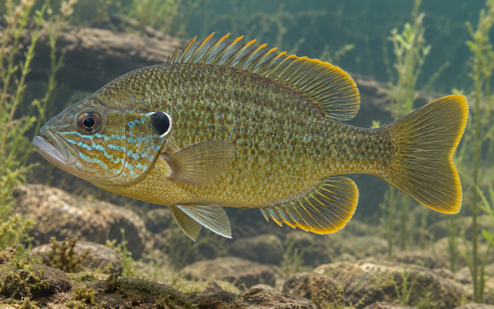
  • Common Carp identification image Common Carp Cyprinus carpioReported
  • CatfishReported
  • SunfishReported
Amenities
Picnicking
Yes
Management & Official Information
Managed By
County
Sources & Method
Sources used for New Jersey Waterways

IonaFish compiles Waterway information from public and government sources, geographic data, fisheries information, and reviewed research. Information is normalized and presented in IonaFish's fisherman-focused format.

  1. Primary fishing and access authorities — New Jersey Fish & Wildlife / NJDEPThe publicly accessible fishing-water catalog qualifies the established standing-water pack. Current trout-stocked stream data, Places to Fish, trout-water listings, the Freshwater Fishing Digest, and reviewed New Jersey park or access material qualify applicable flowing-water records.
  2. Supporting identity and geography — USGS, GNIS, and federal hydrographyFederal names, identifiers, locations, and hydrologic context support canonical identity and geographic reconciliation where actually used; they do not by themselves qualify New Jersey fishing-pack membership.
  3. Bounded New Jersey and local corroborationNew Jersey government, county, municipal, park, public-authority, and other official sources support specific access, location, restrictions, stocking, fisheries, or local-use facts where directly reviewed.
  4. Historical provenance and reviewed researchInactive historical hydrography and reviewed geographic or map research may be retained for provenance and reconciliation. They are not active fishing, access, or statewide membership authority.
  5. IonaFish review, reconciliation, and normalizationIonaFish independently reviews and reconciles applicable source facts into shared canonical Waterway identities, normalized terminology, fact-level provenance, and fisherman-focused presentation.

This state-level list describes sources used across the Waterway research and mapping workflow. Not every source contributed to every individual Waterway.

Wild Fowl Pond

Pond • United States, Pennsylvania, Wyoming

View Official Location on Map

Waterway Information

Identity & Location
Waterway Name
Wild Fowl Pond
State
Pennsylvania
County / Counties
Wyoming
Hydrologic Class
Standing water
Waterway Type
Pond
Map Location
41.389140, -76.271700
Fishing Access
Public Fishing Access
Unknown
Sources & Method
Sources used for Pennsylvania Waterways

IonaFish compiles Waterway information from public and government sources, geographic data, fisheries information, and reviewed research. Information is normalized and presented in IonaFish's fisherman-focused format.

  1. Direct active production sources — Pennsylvania Fish and Boat Commission (PFBC)PFBC Waterway, fisheries, stocking, regulation, verified access, and open-fishing records that actively supply final Pennsylvania facts.
  2. Supporting identity and geography — GNIS and USGSFederal names, identifiers, and geographic support only where actually bound to a final Waterway.
  3. Legacy provenance — historical NHD and retired hydrography identifiersRetained on historical records where applicable; these are not active statewide coverage sources.
  4. Bounded local corroborationCounty, municipal, park, authority, and other local public sources only where they directly support a reviewed record.
  5. Review methodology — reviewed geographic and map researchUsed to reconcile identity and access locations as a review method, not as an authoritative source family.
  6. IonaFish normalizationIonaFish reconciles source facts into canonical Waterway identities, normalized terminology, and fisherman-focused presentation.

This state-level list describes sources used across the Waterway research and mapping workflow. Not every source contributed to every individual Waterway.

Wilde Lake

Reservoir • United States, Howard, Maryland

View Official Location on Map

Waterway Information

Identity & Location
Waterway Name
Wilde Lake
State
Maryland
County / Counties
Howard
Hydrologic Class
Standing water
Waterway Type
Reservoir
Map Location
39.223622, -76.862399
Fishing Access
Public Fishing Access
Confirmed, See Access Conditions
Access Conditions
Maryland fishing license required
Sources & Method
Sources used for Maryland Waterways

IonaFish compiles Waterway information from public and government sources, geographic data, fisheries information, and reviewed research. Information is normalized and presented in IonaFish's fisherman-focused format.

  1. U.S. Geological Survey 3D Hydrography Program (3DHP)Federal hydrography used for candidate identity and location support.
  2. Geographic Names Information System (GNIS)Federal names, identifiers, feature classes, and location support.
  3. Maryland Department of Natural Resources official factual pages and schedulesCandidate-specific fishing, stocking, public-access, freshwater/tidal-scope, and restriction facts where used.
  4. U.S. Fish and Wildlife Service official factual pagesCandidate-specific federal refuge fishing and access facts where used.
  5. U.S. National Park Service official factual pagesCandidate-specific federal park fishing, access, launch, and restriction facts where used.
  6. U.S. Army Corps of Engineers official factual pagesCandidate-specific federal reservoir fishing, access, and launch facts where used.
  7. Maryland local governments, park agencies, and public reservoir authoritiesCandidate-specific fishing, access, permit, fee, hour, launch, and restriction facts where used.
  8. IonaFish normalization, compilation, and presentationReviewed candidate bindings, fact-level provenance, and fisherman-focused presentation.

This state-level list describes sources used across the Waterway research and mapping workflow. Not every source contributed to every individual Waterway.

Willimantic River

River • United States, Connecticut

Waterway Information

Identity & Location
Waterway Name
Willimantic River
State
Connecticut
County / Counties
Unknown
Hydrologic Class
Flowing water
Waterway Type
River
Map Location
Unknown
Fishing Access
Public Fishing Access
Conditional
Access Conditions
Rivers and streams may have multiple public access locations with different ownership, parking, fees, regulations, and seasonal restrictions. Check current state or managing-authority information before visiting., This is not a whole-waterway access claim; current property rules, hours, parking limits, closures, and posted restrictions apply., Special regulations apply within the reviewed Trout Management Area reach.
Fishing Information
Fish Species Reported for This Waterway

Species records and fish populations may change over time.

  • Brook Trout identification image Brook Trout Salvelinus fontinalisSurveyed · Stocked
  • Green Sunfish identification image Green Sunfish Lepomis cyanellusSurveyed
  • Bluegill identification image Bluegill Lepomis macrochirusSurveyed
  • Rainbow Trout identification image Rainbow Trout Oncorhynchus mykissSurveyed · Stocked
  • Largemouth Bass identification image Largemouth Bass Micropterus salmoidesSurveyed
  • Brown Bullhead identification image Brown Bullhead Ameiurus nebulosusSurveyed
  • Smallmouth Bass identification image Smallmouth Bass Micropterus dolomieuSurveyed
  • Pumpkinseed identification image Pumpkinseed Lepomis gibbosusSurveyed
  • Blacknose Dace identification image Blacknose Dace Rhinichthys atratulusSurveyed
  • Golden Shiner identification image Golden Shiner Notemigonus crysoleucasSurveyed
  • Yellow Perch identification image Yellow Perch Perca flavescensSurveyed
  • White Sucker identification image White Sucker Catostomus commersoniiSurveyed
  • Redbreast Sunfish identification image Redbreast Sunfish Lepomis auritusSurveyed
  • Black Crappie identification image Black Crappie Pomoxis nigromaculatusSurveyed
  • American Eel identification image American Eel Anguilla rostrataSurveyed
  • Yellow Bullhead identification image Yellow Bullhead Ameiurus natalisSurveyed
  • Chain Pickerel identification image Chain Pickerel Esox nigerSurveyed
  • Common Carp identification image Common Carp Cyprinus carpioSurveyed
  • Brown Trout identification image Brown Trout Salmo truttaSurveyed · Stocked
  • Tessellated Darter identification image Tessellated Darter Etheostoma olmstediSurveyed
  • Rock Bass identification image Rock Bass Ambloplites rupestrisSurveyed
  • Spottail Shiner identification image Spottail Shiner Notropis hudsoniusSurveyed
  • TroutStocked
Sources & Method
Sources used for Connecticut Waterways

IonaFish compiles Waterway information from public and government sources, geographic data, fisheries information, and reviewed research. Information is normalized and presented in IonaFish's fisherman-focused format.

  1. Connecticut DEEP stocked lakes and stocked streamsOfficial Waterway identity, type, location, geometry, and reviewed reach context for the approved Connecticut cohort.
  2. Connecticut DEEP 2026 Fishing GuideReviewed public-fishing access, managed-water designation, and material access or special-regulation conditions.
  3. Connecticut DEEP Community Fishing WatersStanding-water identity and locality corroboration where directly used.
  4. Connecticut DEEP Fish Community DataWaterway- and municipality-matched survey observations with exact sample years; historical observations are not presented as necessarily current.
  5. Connecticut DEEP 2025 Annual and 2026 Current Fish Stocking ReportsCompleted Waterway-specific stocking evidence. Exact species and broad Trout wording retain the source's original specificity.
  6. Connecticut DEEP fish distribution-map methodologyArchived methodology explains explicit capture points and historical-versus-recent symbols. Shaded drainage distributions are not Waterway-level evidence.
  7. IonaFish review, reconciliation, and normalizationCanonical parent-Waterway identities, reach-limited access presentation, provenance linkage, and fisherman-focused terminology.

This state-level list describes sources used across the Waterway research and mapping workflow. Not every source contributed to every individual Waterway.

Willow Creek

Creek • United States, Mckean, Pennsylvania

View Official Location on Map

Waterway Information

Identity & Location
Waterway Name
Willow Creek
State
Pennsylvania
County / Counties
Mckean
Hydrologic Class
Flowing water
Waterway Type
Creek
Map Location
41.959150, -78.793650
Fishing Access
Public Fishing Access
Conditional
Access Conditions
Rivers and streams may have multiple public access locations with different ownership, parking, launch facilities, regulations, and seasonal restrictions. Some sections may cross private property, and PFBC listing, stocking, or mapping does not guarantee public access. Check current PFBC and managing-authority information before visiting.
Fishing Information
Fish Species Reported for This Waterway

Species records and fish populations may change over time.

  • TroutReported
Sources & Method
Sources used for Pennsylvania Waterways

IonaFish compiles Waterway information from public and government sources, geographic data, fisheries information, and reviewed research. Information is normalized and presented in IonaFish's fisherman-focused format.

  1. Direct active production sources — Pennsylvania Fish and Boat Commission (PFBC)PFBC Waterway, fisheries, stocking, regulation, verified access, and open-fishing records that actively supply final Pennsylvania facts.
  2. Supporting identity and geography — GNIS and USGSFederal names, identifiers, and geographic support only where actually bound to a final Waterway.
  3. Legacy provenance — historical NHD and retired hydrography identifiersRetained on historical records where applicable; these are not active statewide coverage sources.
  4. Bounded local corroborationCounty, municipal, park, authority, and other local public sources only where they directly support a reviewed record.
  5. Review methodology — reviewed geographic and map researchUsed to reconcile identity and access locations as a review method, not as an authoritative source family.
  6. IonaFish normalizationIonaFish reconciles source facts into canonical Waterway identities, normalized terminology, and fisherman-focused presentation.

This state-level list describes sources used across the Waterway research and mapping workflow. Not every source contributed to every individual Waterway.

Willow Creek

Creek • United States, Berks, Pennsylvania

View Official Location on Map

Waterway Information

Identity & Location
Waterway Name
Willow Creek
State
Pennsylvania
County / Counties
Berks
Hydrologic Class
Flowing water
Waterway Type
Creek
Map Location
40.450012, -75.881042
Fishing Access
Public Fishing Access
Conditional
Access Conditions
Rivers and streams may have multiple public access locations with different ownership, parking, launch facilities, regulations, and seasonal restrictions. Some sections may cross private property, and PFBC listing, stocking, or mapping does not guarantee public access. Check current PFBC and managing-authority information before visiting.
Fishing Information
Fish Species Reported for This Waterway

Species records and fish populations may change over time.

  • Brook Trout identification image Brook Trout Salvelinus fontinalisReported
  • TroutReported
Sources & Method
Sources used for Pennsylvania Waterways

IonaFish compiles Waterway information from public and government sources, geographic data, fisheries information, and reviewed research. Information is normalized and presented in IonaFish's fisherman-focused format.

  1. Direct active production sources — Pennsylvania Fish and Boat Commission (PFBC)PFBC Waterway, fisheries, stocking, regulation, verified access, and open-fishing records that actively supply final Pennsylvania facts.
  2. Supporting identity and geography — GNIS and USGSFederal names, identifiers, and geographic support only where actually bound to a final Waterway.
  3. Legacy provenance — historical NHD and retired hydrography identifiersRetained on historical records where applicable; these are not active statewide coverage sources.
  4. Bounded local corroborationCounty, municipal, park, authority, and other local public sources only where they directly support a reviewed record.
  5. Review methodology — reviewed geographic and map researchUsed to reconcile identity and access locations as a review method, not as an authoritative source family.
  6. IonaFish normalizationIonaFish reconciles source facts into canonical Waterway identities, normalized terminology, and fisherman-focused presentation.

This state-level list describes sources used across the Waterway research and mapping workflow. Not every source contributed to every individual Waterway.

Willow Grove Lake

Lake • United States, Malaga, New Jersey, Salem • 90.92433949 acres

View Official Location on Map

Waterway Information

Identity & Location
Waterway Name
Willow Grove Lake
State
New Jersey
County / Counties
Salem
Nearest Town
Malaga
Hydrologic Class
Standing water
Waterway Type
Lake
Size / Acres
90.9243 acres
Map Location
39.554914, -75.072919
Fishing Access
Public Fishing Access
Confirmed
Permit Required
No permit required
Boat Access & Restrictions
Cartop / Kayak Launch
Available
Motor Use
Electric motors only
Fishing Information
Fish Species Reported for This Waterway

Species records and fish populations may change over time.

  • Largemouth Bass identification image Largemouth Bass Micropterus salmoidesReported
  • Yellow Perch identification image Yellow Perch Perca flavescensReported
  • Common Carp identification image Common Carp Cyprinus carpioReported
  • CatfishReported
  • CrappieReported
  • PickerelReported
  • SunfishReported
Management & Official Information
Managed By
Municipal, Private
Sources & Method
Sources used for New Jersey Waterways

IonaFish compiles Waterway information from public and government sources, geographic data, fisheries information, and reviewed research. Information is normalized and presented in IonaFish's fisherman-focused format.

  1. Primary fishing and access authorities — New Jersey Fish & Wildlife / NJDEPThe publicly accessible fishing-water catalog qualifies the established standing-water pack. Current trout-stocked stream data, Places to Fish, trout-water listings, the Freshwater Fishing Digest, and reviewed New Jersey park or access material qualify applicable flowing-water records.
  2. Supporting identity and geography — USGS, GNIS, and federal hydrographyFederal names, identifiers, locations, and hydrologic context support canonical identity and geographic reconciliation where actually used; they do not by themselves qualify New Jersey fishing-pack membership.
  3. Bounded New Jersey and local corroborationNew Jersey government, county, municipal, park, public-authority, and other official sources support specific access, location, restrictions, stocking, fisheries, or local-use facts where directly reviewed.
  4. Historical provenance and reviewed researchInactive historical hydrography and reviewed geographic or map research may be retained for provenance and reconciliation. They are not active fishing, access, or statewide membership authority.
  5. IonaFish review, reconciliation, and normalizationIonaFish independently reviews and reconciles applicable source facts into shared canonical Waterway identities, normalized terminology, fact-level provenance, and fisherman-focused presentation.

This state-level list describes sources used across the Waterway research and mapping workflow. Not every source contributed to every individual Waterway.

Wills Creek

Creek • Bedford, Somerset, United States, Pennsylvania

View Official Location on Map

Waterway Information

Identity & Location
Waterway Name
Wills Creek
State
Pennsylvania
County / Counties
Bedford, Somerset
Hydrologic Class
Flowing water
Waterway Type
Creek
Map Location
39.825451, -78.762619
Fishing Access
Public Fishing Access
Conditional
Access Conditions
Rivers and streams may have multiple public access locations with different ownership, parking, launch facilities, regulations, and seasonal restrictions. Some sections may cross private property, and PFBC listing, stocking, or mapping does not guarantee public access. Check current PFBC and managing-authority information before visiting.
Sources & Method
Sources used for Pennsylvania Waterways

IonaFish compiles Waterway information from public and government sources, geographic data, fisheries information, and reviewed research. Information is normalized and presented in IonaFish's fisherman-focused format.

  1. Direct active production sources — Pennsylvania Fish and Boat Commission (PFBC)PFBC Waterway, fisheries, stocking, regulation, verified access, and open-fishing records that actively supply final Pennsylvania facts.
  2. Supporting identity and geography — GNIS and USGSFederal names, identifiers, and geographic support only where actually bound to a final Waterway.
  3. Legacy provenance — historical NHD and retired hydrography identifiersRetained on historical records where applicable; these are not active statewide coverage sources.
  4. Bounded local corroborationCounty, municipal, park, authority, and other local public sources only where they directly support a reviewed record.
  5. Review methodology — reviewed geographic and map researchUsed to reconcile identity and access locations as a review method, not as an authoritative source family.
  6. IonaFish normalizationIonaFish reconciles source facts into canonical Waterway identities, normalized terminology, and fisherman-focused presentation.

This state-level list describes sources used across the Waterway research and mapping workflow. Not every source contributed to every individual Waterway.

Wilmore Dam

Unknown • United States, Cambria, Pennsylvania

View Official Location on Map

Waterway Information

Identity & Location
Waterway Name
Wilmore Dam
State
Pennsylvania
County / Counties
Cambria
Hydrologic Class
Standing water
Waterway Type
Unknown
Map Location
40.409443, -78.688057
Known Alternate Names
Wilmore Dm
Fishing Access
Public Fishing Access
Unknown
Fishing Information
Fish Species Reported for This Waterway

Species records and fish populations may change over time.

  • White Crappie identification image White Crappie Pomoxis annularisReported
  • Bluegill identification image Bluegill Lepomis macrochirusReported
  • Largemouth Bass identification image Largemouth Bass Micropterus salmoidesReported
  • Pumpkinseed identification image Pumpkinseed Lepomis gibbosusReported
  • Yellow Perch identification image Yellow Perch Perca flavescensReported
  • Black Crappie identification image Black Crappie Pomoxis nigromaculatusReported
  • Channel Catfish identification image Channel Catfish Ictalurus punctatusReported · Stocked
Sources & Method
Sources used for Pennsylvania Waterways

IonaFish compiles Waterway information from public and government sources, geographic data, fisheries information, and reviewed research. Information is normalized and presented in IonaFish's fisherman-focused format.

  1. Direct active production sources — Pennsylvania Fish and Boat Commission (PFBC)PFBC Waterway, fisheries, stocking, regulation, verified access, and open-fishing records that actively supply final Pennsylvania facts.
  2. Supporting identity and geography — GNIS and USGSFederal names, identifiers, and geographic support only where actually bound to a final Waterway.
  3. Legacy provenance — historical NHD and retired hydrography identifiersRetained on historical records where applicable; these are not active statewide coverage sources.
  4. Bounded local corroborationCounty, municipal, park, authority, and other local public sources only where they directly support a reviewed record.
  5. Review methodology — reviewed geographic and map researchUsed to reconcile identity and access locations as a review method, not as an authoritative source family.
  6. IonaFish normalizationIonaFish reconciles source facts into canonical Waterway identities, normalized terminology, and fisherman-focused presentation.

This state-level list describes sources used across the Waterway research and mapping workflow. Not every source contributed to every individual Waterway.

Wilson Lake

Lake • United States, Fries Mill, Gloucester, New Jersey • 61.25234767 acres

View Official Location on Map

Waterway Information

Identity & Location
Waterway Name
Wilson Lake
State
New Jersey
County / Counties
Gloucester
Nearest Town
Fries Mill
Hydrologic Class
Standing water
Waterway Type
Lake
Size / Acres
61.2523 acres
Map Location
39.661473, -75.047897
Fishing Access
Public Fishing Access
Confirmed
Permit Required
No permit required
Boat Access & Restrictions
Boat Ramp
Available
Cartop / Kayak Launch
Available
Motor Use
Electric motors only
Fishing Information
Fish Species Reported for This Waterway

Species records and fish populations may change over time.

  • Largemouth Bass identification image Largemouth Bass Micropterus salmoidesReported
  • Yellow Perch identification image Yellow Perch Perca flavescensReported
  • Common Carp identification image Common Carp Cyprinus carpioReported
  • CatfishReported
  • CrappieReported
  • PickerelReported
  • SunfishReported
Amenities
Swimming
Yes
Picnicking
Yes
Management & Official Information
Managed By
County
Sources & Method
Sources used for New Jersey Waterways

IonaFish compiles Waterway information from public and government sources, geographic data, fisheries information, and reviewed research. Information is normalized and presented in IonaFish's fisherman-focused format.

  1. Primary fishing and access authorities — New Jersey Fish & Wildlife / NJDEPThe publicly accessible fishing-water catalog qualifies the established standing-water pack. Current trout-stocked stream data, Places to Fish, trout-water listings, the Freshwater Fishing Digest, and reviewed New Jersey park or access material qualify applicable flowing-water records.
  2. Supporting identity and geography — USGS, GNIS, and federal hydrographyFederal names, identifiers, locations, and hydrologic context support canonical identity and geographic reconciliation where actually used; they do not by themselves qualify New Jersey fishing-pack membership.
  3. Bounded New Jersey and local corroborationNew Jersey government, county, municipal, park, public-authority, and other official sources support specific access, location, restrictions, stocking, fisheries, or local-use facts where directly reviewed.
  4. Historical provenance and reviewed researchInactive historical hydrography and reviewed geographic or map research may be retained for provenance and reconciliation. They are not active fishing, access, or statewide membership authority.
  5. IonaFish review, reconciliation, and normalizationIonaFish independently reviews and reconciles applicable source facts into shared canonical Waterway identities, normalized terminology, fact-level provenance, and fisherman-focused presentation.

This state-level list describes sources used across the Waterway research and mapping workflow. Not every source contributed to every individual Waterway.

Wilson Park Pond (McGiluory's Pond)

Pond • United States, Linden, New Jersey, Union • 1.7652856799999999 acres

View Official Location on Map

Waterway Information

Identity & Location
Waterway Name
Wilson Park Pond (McGiluory's Pond)
State
New Jersey
County / Counties
Union
Nearest Town
Linden
Hydrologic Class
Standing water
Waterway Type
Pond
Size / Acres
1.76529 acres
Map Location
40.636593, -74.267208
Fishing Access
Public Fishing Access
Confirmed
Permit Required
No permit required
Boat Access & Restrictions
Motor Use
No motors
Fishing Information
Fish Species Reported for This Waterway

Species records and fish populations may change over time.

  • Largemouth Bass identification image Largemouth Bass Micropterus salmoidesReported
  • Common Carp identification image Common Carp Cyprinus carpioReported
  • SunfishReported
Amenities
Picnicking
Yes
Management & Official Information
Managed By
Municipal
Sources & Method
Sources used for New Jersey Waterways

IonaFish compiles Waterway information from public and government sources, geographic data, fisheries information, and reviewed research. Information is normalized and presented in IonaFish's fisherman-focused format.

  1. Primary fishing and access authorities — New Jersey Fish & Wildlife / NJDEPThe publicly accessible fishing-water catalog qualifies the established standing-water pack. Current trout-stocked stream data, Places to Fish, trout-water listings, the Freshwater Fishing Digest, and reviewed New Jersey park or access material qualify applicable flowing-water records.
  2. Supporting identity and geography — USGS, GNIS, and federal hydrographyFederal names, identifiers, locations, and hydrologic context support canonical identity and geographic reconciliation where actually used; they do not by themselves qualify New Jersey fishing-pack membership.
  3. Bounded New Jersey and local corroborationNew Jersey government, county, municipal, park, public-authority, and other official sources support specific access, location, restrictions, stocking, fisheries, or local-use facts where directly reviewed.
  4. Historical provenance and reviewed researchInactive historical hydrography and reviewed geographic or map research may be retained for provenance and reconciliation. They are not active fishing, access, or statewide membership authority.
  5. IonaFish review, reconciliation, and normalizationIonaFish independently reviews and reconciles applicable source facts into shared canonical Waterway identities, normalized terminology, fact-level provenance, and fisherman-focused presentation.

This state-level list describes sources used across the Waterway research and mapping workflow. Not every source contributed to every individual Waterway.

Wilson Run

Unknown • United States, Clearfield, Pennsylvania

View Official Location on Map

Waterway Information

Identity & Location
Waterway Name
Wilson Run
State
Pennsylvania
County / Counties
Clearfield
Hydrologic Class
Flowing water
Waterway Type
Unknown
Map Location
40.827970, -78.667360
Fishing Access
Public Fishing Access
Conditional
Access Conditions
Rivers and streams may have multiple public access locations with different ownership, parking, launch facilities, regulations, and seasonal restrictions. Some sections may cross private property, and PFBC listing, stocking, or mapping does not guarantee public access. Check current PFBC and managing-authority information before visiting.
Fishing Information
Fish Species Reported for This Waterway

Species records and fish populations may change over time.

  • TroutReported
Sources & Method
Sources used for Pennsylvania Waterways

IonaFish compiles Waterway information from public and government sources, geographic data, fisheries information, and reviewed research. Information is normalized and presented in IonaFish's fisherman-focused format.

  1. Direct active production sources — Pennsylvania Fish and Boat Commission (PFBC)PFBC Waterway, fisheries, stocking, regulation, verified access, and open-fishing records that actively supply final Pennsylvania facts.
  2. Supporting identity and geography — GNIS and USGSFederal names, identifiers, and geographic support only where actually bound to a final Waterway.
  3. Legacy provenance — historical NHD and retired hydrography identifiersRetained on historical records where applicable; these are not active statewide coverage sources.
  4. Bounded local corroborationCounty, municipal, park, authority, and other local public sources only where they directly support a reviewed record.
  5. Review methodology — reviewed geographic and map researchUsed to reconcile identity and access locations as a review method, not as an authoritative source family.
  6. IonaFish normalizationIonaFish reconciles source facts into canonical Waterway identities, normalized terminology, and fisherman-focused presentation.

This state-level list describes sources used across the Waterway research and mapping workflow. Not every source contributed to every individual Waterway.

Wilson Run

Unknown • United States, Elk, Pennsylvania

View Official Location on Map

Waterway Information

Identity & Location
Waterway Name
Wilson Run
State
Pennsylvania
County / Counties
Elk
Hydrologic Class
Flowing water
Waterway Type
Unknown
Map Location
41.595570, -78.721140
Fishing Access
Public Fishing Access
Conditional
Access Conditions
Rivers and streams may have multiple public access locations with different ownership, parking, launch facilities, regulations, and seasonal restrictions. Some sections may cross private property, and PFBC listing, stocking, or mapping does not guarantee public access. Check current PFBC and managing-authority information before visiting.
Fishing Information
Fish Species Reported for This Waterway

Species records and fish populations may change over time.

  • TroutReported
Sources & Method
Sources used for Pennsylvania Waterways

IonaFish compiles Waterway information from public and government sources, geographic data, fisheries information, and reviewed research. Information is normalized and presented in IonaFish's fisherman-focused format.

  1. Direct active production sources — Pennsylvania Fish and Boat Commission (PFBC)PFBC Waterway, fisheries, stocking, regulation, verified access, and open-fishing records that actively supply final Pennsylvania facts.
  2. Supporting identity and geography — GNIS and USGSFederal names, identifiers, and geographic support only where actually bound to a final Waterway.
  3. Legacy provenance — historical NHD and retired hydrography identifiersRetained on historical records where applicable; these are not active statewide coverage sources.
  4. Bounded local corroborationCounty, municipal, park, authority, and other local public sources only where they directly support a reviewed record.
  5. Review methodology — reviewed geographic and map researchUsed to reconcile identity and access locations as a review method, not as an authoritative source family.
  6. IonaFish normalizationIonaFish reconciles source facts into canonical Waterway identities, normalized terminology, and fisherman-focused presentation.

This state-level list describes sources used across the Waterway research and mapping workflow. Not every source contributed to every individual Waterway.

Wilson Run

Stream • United States, Delaware, New Castle

Waterway Information

Identity & Location
Waterway Name
Wilson Run
State
Delaware
County / Counties
New Castle
Hydrologic Class
Flowing water
Waterway Type
Stream
Map Location
Unknown
Fishing Access
Public Fishing Access
Conditional, See Access Conditions
Access Conditions
A Delaware fishing license and trout stamp are required where applicable; current freshwater and trout regulations apply., Designated 2026 stocked reach: Route 72 through Brandywine Creek State Park; the newer web page governs over the PDF's Route 92 wording., Access is limited to lawful public locations and managed reaches; respect private property and do not assume the entire stream is publicly accessible., Applicable state-park access rules also apply.
Fishing Information
Trout Information
Delaware Freshwater Trout Program
Fish Species Reported for This Waterway

Species records and fish populations may change over time.

  • Rainbow Trout identification image Rainbow Trout Oncorhynchus mykissStocked
Sources & Method
Sources used for Delaware Waterways

IonaFish compiles Waterway information from public and government sources, geographic data, fisheries information, and reviewed research. Information is normalized and presented in IonaFish's fisherman-focused format.

  1. Delaware FirstMap and DNREC public-pond geographic dataMain/youth pond points, polygons, fishing facilities, and fishing-access review layers.
  2. DNREC Public Freshwater Fishing Ponds and Small Pond AnglingPublic-pond identity and youth-program information.
  3. DNREC Freshwater Trout Fishing and Fish StockingTrout-program identity, designation, stocking context, and official fisheries resources.
  4. DNREC Freshwater Pond Fish Community SurveysPond-specific fisheries survey evidence.
  5. DNREC Tidal Largemouth Bass SurveyTidal-system identity and largemouth bass evidence.
  6. DNREC Shad Restoration and Species and Habitat MonitoringNanticoke River and related fisheries evidence.
  7. Delaware Fish FactsTaxonomy and fisheries evidence review support.
  8. IonaFish normalization, compilation, and presentationCanonical identity decisions, normalization, provenance linkage, and fisherman-focused presentation.

This state-level list describes sources used across the Waterway research and mapping workflow. Not every source contributed to every individual Waterway.
Wisecarver Reservoir

Reservoir • United States, Greene, Pennsylvania

View Official Location on Map

Waterway Information

Identity & Location
Waterway Name
Wisecarver Reservoir
State
Pennsylvania
County / Counties
Greene
Hydrologic Class
Standing water
Waterway Type
Reservoir
Map Location
39.905556, -80.209999
Fishing Access
Public Fishing Access
Unknown
Fishing Information
Fish Species Reported for This Waterway

Species records and fish populations may change over time.

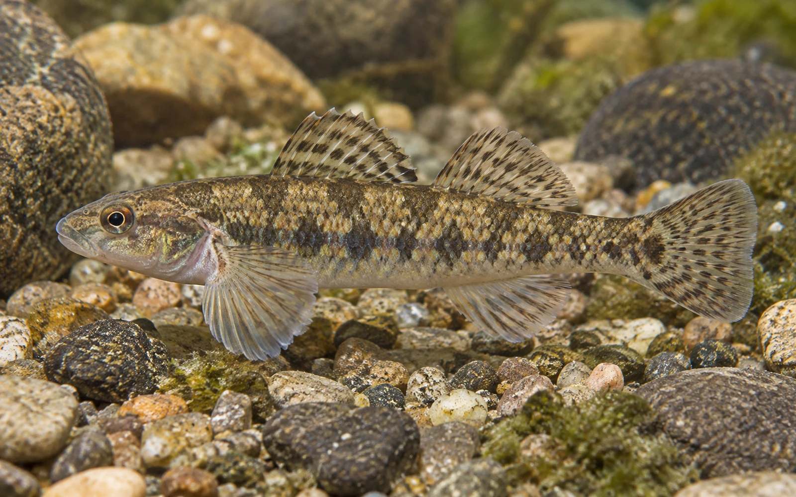
  • White Crappie identification image White Crappie Pomoxis annularisStocked
  • Bluegill identification image Bluegill Lepomis macrochirusReported · Stocked
  • Largemouth Bass identification image Largemouth Bass Micropterus salmoidesReported · Stocked
  • Black Crappie identification image Black Crappie Pomoxis nigromaculatusReported
  • Channel Catfish identification image Channel Catfish Ictalurus punctatusReported · Stocked
Sources & Method
Sources used for Pennsylvania Waterways

IonaFish compiles Waterway information from public and government sources, geographic data, fisheries information, and reviewed research. Information is normalized and presented in IonaFish's fisherman-focused format.

  1. Direct active production sources — Pennsylvania Fish and Boat Commission (PFBC)PFBC Waterway, fisheries, stocking, regulation, verified access, and open-fishing records that actively supply final Pennsylvania facts.
  2. Supporting identity and geography — GNIS and USGSFederal names, identifiers, and geographic support only where actually bound to a final Waterway.
  3. Legacy provenance — historical NHD and retired hydrography identifiersRetained on historical records where applicable; these are not active statewide coverage sources.
  4. Bounded local corroborationCounty, municipal, park, authority, and other local public sources only where they directly support a reviewed record.
  5. Review methodology — reviewed geographic and map researchUsed to reconcile identity and access locations as a review method, not as an authoritative source family.
  6. IonaFish normalizationIonaFish reconciles source facts into canonical Waterway identities, normalized terminology, and fisherman-focused presentation.

This state-level list describes sources used across the Waterway research and mapping workflow. Not every source contributed to every individual Waterway.

Wissahickon Creek

Creek • Montgomery, Philadelphia, United States, Pennsylvania

View Official Location on Map

Waterway Information

Identity & Location
Waterway Name
Wissahickon Creek
State
Pennsylvania
County / Counties
Montgomery, Philadelphia
Hydrologic Class
Flowing water
Waterway Type
Creek
Map Location
40.113720, -75.219760
Fishing Access
Public Fishing Access
Conditional
Access Conditions
Rivers and streams may have multiple public access locations with different ownership, parking, launch facilities, regulations, and seasonal restrictions. Some sections may cross private property, and PFBC listing, stocking, or mapping does not guarantee public access. Check current PFBC and managing-authority information before visiting.
Fishing Information
Fish Species Reported for This Waterway

Species records and fish populations may change over time.

  • Rainbow Trout identification image Rainbow Trout Oncorhynchus mykissStocked
  • Brown Trout identification image Brown Trout Salmo truttaStocked
Sources & Method
Sources used for Pennsylvania Waterways

IonaFish compiles Waterway information from public and government sources, geographic data, fisheries information, and reviewed research. Information is normalized and presented in IonaFish's fisherman-focused format.

  1. Direct active production sources — Pennsylvania Fish and Boat Commission (PFBC)PFBC Waterway, fisheries, stocking, regulation, verified access, and open-fishing records that actively supply final Pennsylvania facts.
  2. Supporting identity and geography — GNIS and USGSFederal names, identifiers, and geographic support only where actually bound to a final Waterway.
  3. Legacy provenance — historical NHD and retired hydrography identifiersRetained on historical records where applicable; these are not active statewide coverage sources.
  4. Bounded local corroborationCounty, municipal, park, authority, and other local public sources only where they directly support a reviewed record.
  5. Review methodology — reviewed geographic and map researchUsed to reconcile identity and access locations as a review method, not as an authoritative source family.
  6. IonaFish normalizationIonaFish reconciles source facts into canonical Waterway identities, normalized terminology, and fisherman-focused presentation.

This state-level list describes sources used across the Waterway research and mapping workflow. Not every source contributed to every individual Waterway.

Wolf Creek

Creek • Butler, Mercer, United States, Pennsylvania

View Official Location on Map

Waterway Information

Identity & Location
Waterway Name
Wolf Creek
State
Pennsylvania
County / Counties
Butler, Mercer
Hydrologic Class
Flowing water
Waterway Type
Creek
Map Location
41.146170, -80.090240
Fishing Access
Public Fishing Access
Conditional
Access Conditions
Rivers and streams may have multiple public access locations with different ownership, parking, launch facilities, regulations, and seasonal restrictions. Some sections may cross private property, and PFBC listing, stocking, or mapping does not guarantee public access. Check current PFBC and managing-authority information before visiting.
Fishing Information
Fish Species Reported for This Waterway

Species records and fish populations may change over time.

  • Smallmouth Bass identification image Smallmouth Bass Micropterus dolomieuReported
  • TroutReported
Sources & Method
Sources used for Pennsylvania Waterways

IonaFish compiles Waterway information from public and government sources, geographic data, fisheries information, and reviewed research. Information is normalized and presented in IonaFish's fisherman-focused format.

  1. Direct active production sources — Pennsylvania Fish and Boat Commission (PFBC)PFBC Waterway, fisheries, stocking, regulation, verified access, and open-fishing records that actively supply final Pennsylvania facts.
  2. Supporting identity and geography — GNIS and USGSFederal names, identifiers, and geographic support only where actually bound to a final Waterway.
  3. Legacy provenance — historical NHD and retired hydrography identifiersRetained on historical records where applicable; these are not active statewide coverage sources.
  4. Bounded local corroborationCounty, municipal, park, authority, and other local public sources only where they directly support a reviewed record.
  5. Review methodology — reviewed geographic and map researchUsed to reconcile identity and access locations as a review method, not as an authoritative source family.
  6. IonaFish normalizationIonaFish reconciles source facts into canonical Waterway identities, normalized terminology, and fisherman-focused presentation.

This state-level list describes sources used across the Waterway research and mapping workflow. Not every source contributed to every individual Waterway.

Wolf Run

Unknown • United States, Centre, Pennsylvania

View Official Location on Map

Waterway Information

Identity & Location
Waterway Name
Wolf Run
State
Pennsylvania
County / Counties
Centre
Hydrologic Class
Flowing water
Waterway Type
Unknown
Map Location
41.111346, -77.896855
Fishing Access
Public Fishing Access
Conditional
Access Conditions
Rivers and streams may have multiple public access locations with different ownership, parking, launch facilities, regulations, and seasonal restrictions. Some sections may cross private property, and PFBC listing, stocking, or mapping does not guarantee public access. Check current PFBC and managing-authority information before visiting.
Fishing Information
Fish Species Reported for This Waterway

Species records and fish populations may change over time.

  • TroutReported
Sources & Method
Sources used for Pennsylvania Waterways

IonaFish compiles Waterway information from public and government sources, geographic data, fisheries information, and reviewed research. Information is normalized and presented in IonaFish's fisherman-focused format.

  1. Direct active production sources — Pennsylvania Fish and Boat Commission (PFBC)PFBC Waterway, fisheries, stocking, regulation, verified access, and open-fishing records that actively supply final Pennsylvania facts.
  2. Supporting identity and geography — GNIS and USGSFederal names, identifiers, and geographic support only where actually bound to a final Waterway.
  3. Legacy provenance — historical NHD and retired hydrography identifiersRetained on historical records where applicable; these are not active statewide coverage sources.
  4. Bounded local corroborationCounty, municipal, park, authority, and other local public sources only where they directly support a reviewed record.
  5. Review methodology — reviewed geographic and map researchUsed to reconcile identity and access locations as a review method, not as an authoritative source family.
  6. IonaFish normalizationIonaFish reconciles source facts into canonical Waterway identities, normalized terminology, and fisherman-focused presentation.

This state-level list describes sources used across the Waterway research and mapping workflow. Not every source contributed to every individual Waterway.

Wolf Run

Unknown • United States, Clearfield, Pennsylvania

View Official Location on Map

Waterway Information

Identity & Location
Waterway Name
Wolf Run
State
Pennsylvania
County / Counties
Clearfield
Hydrologic Class
Flowing water
Waterway Type
Unknown
Map Location
41.159640, -78.793950
Fishing Access
Public Fishing Access
Conditional
Access Conditions
Rivers and streams may have multiple public access locations with different ownership, parking, launch facilities, regulations, and seasonal restrictions. Some sections may cross private property, and PFBC listing, stocking, or mapping does not guarantee public access. Check current PFBC and managing-authority information before visiting.
Sources & Method
Sources used for Pennsylvania Waterways

IonaFish compiles Waterway information from public and government sources, geographic data, fisheries information, and reviewed research. Information is normalized and presented in IonaFish's fisherman-focused format.

  1. Direct active production sources — Pennsylvania Fish and Boat Commission (PFBC)PFBC Waterway, fisheries, stocking, regulation, verified access, and open-fishing records that actively supply final Pennsylvania facts.
  2. Supporting identity and geography — GNIS and USGSFederal names, identifiers, and geographic support only where actually bound to a final Waterway.
  3. Legacy provenance — historical NHD and retired hydrography identifiersRetained on historical records where applicable; these are not active statewide coverage sources.
  4. Bounded local corroborationCounty, municipal, park, authority, and other local public sources only where they directly support a reviewed record.
  5. Review methodology — reviewed geographic and map researchUsed to reconcile identity and access locations as a review method, not as an authoritative source family.
  6. IonaFish normalizationIonaFish reconciles source facts into canonical Waterway identities, normalized terminology, and fisherman-focused presentation.

This state-level list describes sources used across the Waterway research and mapping workflow. Not every source contributed to every individual Waterway.

Wolf Run

Unknown • United States, Elk, Pennsylvania

View Official Location on Map

Waterway Information

Identity & Location
Waterway Name
Wolf Run
State
Pennsylvania
County / Counties
Elk
Hydrologic Class
Flowing water
Waterway Type
Unknown
Map Location
41.596819, -78.873842
Fishing Access
Public Fishing Access
Conditional
Access Conditions
Rivers and streams may have multiple public access locations with different ownership, parking, launch facilities, regulations, and seasonal restrictions. Some sections may cross private property, and PFBC listing, stocking, or mapping does not guarantee public access. Check current PFBC and managing-authority information before visiting.
Fishing Information
Fish Species Reported for This Waterway

Species records and fish populations may change over time.

  • TroutReported
Sources & Method
Sources used for Pennsylvania Waterways

IonaFish compiles Waterway information from public and government sources, geographic data, fisheries information, and reviewed research. Information is normalized and presented in IonaFish's fisherman-focused format.

  1. Direct active production sources — Pennsylvania Fish and Boat Commission (PFBC)PFBC Waterway, fisheries, stocking, regulation, verified access, and open-fishing records that actively supply final Pennsylvania facts.
  2. Supporting identity and geography — GNIS and USGSFederal names, identifiers, and geographic support only where actually bound to a final Waterway.
  3. Legacy provenance — historical NHD and retired hydrography identifiersRetained on historical records where applicable; these are not active statewide coverage sources.
  4. Bounded local corroborationCounty, municipal, park, authority, and other local public sources only where they directly support a reviewed record.
  5. Review methodology — reviewed geographic and map researchUsed to reconcile identity and access locations as a review method, not as an authoritative source family.
  6. IonaFish normalizationIonaFish reconciles source facts into canonical Waterway identities, normalized terminology, and fisherman-focused presentation.

This state-level list describes sources used across the Waterway research and mapping workflow. Not every source contributed to every individual Waterway.

Woodcliff Lake (North Hudson County Park Pond)

Pond • Hudson, United States, Bergen, N. Bergen, New Jersey • 15.73295188 acres

View Official Location on Map

Waterway Information

Identity & Location
Waterway Name
Woodcliff Lake (North Hudson County Park Pond)
State
New Jersey
County / Counties
Hudson, Bergen
Nearest Town
N. Bergen
Hydrologic Class
Standing water
Waterway Type
Pond
Size / Acres
15.733 acres
Map Location
40.802835, -73.998513
Known Alternate Names
North Hudson Park Lake, Woodcliff Lake (James J. Braddock No. Hudson County Park Pond)
Fishing Access
Public Fishing Access
Confirmed
Permit Required
No permit required
Boat Access & Restrictions
Motor Use
No motors
Fishing Information
Trout Information
Seasonal trout water
Fish Species Reported for This Waterway

Species records and fish populations may change over time.

  • Rainbow Trout identification image Rainbow Trout Oncorhynchus mykissStocked
  • Largemouth Bass identification image Largemouth Bass Micropterus salmoidesReported
  • Yellow Perch identification image Yellow Perch Perca flavescensReported
  • Common Carp identification image Common Carp Cyprinus carpioReported
  • Channel Catfish identification image Channel Catfish Ictalurus punctatusReported
  • SunfishReported
Amenities
Picnicking
Yes
Management & Official Information
Managed By
County
Sources & Method
Sources used for New Jersey Waterways

IonaFish compiles Waterway information from public and government sources, geographic data, fisheries information, and reviewed research. Information is normalized and presented in IonaFish's fisherman-focused format.

  1. Primary fishing and access authorities — New Jersey Fish & Wildlife / NJDEPThe publicly accessible fishing-water catalog qualifies the established standing-water pack. Current trout-stocked stream data, Places to Fish, trout-water listings, the Freshwater Fishing Digest, and reviewed New Jersey park or access material qualify applicable flowing-water records.
  2. Supporting identity and geography — USGS, GNIS, and federal hydrographyFederal names, identifiers, locations, and hydrologic context support canonical identity and geographic reconciliation where actually used; they do not by themselves qualify New Jersey fishing-pack membership.
  3. Bounded New Jersey and local corroborationNew Jersey government, county, municipal, park, public-authority, and other official sources support specific access, location, restrictions, stocking, fisheries, or local-use facts where directly reviewed.
  4. Historical provenance and reviewed researchInactive historical hydrography and reviewed geographic or map research may be retained for provenance and reconciliation. They are not active fishing, access, or statewide membership authority.
  5. IonaFish review, reconciliation, and normalizationIonaFish independently reviews and reconciles applicable source facts into shared canonical Waterway identities, normalized terminology, fact-level provenance, and fisherman-focused presentation.

This state-level list describes sources used across the Waterway research and mapping workflow. Not every source contributed to every individual Waterway.

Woodcock Creek

Creek • United States, Crawford, Pennsylvania

View Official Location on Map

Waterway Information

Identity & Location
Waterway Name
Woodcock Creek
State
Pennsylvania
County / Counties
Crawford
Hydrologic Class
Flowing water
Waterway Type
Creek
Map Location
41.696700, -80.012940
Fishing Access
Public Fishing Access
Conditional
Access Conditions
Rivers and streams may have multiple public access locations with different ownership, parking, launch facilities, regulations, and seasonal restrictions. Some sections may cross private property, and PFBC listing, stocking, or mapping does not guarantee public access. Check current PFBC and managing-authority information before visiting.
Fishing Information
Fish Species Reported for This Waterway

Species records and fish populations may change over time.

  • Smallmouth Bass identification image Smallmouth Bass Micropterus dolomieuReported
  • Muskellunge identification image Muskellunge Esox masquinongyReported
  • Walleye identification image Walleye Sander vitreusReported
Sources & Method
Sources used for Pennsylvania Waterways

IonaFish compiles Waterway information from public and government sources, geographic data, fisheries information, and reviewed research. Information is normalized and presented in IonaFish's fisherman-focused format.

  1. Direct active production sources — Pennsylvania Fish and Boat Commission (PFBC)PFBC Waterway, fisheries, stocking, regulation, verified access, and open-fishing records that actively supply final Pennsylvania facts.
  2. Supporting identity and geography — GNIS and USGSFederal names, identifiers, and geographic support only where actually bound to a final Waterway.
  3. Legacy provenance — historical NHD and retired hydrography identifiersRetained on historical records where applicable; these are not active statewide coverage sources.
  4. Bounded local corroborationCounty, municipal, park, authority, and other local public sources only where they directly support a reviewed record.
  5. Review methodology — reviewed geographic and map researchUsed to reconcile identity and access locations as a review method, not as an authoritative source family.
  6. IonaFish normalizationIonaFish reconciles source facts into canonical Waterway identities, normalized terminology, and fisherman-focused presentation.

This state-level list describes sources used across the Waterway research and mapping workflow. Not every source contributed to every individual Waterway.

Woodcock Creek Lake

Lake • United States, Crawford, Pennsylvania

View Official Location on Map

Waterway Information

Identity & Location
Waterway Name
Woodcock Creek Lake
State
Pennsylvania
County / Counties
Crawford
Hydrologic Class
Standing water
Waterway Type
Lake
Map Location
41.696110, -80.101387
Fishing Access
Public Fishing Access
Unknown
Fishing Information
Fish Species Reported for This Waterway

Species records and fish populations may change over time.

  • White Crappie identification image White Crappie Pomoxis annularisReported
  • Bluegill identification image Bluegill Lepomis macrochirusReported
  • Largemouth Bass identification image Largemouth Bass Micropterus salmoidesReported
  • Smallmouth Bass identification image Smallmouth Bass Micropterus dolomieuReported
  • Pumpkinseed identification image Pumpkinseed Lepomis gibbosusReported
  • Yellow Perch identification image Yellow Perch Perca flavescensReported
  • Black Crappie identification image Black Crappie Pomoxis nigromaculatusReported · Stocked
  • Muskellunge identification image Muskellunge Esox masquinongyReported · Stocked
  • Walleye identification image Walleye Sander vitreusReported · Stocked
  • Channel Catfish identification image Channel Catfish Ictalurus punctatusReported · Stocked
Sources & Method
Sources used for Pennsylvania Waterways

IonaFish compiles Waterway information from public and government sources, geographic data, fisheries information, and reviewed research. Information is normalized and presented in IonaFish's fisherman-focused format.

  1. Direct active production sources — Pennsylvania Fish and Boat Commission (PFBC)PFBC Waterway, fisheries, stocking, regulation, verified access, and open-fishing records that actively supply final Pennsylvania facts.
  2. Supporting identity and geography — GNIS and USGSFederal names, identifiers, and geographic support only where actually bound to a final Waterway.
  3. Legacy provenance — historical NHD and retired hydrography identifiersRetained on historical records where applicable; these are not active statewide coverage sources.
  4. Bounded local corroborationCounty, municipal, park, authority, and other local public sources only where they directly support a reviewed record.
  5. Review methodology — reviewed geographic and map researchUsed to reconcile identity and access locations as a review method, not as an authoritative source family.
  6. IonaFish normalizationIonaFish reconciles source facts into canonical Waterway identities, normalized terminology, and fisherman-focused presentation.

This state-level list describes sources used across the Waterway research and mapping workflow. Not every source contributed to every individual Waterway.

Wooddale Park Pond

Pond • United States, Bergen, New Jersey, Woodcliff Lake • 3.78991159 acres

View Official Location on Map

Waterway Information

Identity & Location
Waterway Name
Wooddale Park Pond
State
New Jersey
County / Counties
Bergen
Nearest Town
Woodcliff Lake
Hydrologic Class
Standing water
Waterway Type
Pond
Size / Acres
3.78991 acres
Map Location
41.021388, -74.030418
Known Alternate Names
Woodale County Park Lake
Fishing Access
Public Fishing Access
Confirmed
Permit Required
No permit required
Boat Access & Restrictions
Motor Use
No motors
Fishing Information
Fish Species Reported for This Waterway

Species records and fish populations may change over time.

  • Rainbow Trout identification image Rainbow Trout Oncorhynchus mykissStocked
  • Common Carp identification image Common Carp Cyprinus carpioReported
  • CatfishReported
  • SunfishReported
Amenities
Picnicking
Yes
Management & Official Information
Managed By
County
Sources & Method
Sources used for New Jersey Waterways

IonaFish compiles Waterway information from public and government sources, geographic data, fisheries information, and reviewed research. Information is normalized and presented in IonaFish's fisherman-focused format.

  1. Primary fishing and access authorities — New Jersey Fish & Wildlife / NJDEPThe publicly accessible fishing-water catalog qualifies the established standing-water pack. Current trout-stocked stream data, Places to Fish, trout-water listings, the Freshwater Fishing Digest, and reviewed New Jersey park or access material qualify applicable flowing-water records.
  2. Supporting identity and geography — USGS, GNIS, and federal hydrographyFederal names, identifiers, locations, and hydrologic context support canonical identity and geographic reconciliation where actually used; they do not by themselves qualify New Jersey fishing-pack membership.
  3. Bounded New Jersey and local corroborationNew Jersey government, county, municipal, park, public-authority, and other official sources support specific access, location, restrictions, stocking, fisheries, or local-use facts where directly reviewed.
  4. Historical provenance and reviewed researchInactive historical hydrography and reviewed geographic or map research may be retained for provenance and reconciliation. They are not active fishing, access, or statewide membership authority.
  5. IonaFish review, reconciliation, and normalizationIonaFish independently reviews and reconciles applicable source facts into shared canonical Waterway identities, normalized terminology, fact-level provenance, and fisherman-focused presentation.

This state-level list describes sources used across the Waterway research and mapping workflow. Not every source contributed to every individual Waterway.

Wooden Bridge Creek

Creek • United States, Fulton, Pennsylvania

View Official Location on Map

Waterway Information

Identity & Location
Waterway Name
Wooden Bridge Creek
State
Pennsylvania
County / Counties
Fulton
Hydrologic Class
Flowing water
Waterway Type
Creek
Map Location
40.064696, -78.041663
Fishing Access
Public Fishing Access
Conditional
Access Conditions
Rivers and streams may have multiple public access locations with different ownership, parking, launch facilities, regulations, and seasonal restrictions. Some sections may cross private property, and PFBC listing, stocking, or mapping does not guarantee public access. Check current PFBC and managing-authority information before visiting.
Fishing Information
Fish Species Reported for This Waterway

Species records and fish populations may change over time.

  • TroutReported
Sources & Method
Sources used for Pennsylvania Waterways

IonaFish compiles Waterway information from public and government sources, geographic data, fisheries information, and reviewed research. Information is normalized and presented in IonaFish's fisherman-focused format.

  1. Direct active production sources — Pennsylvania Fish and Boat Commission (PFBC)PFBC Waterway, fisheries, stocking, regulation, verified access, and open-fishing records that actively supply final Pennsylvania facts.
  2. Supporting identity and geography — GNIS and USGSFederal names, identifiers, and geographic support only where actually bound to a final Waterway.
  3. Legacy provenance — historical NHD and retired hydrography identifiersRetained on historical records where applicable; these are not active statewide coverage sources.
  4. Bounded local corroborationCounty, municipal, park, authority, and other local public sources only where they directly support a reviewed record.
  5. Review methodology — reviewed geographic and map researchUsed to reconcile identity and access locations as a review method, not as an authoritative source family.
  6. IonaFish normalizationIonaFish reconciles source facts into canonical Waterway identities, normalized terminology, and fisherman-focused presentation.

This state-level list describes sources used across the Waterway research and mapping workflow. Not every source contributed to every individual Waterway.

Woodsboro Community Pond

Unknown • United States, Maryland

Waterway Information

Identity & Location
Waterway Name
Woodsboro Community Pond
State
Maryland
County / Counties
Unknown
Hydrologic Class
Standing water
Waterway Type
Unknown
Map Location
Unknown
Fishing Access
Public Fishing Access
Confirmed
Fishing Information
Fish Species Reported for This Waterway

Species records and fish populations may change over time.

  • TroutStocked
Sources & Method
Sources used for Maryland Waterways

IonaFish compiles Waterway information from public and government sources, geographic data, fisheries information, and reviewed research. Information is normalized and presented in IonaFish's fisherman-focused format.

  1. U.S. Geological Survey 3D Hydrography Program (3DHP)Federal hydrography used for candidate identity and location support.
  2. Geographic Names Information System (GNIS)Federal names, identifiers, feature classes, and location support.
  3. Maryland Department of Natural Resources official factual pages and schedulesCandidate-specific fishing, stocking, public-access, freshwater/tidal-scope, and restriction facts where used.
  4. U.S. Fish and Wildlife Service official factual pagesCandidate-specific federal refuge fishing and access facts where used.
  5. U.S. National Park Service official factual pagesCandidate-specific federal park fishing, access, launch, and restriction facts where used.
  6. U.S. Army Corps of Engineers official factual pagesCandidate-specific federal reservoir fishing, access, and launch facts where used.
  7. Maryland local governments, park agencies, and public reservoir authoritiesCandidate-specific fishing, access, permit, fee, hour, launch, and restriction facts where used.
  8. IonaFish normalization, compilation, and presentationReviewed candidate bindings, fact-level provenance, and fisherman-focused presentation.

This state-level list describes sources used across the Waterway research and mapping workflow. Not every source contributed to every individual Waterway.

Woodstown Memorial Lake

Lake • United States, New Jersey, Salem, Woodstown • 22.96681426 acres

View Official Location on Map

Waterway Information

Identity & Location
Waterway Name
Woodstown Memorial Lake
State
New Jersey
County / Counties
Salem
Nearest Town
Woodstown
Hydrologic Class
Standing water
Waterway Type
Lake
Size / Acres
22.9668 acres
Map Location
39.644555, -75.325359
Known Alternate Names
Memorial Lake
Fishing Access
Public Fishing Access
Confirmed
Permit Required
No permit required
Boat Access & Restrictions
Cartop / Kayak Launch
Available
Motor Use
Electric motors only
Fishing Information
Fish Species Reported for This Waterway

Species records and fish populations may change over time.

  • Largemouth Bass identification image Largemouth Bass Micropterus salmoidesReported
  • Yellow Perch identification image Yellow Perch Perca flavescensReported
  • Common Carp identification image Common Carp Cyprinus carpioReported
  • Channel Catfish identification image Channel Catfish Ictalurus punctatusReported · Stocked
  • CrappieReported
  • PickerelReported
  • SunfishReported
Amenities
Picnicking
Yes
Management & Official Information
Managed By
Municipal
Sources & Method
Sources used for New Jersey Waterways

IonaFish compiles Waterway information from public and government sources, geographic data, fisheries information, and reviewed research. Information is normalized and presented in IonaFish's fisherman-focused format.

  1. Primary fishing and access authorities — New Jersey Fish & Wildlife / NJDEPThe publicly accessible fishing-water catalog qualifies the established standing-water pack. Current trout-stocked stream data, Places to Fish, trout-water listings, the Freshwater Fishing Digest, and reviewed New Jersey park or access material qualify applicable flowing-water records.
  2. Supporting identity and geography — USGS, GNIS, and federal hydrographyFederal names, identifiers, locations, and hydrologic context support canonical identity and geographic reconciliation where actually used; they do not by themselves qualify New Jersey fishing-pack membership.
  3. Bounded New Jersey and local corroborationNew Jersey government, county, municipal, park, public-authority, and other official sources support specific access, location, restrictions, stocking, fisheries, or local-use facts where directly reviewed.
  4. Historical provenance and reviewed researchInactive historical hydrography and reviewed geographic or map research may be retained for provenance and reconciliation. They are not active fishing, access, or statewide membership authority.
  5. IonaFish review, reconciliation, and normalizationIonaFish independently reviews and reconciles applicable source facts into shared canonical Waterway identities, normalized terminology, fact-level provenance, and fisherman-focused presentation.

This state-level list describes sources used across the Waterway research and mapping workflow. Not every source contributed to every individual Waterway.

Woolmans Lake

Lake • United States, Burlington, Mt. Holly, New Jersey • 5.7504810200000005 acres

View Official Location on Map

Waterway Information

Identity & Location
Waterway Name
Woolmans Lake
State
New Jersey
County / Counties
Burlington
Nearest Town
Mt. Holly
Hydrologic Class
Standing water
Waterway Type
Lake
Size / Acres
5.75048 acres
Map Location
39.995445, -74.779091
Known Alternate Names
Woolman Lake
Fishing Access
Public Fishing Access
Confirmed
Permit Required
No permit required
Boat Access & Restrictions
Cartop / Kayak Launch
Available
Motor Use
Electric motors only
Fishing Information
Fish Species Reported for This Waterway

Species records and fish populations may change over time.

  • Largemouth Bass identification image Largemouth Bass Micropterus salmoidesReported
  • Yellow Perch identification image Yellow Perch Perca flavescensReported
  • Common Carp identification image Common Carp Cyprinus carpioReported
  • Channel Catfish identification image Channel Catfish Ictalurus punctatusStocked
  • CrappieReported
  • PickerelReported
  • SunfishReported
Amenities
Picnicking
Yes
Management & Official Information
Managed By
Municipal
Sources & Method
Sources used for New Jersey Waterways

IonaFish compiles Waterway information from public and government sources, geographic data, fisheries information, and reviewed research. Information is normalized and presented in IonaFish's fisherman-focused format.

  1. Primary fishing and access authorities — New Jersey Fish & Wildlife / NJDEPThe publicly accessible fishing-water catalog qualifies the established standing-water pack. Current trout-stocked stream data, Places to Fish, trout-water listings, the Freshwater Fishing Digest, and reviewed New Jersey park or access material qualify applicable flowing-water records.
  2. Supporting identity and geography — USGS, GNIS, and federal hydrographyFederal names, identifiers, locations, and hydrologic context support canonical identity and geographic reconciliation where actually used; they do not by themselves qualify New Jersey fishing-pack membership.
  3. Bounded New Jersey and local corroborationNew Jersey government, county, municipal, park, public-authority, and other official sources support specific access, location, restrictions, stocking, fisheries, or local-use facts where directly reviewed.
  4. Historical provenance and reviewed researchInactive historical hydrography and reviewed geographic or map research may be retained for provenance and reconciliation. They are not active fishing, access, or statewide membership authority.
  5. IonaFish review, reconciliation, and normalizationIonaFish independently reviews and reconciles applicable source facts into shared canonical Waterway identities, normalized terminology, fact-level provenance, and fisherman-focused presentation.

This state-level list describes sources used across the Waterway research and mapping workflow. Not every source contributed to every individual Waterway.

Wye Mills Lake

Unknown • United States, Maryland, Queen Anne'S

View Official Location on Map

Waterway Information

Identity & Location
Waterway Name
Wye Mills Lake
State
Maryland
County / Counties
Queen Anne'S
Hydrologic Class
Standing water
Waterway Type
Unknown
Map Location
38.942000, -76.079000
Fishing Access
Public Fishing Access
Confirmed, See Access Conditions
Access Conditions
Maryland fishing license and regulations apply
Fishing Information
Fish Species Reported for This Waterway

Species records and fish populations may change over time.

  • White Crappie identification image White Crappie Pomoxis annularisReported
  • Gizzard Shad identification image Gizzard Shad Dorosoma cepedianumReported
  • Bluegill identification image Bluegill Lepomis macrochirusReported
  • Largemouth Bass identification image Largemouth Bass Micropterus salmoidesReported
  • Brown Bullhead identification image Brown Bullhead Ameiurus nebulosusReported
  • Pumpkinseed identification image Pumpkinseed Lepomis gibbosusReported
  • Golden Shiner identification image Golden Shiner Notemigonus crysoleucasReported
  • Yellow Perch identification image Yellow Perch Perca flavescensReported
  • Black Crappie identification image Black Crappie Pomoxis nigromaculatusReported
  • Common Carp identification image Common Carp Cyprinus carpioReported
Sources & Method
Sources used for Maryland Waterways

IonaFish compiles Waterway information from public and government sources, geographic data, fisheries information, and reviewed research. Information is normalized and presented in IonaFish's fisherman-focused format.

  1. U.S. Geological Survey 3D Hydrography Program (3DHP)Federal hydrography used for candidate identity and location support.
  2. Geographic Names Information System (GNIS)Federal names, identifiers, feature classes, and location support.
  3. Maryland Department of Natural Resources official factual pages and schedulesCandidate-specific fishing, stocking, public-access, freshwater/tidal-scope, and restriction facts where used.
  4. U.S. Fish and Wildlife Service official factual pagesCandidate-specific federal refuge fishing and access facts where used.
  5. U.S. National Park Service official factual pagesCandidate-specific federal park fishing, access, launch, and restriction facts where used.
  6. U.S. Army Corps of Engineers official factual pagesCandidate-specific federal reservoir fishing, access, and launch facts where used.
  7. Maryland local governments, park agencies, and public reservoir authoritiesCandidate-specific fishing, access, permit, fee, hour, launch, and restriction facts where used.
  8. IonaFish normalization, compilation, and presentationReviewed candidate bindings, fact-level provenance, and fisherman-focused presentation.

This state-level list describes sources used across the Waterway research and mapping workflow. Not every source contributed to every individual Waterway.

Wykoff Run

Unknown • United States, Cameron, Pennsylvania

View Official Location on Map

Waterway Information

Identity & Location
Waterway Name
Wykoff Run
State
Pennsylvania
County / Counties
Cameron
Hydrologic Class
Flowing water
Waterway Type
Unknown
Map Location
41.284637, -78.124290
Fishing Access
Public Fishing Access
Conditional
Access Conditions
Rivers and streams may have multiple public access locations with different ownership, parking, launch facilities, regulations, and seasonal restrictions. Some sections may cross private property, and PFBC listing, stocking, or mapping does not guarantee public access. Check current PFBC and managing-authority information before visiting.
Fishing Information
Fish Species Reported for This Waterway

Species records and fish populations may change over time.

  • TroutReported
Sources & Method
Sources used for Pennsylvania Waterways

IonaFish compiles Waterway information from public and government sources, geographic data, fisheries information, and reviewed research. Information is normalized and presented in IonaFish's fisherman-focused format.

  1. Direct active production sources — Pennsylvania Fish and Boat Commission (PFBC)PFBC Waterway, fisheries, stocking, regulation, verified access, and open-fishing records that actively supply final Pennsylvania facts.
  2. Supporting identity and geography — GNIS and USGSFederal names, identifiers, and geographic support only where actually bound to a final Waterway.
  3. Legacy provenance — historical NHD and retired hydrography identifiersRetained on historical records where applicable; these are not active statewide coverage sources.
  4. Bounded local corroborationCounty, municipal, park, authority, and other local public sources only where they directly support a reviewed record.
  5. Review methodology — reviewed geographic and map researchUsed to reconcile identity and access locations as a review method, not as an authoritative source family.
  6. IonaFish normalizationIonaFish reconciles source facts into canonical Waterway identities, normalized terminology, and fisherman-focused presentation.

This state-level list describes sources used across the Waterway research and mapping workflow. Not every source contributed to every individual Waterway.

Wynooska Lake

Lake • United States, Pennsylvania, Pike

View Official Location on Map

Waterway Information

Identity & Location
Waterway Name
Wynooska Lake
State
Pennsylvania
County / Counties
Pike
Hydrologic Class
Standing water
Waterway Type
Lake
Map Location
41.286251, -75.248576
Fishing Access
Public Fishing Access
Unknown
Sources & Method
Sources used for Pennsylvania Waterways

IonaFish compiles Waterway information from public and government sources, geographic data, fisheries information, and reviewed research. Information is normalized and presented in IonaFish's fisherman-focused format.

  1. Direct active production sources — Pennsylvania Fish and Boat Commission (PFBC)PFBC Waterway, fisheries, stocking, regulation, verified access, and open-fishing records that actively supply final Pennsylvania facts.
  2. Supporting identity and geography — GNIS and USGSFederal names, identifiers, and geographic support only where actually bound to a final Waterway.
  3. Legacy provenance — historical NHD and retired hydrography identifiersRetained on historical records where applicable; these are not active statewide coverage sources.
  4. Bounded local corroborationCounty, municipal, park, authority, and other local public sources only where they directly support a reviewed record.
  5. Review methodology — reviewed geographic and map researchUsed to reconcile identity and access locations as a review method, not as an authoritative source family.
  6. IonaFish normalizationIonaFish reconciles source facts into canonical Waterway identities, normalized terminology, and fisherman-focused presentation.

This state-level list describes sources used across the Waterway research and mapping workflow. Not every source contributed to every individual Waterway.

Wyomissing Creek

Creek • United States, Berks, Pennsylvania

View Official Location on Map

Waterway Information

Identity & Location
Waterway Name
Wyomissing Creek
State
Pennsylvania
County / Counties
Berks
Hydrologic Class
Flowing water
Waterway Type
Creek
Map Location
40.295502, -75.979596
Fishing Access
Public Fishing Access
Conditional
Access Conditions
Rivers and streams may have multiple public access locations with different ownership, parking, launch facilities, regulations, and seasonal restrictions. Some sections may cross private property, and PFBC listing, stocking, or mapping does not guarantee public access. Check current PFBC and managing-authority information before visiting.
Fishing Information
Fish Species Reported for This Waterway

Species records and fish populations may change over time.

  • Brown Trout identification image Brown Trout Salmo truttaReported
  • TroutReported
Sources & Method
Sources used for Pennsylvania Waterways

IonaFish compiles Waterway information from public and government sources, geographic data, fisheries information, and reviewed research. Information is normalized and presented in IonaFish's fisherman-focused format.

  1. Direct active production sources — Pennsylvania Fish and Boat Commission (PFBC)PFBC Waterway, fisheries, stocking, regulation, verified access, and open-fishing records that actively supply final Pennsylvania facts.
  2. Supporting identity and geography — GNIS and USGSFederal names, identifiers, and geographic support only where actually bound to a final Waterway.
  3. Legacy provenance — historical NHD and retired hydrography identifiersRetained on historical records where applicable; these are not active statewide coverage sources.
  4. Bounded local corroborationCounty, municipal, park, authority, and other local public sources only where they directly support a reviewed record.
  5. Review methodology — reviewed geographic and map researchUsed to reconcile identity and access locations as a review method, not as an authoritative source family.
  6. IonaFish normalizationIonaFish reconciles source facts into canonical Waterway identities, normalized terminology, and fisherman-focused presentation.

This state-level list describes sources used across the Waterway research and mapping workflow. Not every source contributed to every individual Waterway.

Wysox Creek

Creek • United States, Bradford, Pennsylvania

View Official Location on Map

Waterway Information

Identity & Location
Waterway Name
Wysox Creek
State
Pennsylvania
County / Counties
Bradford
Hydrologic Class
Flowing water
Waterway Type
Creek
Map Location
41.819749, -76.355428
Fishing Access
Public Fishing Access
Conditional
Access Conditions
Rivers and streams may have multiple public access locations with different ownership, parking, launch facilities, regulations, and seasonal restrictions. Some sections may cross private property, and PFBC listing, stocking, or mapping does not guarantee public access. Check current PFBC and managing-authority information before visiting.
Sources & Method
Sources used for Pennsylvania Waterways

IonaFish compiles Waterway information from public and government sources, geographic data, fisheries information, and reviewed research. Information is normalized and presented in IonaFish's fisherman-focused format.

  1. Direct active production sources — Pennsylvania Fish and Boat Commission (PFBC)PFBC Waterway, fisheries, stocking, regulation, verified access, and open-fishing records that actively supply final Pennsylvania facts.
  2. Supporting identity and geography — GNIS and USGSFederal names, identifiers, and geographic support only where actually bound to a final Waterway.
  3. Legacy provenance — historical NHD and retired hydrography identifiersRetained on historical records where applicable; these are not active statewide coverage sources.
  4. Bounded local corroborationCounty, municipal, park, authority, and other local public sources only where they directly support a reviewed record.
  5. Review methodology — reviewed geographic and map researchUsed to reconcile identity and access locations as a review method, not as an authoritative source family.
  6. IonaFish normalizationIonaFish reconciles source facts into canonical Waterway identities, normalized terminology, and fisherman-focused presentation.

This state-level list describes sources used across the Waterway research and mapping workflow. Not every source contributed to every individual Waterway.

Yantic River

River • United States, Connecticut

Waterway Information

Identity & Location
Waterway Name
Yantic River
State
Connecticut
County / Counties
Unknown
Hydrologic Class
Flowing water
Waterway Type
River
Map Location
Unknown
Fishing Access
Public Fishing Access
Conditional
Access Conditions
Rivers and streams may have multiple public access locations with different ownership, parking, fees, regulations, and seasonal restrictions. Check current state or managing-authority information before visiting., This is not a whole-waterway access claim; current property rules, hours, parking limits, closures, and posted restrictions apply., Special regulations apply within the reviewed Trout Management Area reach.
Fishing Information
Fish Species Reported for This Waterway

Species records and fish populations may change over time.

  • Brook Trout identification image Brook Trout Salvelinus fontinalisSurveyed · Stocked
  • Bluegill identification image Bluegill Lepomis macrochirusSurveyed
  • Rainbow Trout identification image Rainbow Trout Oncorhynchus mykissSurveyed · Stocked
  • Largemouth Bass identification image Largemouth Bass Micropterus salmoidesSurveyed
  • Brown Bullhead identification image Brown Bullhead Ameiurus nebulosusSurveyed
  • Smallmouth Bass identification image Smallmouth Bass Micropterus dolomieuSurveyed
  • Pumpkinseed identification image Pumpkinseed Lepomis gibbosusSurveyed
  • Fathead Minnow identification image Fathead Minnow Pimephales promelasSurveyed
  • Blacknose Dace identification image Blacknose Dace Rhinichthys atratulusSurveyed
  • Golden Shiner identification image Golden Shiner Notemigonus crysoleucasSurveyed
  • Yellow Perch identification image Yellow Perch Perca flavescensSurveyed
  • White Sucker identification image White Sucker Catostomus commersoniiSurveyed
  • Redbreast Sunfish identification image Redbreast Sunfish Lepomis auritusSurveyed
  • American Eel identification image American Eel Anguilla rostrataSurveyed
  • Alewife identification image Alewife Alosa pseudoharengusSurveyed
  • Chain Pickerel identification image Chain Pickerel Esox nigerSurveyed
  • Brown Trout identification image Brown Trout Salmo truttaSurveyed · Stocked
  • Tessellated Darter identification image Tessellated Darter Etheostoma olmstediSurveyed
  • White Catfish identification image White Catfish Ameiurus catusSurveyed
  • TroutStocked
Sources & Method
Sources used for Connecticut Waterways

IonaFish compiles Waterway information from public and government sources, geographic data, fisheries information, and reviewed research. Information is normalized and presented in IonaFish's fisherman-focused format.

  1. Connecticut DEEP stocked lakes and stocked streamsOfficial Waterway identity, type, location, geometry, and reviewed reach context for the approved Connecticut cohort.
  2. Connecticut DEEP 2026 Fishing GuideReviewed public-fishing access, managed-water designation, and material access or special-regulation conditions.
  3. Connecticut DEEP Community Fishing WatersStanding-water identity and locality corroboration where directly used.
  4. Connecticut DEEP Fish Community DataWaterway- and municipality-matched survey observations with exact sample years; historical observations are not presented as necessarily current.
  5. Connecticut DEEP 2025 Annual and 2026 Current Fish Stocking ReportsCompleted Waterway-specific stocking evidence. Exact species and broad Trout wording retain the source's original specificity.
  6. Connecticut DEEP fish distribution-map methodologyArchived methodology explains explicit capture points and historical-versus-recent symbols. Shaded drainage distributions are not Waterway-level evidence.
  7. IonaFish review, reconciliation, and normalizationCanonical parent-Waterway identities, reach-limited access presentation, provenance linkage, and fisherman-focused terminology.

This state-level list describes sources used across the Waterway research and mapping workflow. Not every source contributed to every individual Waterway.

Yellow Breeches Creek

Creek • Cumberland, York, United States, Pennsylvania

View Official Location on Map

Waterway Information

Identity & Location
Waterway Name
Yellow Breeches Creek
State
Pennsylvania
County / Counties
Cumberland, York
Hydrologic Class
Flowing water
Waterway Type
Creek
Map Location
40.124764, -77.220854
Fishing Access
Public Fishing Access
Confirmed
Access Conditions
Rivers and streams may have multiple public access locations with different ownership, parking, launch facilities, regulations, and seasonal restrictions. Some sections may cross private property, and PFBC listing, stocking, or mapping does not guarantee public access. Check current PFBC and managing-authority information before visiting.
Fishing Information
Fish Species Reported for This Waterway

Species records and fish populations may change over time.

  • Rainbow Trout identification image Rainbow Trout Oncorhynchus mykissStocked
  • Brown Trout identification image Brown Trout Salmo truttaStocked
  • Rock Bass identification image Rock Bass Ambloplites rupestrisReported
  • TroutReported
Sources & Method
Sources used for Pennsylvania Waterways

IonaFish compiles Waterway information from public and government sources, geographic data, fisheries information, and reviewed research. Information is normalized and presented in IonaFish's fisherman-focused format.

  1. Direct active production sources — Pennsylvania Fish and Boat Commission (PFBC)PFBC Waterway, fisheries, stocking, regulation, verified access, and open-fishing records that actively supply final Pennsylvania facts.
  2. Supporting identity and geography — GNIS and USGSFederal names, identifiers, and geographic support only where actually bound to a final Waterway.
  3. Legacy provenance — historical NHD and retired hydrography identifiersRetained on historical records where applicable; these are not active statewide coverage sources.
  4. Bounded local corroborationCounty, municipal, park, authority, and other local public sources only where they directly support a reviewed record.
  5. Review methodology — reviewed geographic and map researchUsed to reconcile identity and access locations as a review method, not as an authoritative source family.
  6. IonaFish normalizationIonaFish reconciles source facts into canonical Waterway identities, normalized terminology, and fisherman-focused presentation.

This state-level list describes sources used across the Waterway research and mapping workflow. Not every source contributed to every individual Waterway.

Yellow Brook

Stream • United States, Monmouth, New Jersey

View Official Location on Map

Waterway Information

Identity & Location
Waterway Name
Yellow Brook
State
New Jersey
County / Counties
Monmouth
Hydrologic Class
Flowing water
Waterway Type
Stream
Map Location
40.296096, -74.167351
Fishing Access
Public Fishing Access
Conditional
Access Conditions
Rivers and streams may have multiple public access locations with different ownership, parking, fees, regulations, and seasonal restrictions. Check current state or managing-authority information before visiting.
Fishing Information
Fish Species Reported for This Waterway

Species records and fish populations may change over time.

  • Rainbow Trout identification image Rainbow Trout Oncorhynchus mykissStocked
Sources & Method
Sources used for New Jersey Waterways

IonaFish compiles Waterway information from public and government sources, geographic data, fisheries information, and reviewed research. Information is normalized and presented in IonaFish's fisherman-focused format.

  1. Primary fishing and access authorities — New Jersey Fish & Wildlife / NJDEPThe publicly accessible fishing-water catalog qualifies the established standing-water pack. Current trout-stocked stream data, Places to Fish, trout-water listings, the Freshwater Fishing Digest, and reviewed New Jersey park or access material qualify applicable flowing-water records.
  2. Supporting identity and geography — USGS, GNIS, and federal hydrographyFederal names, identifiers, locations, and hydrologic context support canonical identity and geographic reconciliation where actually used; they do not by themselves qualify New Jersey fishing-pack membership.
  3. Bounded New Jersey and local corroborationNew Jersey government, county, municipal, park, public-authority, and other official sources support specific access, location, restrictions, stocking, fisheries, or local-use facts where directly reviewed.
  4. Historical provenance and reviewed researchInactive historical hydrography and reviewed geographic or map research may be retained for provenance and reconciliation. They are not active fishing, access, or statewide membership authority.
  5. IonaFish review, reconciliation, and normalizationIonaFish independently reviews and reconciles applicable source facts into shared canonical Waterway identities, normalized terminology, fact-level provenance, and fisherman-focused presentation.

This state-level list describes sources used across the Waterway research and mapping workflow. Not every source contributed to every individual Waterway.

Yellow Creek

Creek • United States, Indiana, Pennsylvania

View Official Location on Map

Waterway Information

Identity & Location
Waterway Name
Yellow Creek
State
Pennsylvania
County / Counties
Indiana
Hydrologic Class
Flowing water
Waterway Type
Creek
Map Location
40.593560, -78.987550
Fishing Access
Public Fishing Access
Conditional
Access Conditions
Rivers and streams may have multiple public access locations with different ownership, parking, launch facilities, regulations, and seasonal restrictions. Some sections may cross private property, and PFBC listing, stocking, or mapping does not guarantee public access. Check current PFBC and managing-authority information before visiting.
Fishing Information
Fish Species Reported for This Waterway

Species records and fish populations may change over time.

  • Smallmouth Bass identification image Smallmouth Bass Micropterus dolomieuReported
  • Rock Bass identification image Rock Bass Ambloplites rupestrisReported
  • TroutReported
Sources & Method
Sources used for Pennsylvania Waterways

IonaFish compiles Waterway information from public and government sources, geographic data, fisheries information, and reviewed research. Information is normalized and presented in IonaFish's fisherman-focused format.

  1. Direct active production sources — Pennsylvania Fish and Boat Commission (PFBC)PFBC Waterway, fisheries, stocking, regulation, verified access, and open-fishing records that actively supply final Pennsylvania facts.
  2. Supporting identity and geography — GNIS and USGSFederal names, identifiers, and geographic support only where actually bound to a final Waterway.
  3. Legacy provenance — historical NHD and retired hydrography identifiersRetained on historical records where applicable; these are not active statewide coverage sources.
  4. Bounded local corroborationCounty, municipal, park, authority, and other local public sources only where they directly support a reviewed record.
  5. Review methodology — reviewed geographic and map researchUsed to reconcile identity and access locations as a review method, not as an authoritative source family.
  6. IonaFish normalizationIonaFish reconciles source facts into canonical Waterway identities, normalized terminology, and fisherman-focused presentation.

This state-level list describes sources used across the Waterway research and mapping workflow. Not every source contributed to every individual Waterway.

Yellow Creek

Creek • United States, Bedford, Pennsylvania

View Official Location on Map

Waterway Information

Identity & Location
Waterway Name
Yellow Creek
State
Pennsylvania
County / Counties
Bedford
Hydrologic Class
Flowing water
Waterway Type
Creek
Map Location
40.152203, -78.343577
Fishing Access
Public Fishing Access
Conditional
Access Conditions
Rivers and streams may have multiple public access locations with different ownership, parking, launch facilities, regulations, and seasonal restrictions. Some sections may cross private property, and PFBC listing, stocking, or mapping does not guarantee public access. Check current PFBC and managing-authority information before visiting.
Fishing Information
Fish Species Reported for This Waterway

Species records and fish populations may change over time.

  • Brown Trout identification image Brown Trout Salmo truttaReported
  • TroutReported
Sources & Method
Sources used for Pennsylvania Waterways

IonaFish compiles Waterway information from public and government sources, geographic data, fisheries information, and reviewed research. Information is normalized and presented in IonaFish's fisherman-focused format.

  1. Direct active production sources — Pennsylvania Fish and Boat Commission (PFBC)PFBC Waterway, fisheries, stocking, regulation, verified access, and open-fishing records that actively supply final Pennsylvania facts.
  2. Supporting identity and geography — GNIS and USGSFederal names, identifiers, and geographic support only where actually bound to a final Waterway.
  3. Legacy provenance — historical NHD and retired hydrography identifiersRetained on historical records where applicable; these are not active statewide coverage sources.
  4. Bounded local corroborationCounty, municipal, park, authority, and other local public sources only where they directly support a reviewed record.
  5. Review methodology — reviewed geographic and map researchUsed to reconcile identity and access locations as a review method, not as an authoritative source family.
  6. IonaFish normalizationIonaFish reconciles source facts into canonical Waterway identities, normalized terminology, and fisherman-focused presentation.

This state-level list describes sources used across the Waterway research and mapping workflow. Not every source contributed to every individual Waterway.

Yellow Creek Lake (State Park)

Lake • United States, Indiana, Pennsylvania

View Official Location on Map

Waterway Information

Identity & Location
Waterway Name
Yellow Creek Lake (State Park)
State
Pennsylvania
County / Counties
Indiana
Hydrologic Class
Standing water
Waterway Type
Lake
Map Location
40.590832, -79.053329
Known Alternate Names
Yellow Creek Lk
Fishing Access
Public Fishing Access
Unknown
Fishing Information
Fish Species Reported for This Waterway

Species records and fish populations may change over time.

  • Bluegill identification image Bluegill Lepomis macrochirusReported
  • Largemouth Bass identification image Largemouth Bass Micropterus salmoidesReported
  • Northern Pike identification image Northern Pike Esox luciusReported
  • Smallmouth Bass identification image Smallmouth Bass Micropterus dolomieuReported
  • Pumpkinseed identification image Pumpkinseed Lepomis gibbosusReported
  • Yellow Perch identification image Yellow Perch Perca flavescensReported
  • Tiger Muskellunge identification image Tiger Muskellunge Esox lucius x Esox masquinongyReported · Stocked
  • Black Crappie identification image Black Crappie Pomoxis nigromaculatusReported
  • Muskellunge identification image Muskellunge Esox masquinongyReported · Stocked
  • Rock Bass identification image Rock Bass Ambloplites rupestrisReported
  • Walleye identification image Walleye Sander vitreusReported · Stocked
  • BullheadsReported
Sources & Method
Sources used for Pennsylvania Waterways

IonaFish compiles Waterway information from public and government sources, geographic data, fisheries information, and reviewed research. Information is normalized and presented in IonaFish's fisherman-focused format.

  1. Direct active production sources — Pennsylvania Fish and Boat Commission (PFBC)PFBC Waterway, fisheries, stocking, regulation, verified access, and open-fishing records that actively supply final Pennsylvania facts.
  2. Supporting identity and geography — GNIS and USGSFederal names, identifiers, and geographic support only where actually bound to a final Waterway.
  3. Legacy provenance — historical NHD and retired hydrography identifiersRetained on historical records where applicable; these are not active statewide coverage sources.
  4. Bounded local corroborationCounty, municipal, park, authority, and other local public sources only where they directly support a reviewed record.
  5. Review methodology — reviewed geographic and map researchUsed to reconcile identity and access locations as a review method, not as an authoritative source family.
  6. IonaFish normalizationIonaFish reconciles source facts into canonical Waterway identities, normalized terminology, and fisherman-focused presentation.

This state-level list describes sources used across the Waterway research and mapping workflow. Not every source contributed to every individual Waterway.

Youghiogheny River

River • Allegheny, Fayette, Somerset, Westmoreland, United States, Pennsylvania

View Official Location on Map

Waterway Information

Identity & Location
Waterway Name
Youghiogheny River
State
Pennsylvania
County / Counties
Allegheny, Fayette, Somerset, Westmoreland
Hydrologic Class
Flowing water
Waterway Type
River
Map Location
39.808824, -79.364578
Fishing Access
Public Fishing Access
Conditional
Access Conditions
Rivers and streams may have multiple public access locations with different ownership, parking, launch facilities, regulations, and seasonal restrictions. Some sections may cross private property, and PFBC listing, stocking, or mapping does not guarantee public access. Check current PFBC and managing-authority information before visiting.
Fishing Information
Fish Species Reported for This Waterway

Species records and fish populations may change over time.

  • Smallmouth Bass identification image Smallmouth Bass Micropterus dolomieuReported
  • White Bass identification image White Bass Morone chrysopsReported
  • Muskellunge identification image Muskellunge Esox masquinongyReported · Stocked
  • Rock Bass identification image Rock Bass Ambloplites rupestrisReported
  • Sauger identification image Sauger Sander canadensisReported
  • Walleye identification image Walleye Sander vitreusReported · Stocked
  • Channel Catfish identification image Channel Catfish Ictalurus punctatusReported
Sources & Method
Sources used for Pennsylvania Waterways

IonaFish compiles Waterway information from public and government sources, geographic data, fisheries information, and reviewed research. Information is normalized and presented in IonaFish's fisherman-focused format.

  1. Direct active production sources — Pennsylvania Fish and Boat Commission (PFBC)PFBC Waterway, fisheries, stocking, regulation, verified access, and open-fishing records that actively supply final Pennsylvania facts.
  2. Supporting identity and geography — GNIS and USGSFederal names, identifiers, and geographic support only where actually bound to a final Waterway.
  3. Legacy provenance — historical NHD and retired hydrography identifiersRetained on historical records where applicable; these are not active statewide coverage sources.
  4. Bounded local corroborationCounty, municipal, park, authority, and other local public sources only where they directly support a reviewed record.
  5. Review methodology — reviewed geographic and map researchUsed to reconcile identity and access locations as a review method, not as an authoritative source family.
  6. IonaFish normalizationIonaFish reconciles source facts into canonical Waterway identities, normalized terminology, and fisherman-focused presentation.

This state-level list describes sources used across the Waterway research and mapping workflow. Not every source contributed to every individual Waterway.

Youghiogheny River

Unknown • United States, Maryland

View Official Location on Map

Waterway Information

Identity & Location
Waterway Name
Youghiogheny River
State
Maryland
County / Counties
Unknown
Hydrologic Class
Flowing water
Waterway Type
Unknown
Map Location
40.354236, -79.870326
Fishing Access
Public Fishing Access
Confirmed
Fishing Information
Fish Species Reported for This Waterway

Species records and fish populations may change over time.

  • Brook Trout identification image Brook Trout Salvelinus fontinalisReported
  • Rainbow Trout identification image Rainbow Trout Oncorhynchus mykissReported
  • Smallmouth Bass identification image Smallmouth Bass Micropterus dolomieuReported
  • Brown Trout identification image Brown Trout Salmo truttaReported
Sources & Method
Sources used for Maryland Waterways

IonaFish compiles Waterway information from public and government sources, geographic data, fisheries information, and reviewed research. Information is normalized and presented in IonaFish's fisherman-focused format.

  1. U.S. Geological Survey 3D Hydrography Program (3DHP)Federal hydrography used for candidate identity and location support.
  2. Geographic Names Information System (GNIS)Federal names, identifiers, feature classes, and location support.
  3. Maryland Department of Natural Resources official factual pages and schedulesCandidate-specific fishing, stocking, public-access, freshwater/tidal-scope, and restriction facts where used.
  4. U.S. Fish and Wildlife Service official factual pagesCandidate-specific federal refuge fishing and access facts where used.
  5. U.S. National Park Service official factual pagesCandidate-specific federal park fishing, access, launch, and restriction facts where used.
  6. U.S. Army Corps of Engineers official factual pagesCandidate-specific federal reservoir fishing, access, and launch facts where used.
  7. Maryland local governments, park agencies, and public reservoir authoritiesCandidate-specific fishing, access, permit, fee, hour, launch, and restriction facts where used.
  8. IonaFish normalization, compilation, and presentationReviewed candidate bindings, fact-level provenance, and fisherman-focused presentation.

This state-level list describes sources used across the Waterway research and mapping workflow. Not every source contributed to every individual Waterway.

Youghiogheny River Lake

Lake • United States, Fayette, Pennsylvania

View Official Location on Map

Waterway Information

Identity & Location
Waterway Name
Youghiogheny River Lake
State
Pennsylvania
County / Counties
Fayette
Hydrologic Class
Standing water
Waterway Type
Lake
Map Location
39.798058, -79.369446
Fishing Access
Public Fishing Access
Confirmed
Access Conditions
Jockey Hollow 4 PFBC N Unlimited Horsepower 10 spaces or more
Fishing Information
Fish Species Reported for This Waterway

Species records and fish populations may change over time.

  • White Crappie identification image White Crappie Pomoxis annularisReported
  • Bluegill identification image Bluegill Lepomis macrochirusReported
  • Largemouth Bass identification image Largemouth Bass Micropterus salmoidesReported
  • Northern Pike identification image Northern Pike Esox luciusReported
  • Smallmouth Bass identification image Smallmouth Bass Micropterus dolomieuReported
  • Yellow Perch identification image Yellow Perch Perca flavescensReported
  • Black Crappie identification image Black Crappie Pomoxis nigromaculatusReported
  • Chain Pickerel identification image Chain Pickerel Esox nigerReported
  • Rock Bass identification image Rock Bass Ambloplites rupestrisReported
  • Walleye identification image Walleye Sander vitreusReported · Stocked
Sources & Method
Sources used for Pennsylvania Waterways

IonaFish compiles Waterway information from public and government sources, geographic data, fisheries information, and reviewed research. Information is normalized and presented in IonaFish's fisherman-focused format.

  1. Direct active production sources — Pennsylvania Fish and Boat Commission (PFBC)PFBC Waterway, fisheries, stocking, regulation, verified access, and open-fishing records that actively supply final Pennsylvania facts.
  2. Supporting identity and geography — GNIS and USGSFederal names, identifiers, and geographic support only where actually bound to a final Waterway.
  3. Legacy provenance — historical NHD and retired hydrography identifiersRetained on historical records where applicable; these are not active statewide coverage sources.
  4. Bounded local corroborationCounty, municipal, park, authority, and other local public sources only where they directly support a reviewed record.
  5. Review methodology — reviewed geographic and map researchUsed to reconcile identity and access locations as a review method, not as an authoritative source family.
  6. IonaFish normalizationIonaFish reconciles source facts into canonical Waterway identities, normalized terminology, and fisherman-focused presentation.

This state-level list describes sources used across the Waterway research and mapping workflow. Not every source contributed to every individual Waterway.

Young Womans Creek

Creek • United States, Clinton, Pennsylvania

View Official Location on Map

Waterway Information

Identity & Location
Waterway Name
Young Womans Creek
State
Pennsylvania
County / Counties
Clinton
Hydrologic Class
Flowing water
Waterway Type
Creek
Map Location
41.415610, -77.678270
Fishing Access
Public Fishing Access
Conditional
Access Conditions
Rivers and streams may have multiple public access locations with different ownership, parking, launch facilities, regulations, and seasonal restrictions. Some sections may cross private property, and PFBC listing, stocking, or mapping does not guarantee public access. Check current PFBC and managing-authority information before visiting.
Fishing Information
Fish Species Reported for This Waterway

Species records and fish populations may change over time.

  • TroutReported
Sources & Method
Sources used for Pennsylvania Waterways

IonaFish compiles Waterway information from public and government sources, geographic data, fisheries information, and reviewed research. Information is normalized and presented in IonaFish's fisherman-focused format.

  1. Direct active production sources — Pennsylvania Fish and Boat Commission (PFBC)PFBC Waterway, fisheries, stocking, regulation, verified access, and open-fishing records that actively supply final Pennsylvania facts.
  2. Supporting identity and geography — GNIS and USGSFederal names, identifiers, and geographic support only where actually bound to a final Waterway.
  3. Legacy provenance — historical NHD and retired hydrography identifiersRetained on historical records where applicable; these are not active statewide coverage sources.
  4. Bounded local corroborationCounty, municipal, park, authority, and other local public sources only where they directly support a reviewed record.
  5. Review methodology — reviewed geographic and map researchUsed to reconcile identity and access locations as a review method, not as an authoritative source family.
  6. IonaFish normalizationIonaFish reconciles source facts into canonical Waterway identities, normalized terminology, and fisherman-focused presentation.

This state-level list describes sources used across the Waterway research and mapping workflow. Not every source contributed to every individual Waterway.

Zabriskies Pond (Hartung Lake)

Pond • United States, Bergen, New Jersey, Wyckoff • 2.8172709400000002 acres

View Official Location on Map

Waterway Information

Identity & Location
Waterway Name
Zabriskies Pond (Hartung Lake)
State
New Jersey
County / Counties
Bergen
Nearest Town
Wyckoff
Hydrologic Class
Standing water
Waterway Type
Pond
Size / Acres
2.81727 acres
Map Location
40.996503, -74.171117
Known Alternate Names
Ziegler Pond
Fishing Access
Public Fishing Access
Confirmed
Permit Required
No permit required
Boat Access & Restrictions
Motor Use
No motors
Fishing Information
Fish Species Reported for This Waterway

Species records and fish populations may change over time.

  • Largemouth Bass identification image Largemouth Bass Micropterus salmoidesReported
  • Yellow Perch identification image Yellow Perch Perca flavescensReported
  • Common Carp identification image Common Carp Cyprinus carpioReported
  • CatfishReported
  • CrappieReported
  • SunfishReported
Management & Official Information
Managed By
Municipal
Sources & Method
Sources used for New Jersey Waterways

IonaFish compiles Waterway information from public and government sources, geographic data, fisheries information, and reviewed research. Information is normalized and presented in IonaFish's fisherman-focused format.

  1. Primary fishing and access authorities — New Jersey Fish & Wildlife / NJDEPThe publicly accessible fishing-water catalog qualifies the established standing-water pack. Current trout-stocked stream data, Places to Fish, trout-water listings, the Freshwater Fishing Digest, and reviewed New Jersey park or access material qualify applicable flowing-water records.
  2. Supporting identity and geography — USGS, GNIS, and federal hydrographyFederal names, identifiers, locations, and hydrologic context support canonical identity and geographic reconciliation where actually used; they do not by themselves qualify New Jersey fishing-pack membership.
  3. Bounded New Jersey and local corroborationNew Jersey government, county, municipal, park, public-authority, and other official sources support specific access, location, restrictions, stocking, fisheries, or local-use facts where directly reviewed.
  4. Historical provenance and reviewed researchInactive historical hydrography and reviewed geographic or map research may be retained for provenance and reconciliation. They are not active fishing, access, or statewide membership authority.
  5. IonaFish review, reconciliation, and normalizationIonaFish independently reviews and reconciles applicable source facts into shared canonical Waterway identities, normalized terminology, fact-level provenance, and fisherman-focused presentation.

This state-level list describes sources used across the Waterway research and mapping workflow. Not every source contributed to every individual Waterway.

Zerbe Run Rgc Pond

Pond • United States, Northumberland, Pennsylvania

View Official Location on Map

Waterway Information

Identity & Location
Waterway Name
Zerbe Run Rgc Pond
State
Pennsylvania
County / Counties
Northumberland
Hydrologic Class
Standing water
Waterway Type
Pond
Map Location
40.785831, -76.656670
Fishing Access
Public Fishing Access
Unknown
Fishing Information
Fish Species Reported for This Waterway

Species records and fish populations may change over time.

  • TroutStocked
Sources & Method
Sources used for Pennsylvania Waterways

IonaFish compiles Waterway information from public and government sources, geographic data, fisheries information, and reviewed research. Information is normalized and presented in IonaFish's fisherman-focused format.

  1. Direct active production sources — Pennsylvania Fish and Boat Commission (PFBC)PFBC Waterway, fisheries, stocking, regulation, verified access, and open-fishing records that actively supply final Pennsylvania facts.
  2. Supporting identity and geography — GNIS and USGSFederal names, identifiers, and geographic support only where actually bound to a final Waterway.
  3. Legacy provenance — historical NHD and retired hydrography identifiersRetained on historical records where applicable; these are not active statewide coverage sources.
  4. Bounded local corroborationCounty, municipal, park, authority, and other local public sources only where they directly support a reviewed record.
  5. Review methodology — reviewed geographic and map researchUsed to reconcile identity and access locations as a review method, not as an authoritative source family.
  6. IonaFish normalizationIonaFish reconciles source facts into canonical Waterway identities, normalized terminology, and fisherman-focused presentation.

This state-level list describes sources used across the Waterway research and mapping workflow. Not every source contributed to every individual Waterway.